|
1
|
|
|
2
|
|
|
3
|
|
|
4
|
- Genesis Flood Text Considerations
- Archaeological References
- Mesopotamian Flood Texts
- Atra-hasis Epic
- Ziusudra Epic
- Ugarit Ras Shamra Epic
- Gilgamesh (Utnapishtim) Epic
- Earliest Historical Reference
|
|
5
|
- The LORD saw how great man's wickedness on the earth had become, and
that every inclination of the thoughts of his heart was only evil all
the time. The LORD was grieved that he had made man on the earth, and
his heart was filled with pain. So the LORD said, "I will wipe
mankind, whom I have created, from the face of the earth—men and
animals, and creatures that move along the ground, and birds of the
air—for I am grieved that I have made them." But Noah found favor
in the eyes of the LORD. This is the account of Noah. Noah was a
righteous man, blameless among the people of his time, and he walked
with God. Noah had three sons: Shem, Ham and Japheth.
- Now the earth was corrupt in God's sight and was full of violence. God
saw how corrupt the earth had become, for all the people on earth had
corrupted their ways. So God said to Noah, "I am going to put an
end to all people, for the earth is filled with violence because of
them. I am surely going to destroy both them and the earth.”
|
|
6
|
- “So make yourself an ark of cypress wood; make rooms in it and coat it
with pitch inside and out. This is how you are to build it: The ark is
to be 450 feet long, 75 feet wide and 45 feet high. Make a roof for it
and finish the ark to within 18 inches of the top. Put a door in the
side of the ark and make lower, middle and upper decks. I am going to
bring floodwaters on the earth to destroy all life under the heavens,
every creature that has the breath of life in it. Everything on earth
will perish. But I will establish my covenant with you, and you will
enter the ark—you and your sons and your wife and your sons' wives with
you. You are to bring into the ark two of all living creatures, male and
female, to keep them alive with you. Two of every kind of bird, of every
kind of animal and of every kind of creature that moves along the ground
will come to you to be kept alive. You are to take every kind of food
that is to be eaten and store it away as food for you and for
them."
- Noah did everything just as God commanded him.
|
|
7
|
- The LORD then said to Noah, "Go into the ark, you and your whole
family, because I have found you righteous in this generation. Take with
you seven of every kind of clean animal, a male and its mate, and two of
every kind of unclean animal, a male and its mate, and also seven of
every kind of bird, male and female, to keep their various kinds alive
throughout the earth. Seven days from now I will send rain on the earth
for forty days and forty nights, and I will wipe from the face of the
earth every living creature I have made."
- And Noah did all that the LORD commanded him.
- Noah was six hundred years old when the floodwaters came on the earth.
And Noah and his sons and his wife and his sons' wives entered the ark
to escape the waters of the flood. Pairs of clean and unclean animals,
of birds and of all creatures that move along the ground, male and
female, came to Noah and entered the ark, as God had commanded Noah. And
after the seven days the floodwaters came on the earth.
|
|
8
|
- In the six hundredth year of Noah's life, on the seventeenth day of the
second month—on that day all the springs of the great deep burst forth,
and the floodgates of the heavens were opened. And rain fell on the
earth forty days and forty nights.
- On that very day Noah and his sons, Shem, Ham and Japheth, together with
his wife and the wives of his three sons, entered the ark. They had with
them every wild animal according to its kind, all livestock according to
their kinds, every creature that moves along the ground according to its
kind and every bird according to its kind, everything with wings. Pairs
of all creatures that have the breath of life in them came to Noah and
entered the ark. The animals going in were male and female of every
living thing, as God had commanded Noah. Then the LORD shut him in.
|
|
9
|
- For forty days the flood kept coming on the earth, and as the waters
increased they lifted the ark high above the earth. The waters rose and
increased greatly on the earth, and the ark floated on the surface of
the water. They rose greatly on the earth, and all the high mountains
under the entire heavens were covered. The waters rose and covered the
mountains to a depth of more than twenty feet. Every living thing that
moved on the earth perished—birds, livestock, wild animals, all the
creatures that swarm over the earth, and all mankind. Everything on dry
land that had the breath of life in its nostrils died. Every living
thing on the face of the earth was wiped out; men and animals and the
creatures that move along the ground and the birds of the air were wiped
from the earth. Only Noah was left, and those with him in the ark.
- The waters flooded the earth for a hundred and fifty days.
|
|
10
|
- But God remembered Noah and all the wild animals and the livestock that
were with him in the ark, and he sent a wind over the earth, and the
waters receded. Now the springs of the deep and the floodgates of the
heavens had been closed, and the rain had stopped falling from the sky.
The water receded steadily from the earth. At the end of the hundred and
fifty days the water had gone down, and on the seventeenth day of the
seventh month the ark came to rest on the mountains of Ararat. The
waters continued to recede until the tenth month, and on the first day
of the tenth month the tops of the mountains became visible.
- After forty days Noah opened the window he had made in the ark and sent
out a raven, and it kept flying back and forth until the water had dried
up from the earth. Then he sent out a dove to see if the water had
receded from the surface of the ground. But the dove could find no place
to set its feet because there was water over all the surface of the
earth; so it returned to Noah in the ark. He reached out his hand and
took the dove and brought it back to himself in the ark.
|
|
11
|
- He waited seven more days and again sent out the dove from the ark. When
the dove returned to him in the evening, there in its beak was a freshly
plucked olive leaf! Then Noah knew that the water had receded from the
earth. He waited seven more days and sent the dove out again, but this
time it did not return to him.
- By the first day of the first month of Noah's six hundred and first
year, the water had dried up from the earth. Noah then removed the
covering from the ark and saw that the surface of the ground was dry. By
the twenty-seventh day of the second month the earth was completely dry.
- Then God said to Noah, "Come out of the ark, you and your wife and
your sons and their wives. Bring out every kind of living creature that
is with you—the birds, the animals, and all the creatures that move
along the ground—so they can multiply on the earth and be fruitful and
increase in number upon it.“
|
|
12
|
- So Noah came out, together with his sons and his wife and his sons'
wives. All the animals and all the creatures that move along the ground
and all the birds—everything that moves on the earth—came out of the
ark, one kind after another.
- Then Noah built an altar to the LORD and, taking some of all the clean
animals and clean birds, he sacrificed burnt offerings on it. The LORD
smelled the pleasing aroma and said in his heart: "Never again will
I curse the ground because of man, even though every inclination of his
heart is evil from childhood. And never again will I destroy all living
creatures, as I have done.
- "As long as the earth endures,
seedtime and harvest,
cold and heat,
summer and winter,
day and night
will never cease."
|
|
13
|
- Length 450 Feet (~150
Meters)
- Width 75 Feet (~25
Meters)
- Height 45 Feet (~15 Meters)
- Volume 1,396,000 Cubic Feet
- Gross Tonnage 13,960 Tons
- Capacity 522 Railroad
stock cars
- Capacity 125,280 Sheep-sized
animals
- Genus Couple Thousand Less at the time of the flood
- For example, 2 dogs contain variations for all other dogs today
- Animals 16,000 Individual
animals necessary
- Not many large land animals – challenge kids to name large animals
- Could have been young animals also
- Cubit around 18-21 inches (150x25x15 cubits)
|
|
14
|
- The Mountains of “rrt” – Genesis 8:4
- Other Mountains Visible – Genesis 8:5
- The Doves – Genesis 8:8-12
- The Olive Leaf – Genesis 8:11
- The Vineyard – Genesis 9:20
- Journeyed Eastward – Genesis 11:2
- Consider for Primary Locations
- Ararat, Cudi, Iran, Nişir/Nimush
|
|
15
|
- Eschatological Judgment
- Isaiah 8:17-18
- Isaiah 40:31
- James 5:7-11
- Noah’s Family Saved through the Flood by the Ark
- God’s Family Saved through the Flood of Baptism by the Ark of Jesus’
Blood
- 1 Peter 3:18-21
- Matthew 24:37-39
|
|
16
|
- J.W. Wenham, counter to the documentary hypothesis, has shown that the
Flood narrative is chiastic in structure, instead of being redundant, as
critics maintain. The account is consecutive and well-ordered, not a
conflation of two different accounts. Wenham discerns a palistrophic, or
recursive, structure within the flood narrative. He argues that the
literary narrative gives evidence for an overall design.
|
|
17
|
- 7 Days of waiting for flood (7:4)
- 7 Days of waiting for flood (7:10)
- 40 Days of flood rain (7:17a)
- 150 Days of water triumphing (7:24)
- 150 Days of water receding (8:3)
- 40 Days of waiting (8:6)
- 7 Days of waiting (8:10)
- 7 Days of waiting (8:12)
- 40 Days also corresponds with 40 days of waiting and watching in spying
out the land and 40 years waiting in the wilderness (Numbers 14:33-35)
- J.W. Wenham
|
|
18
|
- Those in the Ark had to wait over a year before their own exodus
- Maybe we need to be more patient in the search <g>
- Note that this same 7 Day pattern is also in the Creation account of
chapter 1
- Israel in Egypt had to wait 400 years before the Exodus
- God remembered (wayyizkōr ‘elōhîm) Noah & Israel
- Focus on patience and faithful remnant during the waiting period while
sending out the raven and the dove
|
|
19
|
|
|
20
|
- God sent a wind to dry up the land for the Ark (Genesis 8:1)
- God sent a wind to dry up the Red Sea for Israel to cross during the
Exodus (Exodus 14:21)
|
|
21
|
- Liberal theologians have criticized many things throughout the Bible.
Archaeology has shown many of these criticisms to be wrong from Genesis
12 through Revelation. But Genesis 1-11 is still viewed as myth.
- “If” part of Noah’s Ark were discovered or archaeological evidence
dating back to the period of Noah and his family and descendants
populating the area, it would illuminate the Bible more and provide support
for the Bible and Noah back to Genesis 5, cutting that gap practically
in half.
- And Noah is only nine generations from Adam, assuming there are no
missing generations. Noah’s Ark would actually give support for all
three major world religions spawning from Abraham – Judaism,
Christianity, and Islam.
- Noah’s Ark on a high mountain like Mount Ararat or wood on Mount Cudi
could provide some support for the flood described as worldwide in the
Bible, which many critics dismiss as simply a local or regional flood,
although the mountain could have been uplifted after the ark landed.
- Historians wrote about Noah’s Ark surviving throughout history –
Berossus, Josephus, and others listed below.
|
|
22
|
|
|
23
|
- The Bible's account of Noah, the ark, and the Genesis flood states that
the ark came to rest on the “mountains of rrt” where “rrt” has been
understood and translated “Urartu” or later “Ararat” and during Armenian
times even “Armenia” itself (KJV 2 Kings 19:37, Isaiah 37:38). There are
no vowels in the original Hebrew text of “rrt”. From Assyrian texts, we prefer Urartu
that is known to have existed from at least the late 13th century BC to
the 9th century BC as a loose federation of tribes in the highlands, and
then as a kingdom until the Medes destroyed them in 585 B.C.
|
|
24
|
- B.C. Circa Dates
- 6000-3000 Noah/Flood
- 3500-2200 Transcaucasian Culture
- 1450-Moses/Genesis
- 1275-900 Urartian Tribes – Uruadri / Nairi
- 858-585 – Urartian Kingdom
- 585 – Destruction of Urartian Kingdom by Medes
- 600-100 Armenians, Turks, and Kurds enter
- 300 – “rrt” becomes “Ararat” under Armenian influence Pre-Urartu civilizations
- (Early Transcaucasian, Sumerians, Hurrians, Hittites) more
important remains
- Is “rrt” really Urartu? “Almost certainly”
|
|
25
|
|
|
26
|
|
|
27
|
- Mount Ararat – Agri Dagi, Turkey
- Mount Judi (Cudi in Turkish) – Southeast Turkey
- There are at least four other Mount Judi/Cudi’s
- Durupinar “Impression”
- Mount Suleiman, Iran
- Mount Nisir
- Black Sea
- Mesopotamia
|
|
28
|
|
|
29
|
|
|
30
|
|
|
31
|
|
|
32
|
|
|
33
|
|
|
34
|
|
|
35
|
|
|
36
|
|
|
37
|
- Before Urartu and under some of the same sites, the Early Transcaucasian
Culture made an impact archaeologically in a similar area from the
Araxes and Kura River valleys to southwest of Lake Van from the late
Chalcolithic to the beginning of the Iron Age. While there is no textual
writing available, there remains the possibility that some of this
culture or the in-between Hurrian culture was referred to by a similar
name. Hurrian & Uruatri cultures.
- Refer to the article with Ataturk University professors in Bible and Spade
Vol. 21, No. 3 Summer 2008
|
|
38
|
|
|
39
|
- “The arguments for the placing of the original nucleus of the Early
Trans-Caucasian culture in the Araxes valley around Erevan are not based
solely on the elimination of alternatives for varying reasons, nor only
on the quality of the pottery nor again on the fertility of the region
and its potentiality as the cradle of an expanding population… in favour
of the theory of an original centre of this culture in the middle Araxes
valley, the plain around Erevan; but they surely indicate it as the most
probable centre.”
- Charles Burney
- The People of the Hills: Ancient Ararat and Caucasus
|
|
40
|
|
|
41
|
- In inscriptions of the Assyrian King Shalmaneser I (1280-1261 B.C.) we
find the first occurrence of the term Uruatri, applied to a region of
countries against which the Assyrian king mounted a campaign in the
early years of his reign.
- The Assyrians called them Uruatri, a Hurrian principality according to
P. Mack Crew in The Cambridge Ancient History.
- Boris Piotrovsky states: "[The proto-Urartian culture] had
connections with the Hurrian civilisation…”
- Note the spelling similarities between Hurrian & Urartu.
|
|
42
|
- Name + Similar Letters
- Ur of the Chaldeans (god Khaldi/Haldi and may reference Urartian
language) – UR
- Hurrian – URR
- “rrt” – RRT
- Uruatri – URTR
- Urartu – URTR
- Nipur – UR
- Ararat – RRT
- Urfa – UR
|
|
43
|
- Asian linguistic connection
- Ethnic family connection
- God of Weather connection – Teisheba-Tashpuea
- Urartian city Tushpa (later Van) named after Tashpuea
- Afif Erzen, “Introduction”, Armenian Mythomania, 2007.
- Urartian Royal Title connection – “king of the šuri-lands” is an example
of lording over northern Mesopotamia, which draws on Hurrian tradition
- Albrecht Goetze, Kleinasien
|
|
44
|
- Shalmaneser I in ca. 1275 B.C. conquered Uruatri’s eight lands and their
forces, sacked fifty-one cities, imposed tribute on the inhabitants, and
carried off young men to Ashur as hostages.
- The names of the lands indicate it was an area centered around Lake Van
even at this early date.
- The people called themselves Biainili (var. Biainli) or Nairi (Assyrian
for rivers) and worshipped the god Haldi (Khaldi) and other gods during
at least the later kingdom.
|
|
45
|
- In texts written in the name of the Assyrian King Tukulti-Ninurta I
(1243–1207 B.C.), son of Shalmaneser I, they are now known as “the lands
of Nairi,” a term the Assyrians chose for almost a century replaced the
name of Uruatri (Urartu). Inscriptions in the palace and temple tell how
43 kings of the lands of the Nairi were brought in chains to Assur. Then
the lands of Nairi offered valuable gifts to the king of Assyria,
tribute was exacted from them, and a new honour was added to the
official style of the Assyrian king—“king of all the lands of Nairi.”
Lake Van became “the Sea of Nairi.”
|
|
46
|
- Assyrian King Tukulti-Ninurta I 1243–1207 BC
- “The god Ashur, my lord and master, sent me against the lands of the
distant kings who dwell on the shore of the Upper Sea (i.e., the Black
Sea), owning no master; and thither I went. By toilsome paths and
arduous passes, through which no king before me had gone, by hidden
tracks and unmade roads I led my armies… Where the going was easy I
travelled in my chariot; where it was difficult I advanced with the help
of brazen axes (i.e., clearing a path)… Twenty-three kings of the lands
of Nairi gathered together chariots and warriors in their countries and
rose up against me in war and strife.”
|
|
47
|
- “I advanced against them with all the fury of my dread armament and,
like Adad’s flood, annihilated their great army… Sixty kings of the
lands of Nairi, together with those who came to their aid, did I drive
with my spear as far as the Upper Sea. I captured their great cities, I
carried off their riches and their spoils, I gave their dwellings to the
flames… All the kings of the lands of Nairi did I capture alive. But to
all these kings I showed mercy, granting them their lives in the sight
of Shamash, my lord and master, and freeing them from the bonds of
captivity.”
|
|
48
|
- “Then I caused them to swear on oath to my great gods that they would
serve me and obey me in all time to come; and their sons, the heirs to
their royal houses, I took as hostages to their word. Then I extracted
tribute from them, twelve hundred horses and two thousand head of
cattle, and let them return to their own countries…”
- Boris Piotrovsky, The Ancient Civilization of Urartu, 1969.
|
|
49
|
|
|
50
|
- Sources of the Tigris to the land of Daiani, in the basin of the Chorokh
River (Çhoruh), through the Hurrian Highlands to Upper Sea.
- 225 miles northwest of Van as the crow flies and 275 miles to travel at
least.
- Only 94 miles to Ararat from Van.
- Note that he did not go to Lake Van, the Sea of Nairi.
- The Assyrians may have deliberately avoided the central part of the
area, where they might have encountered stronger resistance.
|
|
51
|
- In regard to Urartu’s influence on the region (Iron Age), Urartean sites
just across the Araxes River in Armenia have been found at Karmir Blur,
Erebuni (Yerevan), and Armavir, some of which are the same sites as the
ETC. The Urartu Kingdom during the 9th century B.C. to 6th
century B.C. had its capital city located at Toprakkale and Tuşpa
Fortress (Tushpa) in Van (Barnett 1963), 150 km (94 miles) southwest of
Mount Ararat. Tushpa overlooks Lake Van, a large salt water lake 1,720 m
in elevation (5,640 ft).
|
|
52
|
|
|
53
|
|
|
54
|
- Marro and Özfirat found Urartean rock tombs carved into a
rocky hill overlooking the village of Büvetli as well as elsewhere in
the Mount Ararat region.
- The large regional capital of Karakoyunlu (in Iğdır) belongs
to the kingdom of Urartu along with the sites of Çetenli and Ziyarettepe
near Doğubayazıt.
|
|
55
|
|
|
56
|
- After visiting İshak Paşa Sarayı (Palace), the surveyors
located a rock chamber tomb close by next to Beyazıt Castle in the
rocky hill area that contains arches and various passages. The rock
chamber tomb was probably from one of the following empires: Urartean
king before empire (1400 BC-858 BC), Urartu (858 BC-585 BC and
overthrown by the Medes); Media (728 BC–559 BC); or Achaemenid Persian
(550 BC–330 BC under Cyrus the Great, Darius and Xerxes).
|
|
57
|
|
|
58
|
|
|
59
|
- The location of the reliefs up some 6-9 m (18-27 ft) on a cliff shows
the importance of the one entombed there and the difficulty that the
sculptor must have had in creating it. Reliefs are located to the left,
right and above the entrance to the rock chamber tomb. The relief to the
right is the dominant figure, the first in the procession, and is
probably the one whose body was inside the tomb. He appears to be a
local or provincial king, which matches Urartu’s loose confederation of
tribes. The king is wearing a striated or braided helmet/headdress, a
garment like a robe or dress, a ribbon across the top of his shoes near
the ankle, and carries a staff extending down to his feet.
|
|
60
|
|
|
61
|
- The mountains of Kurdistan, lying to the south of the Hurrian/Armenian
highlands, are one of the most considerable ranges in western Asia,
constituting a formidable barrier to human movement with their
forbidding crags and their densely wooded slopes. In the 3rd
and 2nd millennia B.C. these mountains separated two regions
of western Asia with quite distinct cultures—the mountain area and the
lowland area. Mount Cudi and these mountains rise from the Mesopotamian
plain.
|
|
62
|
|
|
63
|
- 150 km (94 miles) Van to Ararat – easy to travel
- 152 km (95 miles) Van to Cudi – difficult to travel
- Ironically straight line from Cudi northeast to Ararat crosses Van
- Almost all of Iran is not inside the “mountains of Urartu”
- Traditional Mount Nişir/Nimush is not inside the “mountains of
Urartu”
|
|
64
|
|
|
65
|
|
|
66
|
|
|
67
|
- Much of this debate centers on the translation and timeframe of Genesis
11:1-2, which states, "Now the whole world had one language and a
common speech. As men moved eastward [or "in the east"], they
found a plain in Shinar [Babylonia] and settled there." Although
the Hebrew for the translation "eastward" or "in the
east" has been debated, it should be noted that the context and
timeframe for this passage is actually 100-300 years after the flood,
assuming that "the earth being divided during Peleg's time" is
interpreted as the Tower of Babel and the dividing of the nations by
language.
|
|
68
|
- An assumption that readers of the Bible make when they discuss how
people moved “from the east” into the plain of Shinar is that the people
moved immediately after getting off the ark…
- Where do the Scriptures say that there is no time between Genesis 8:4
and Genesis 11:2?
- This again is an argument from silence
- For Mount Ararat, since the Early Transcaucasian culture could have
moved down the Araxes River valleys to the Caspian and south to the
Zagros and Mesopotamia, this easily could have been a pattern.
|
|
69
|
- In Genesis, it is interesting that the builders “moved eastward” or
“journeyed eastward” (NAS) (miqqedem)
- Consider the following:
- Genesis 3:24 – driven from the garden, Adam & Eve went to a land
“eastward” from the garden
- Genesis 4:16 – Cain was cast out from the presence of God and dwelled in
a land “east of Eden”
- Genesis 13:10-12 – Lot divided from Abraham and sought a land “like the
garden of the Lord” and moved “toward the east”
|
|
70
|
- The author may be intentionally drawing the story of the founding of
Babel into the larger scheme at work throughout the book. It is a scheme
that contrasts God’s way of blessing with man’s own attempt to find the
good, similar to human secularism.
- When man goes “east,” he tended to leave the land of God’s blessing and
went to a land where his hopes on his own turned to ruin, i.e. Tower of
Babel.
|
|
71
|
|
|
72
|
|
|
73
|
|
|
74
|
- Does not even include the Lake Van region, which is where the Urartu’s
traditional center was located.
- Does not include Gordyene mountains south of Van.
- Does not include large Urartean site of Hakkari.
- Does not include any of Turkey or the traditional Hurrian Highlands
extending west to Erzincan.
- Reference Assyrian Campaign to the Upper Sea
- Conveniently includes Elborz mountains (Suleiman) that were never
anywhere close to Urartean sites.
- Yet numerous influential Christian leaders provided financial support
and appear on his video.
|
|
75
|
|
|
76
|
|
|
77
|
|
|
78
|
|
|
79
|
|
|
80
|
|
|
81
|
|
|
82
|
|
|
83
|
|
|
84
|
|
|
85
|
|
|
86
|
|
|
87
|
- Evidence of other mountains visible supports both Ararat and Cudi or
almost any other another mountain of the thousands within the “mountains
of Urartu” region.
- Note that nothing prevents Mount Ararat from being smaller before
potential geologic activities such as lava flows could have helped it
grow larger and more vertical after the flood.
- The same goes for Cudi for any potential uplift.
|
|
88
|
- Doves were well known to Mesopotamians. In fact, they were part of the
Mesopotamians’ diet. Noah’s dove was probably a rock dove (Columba
livia), which is native to the Middle East and which is the ancestor to
all of the various pigeon breeds we have today (including the common
pigeon seen in cities worldwide). Pigeons have a long history of
domestication and interaction with humans. The birds feed mainly on
seeds of cereals (such as barley, the staple food of ancient
Mesopotamia), and commonly nest on human-made structures.
|
|
89
|
- That the pigeon was already at least partially domesticated in
Mesopotamia after Noah’s time comes from al’Ubaid, where a row of
sitting pigeons is pictured on the limestone frieze of a temple façade
dating from ca 3000 B.C. The pigeon’s homing instinct to return to its
nest from considerable distances also must have been recognized and
exploited since earliest times. Noah evidently had knowledge of this
homing instinct when he sent forth a female dove from the ark.
|
|
90
|
- Dove was sent out the 11th month, 18th day.
- Assuming Rosh Hashanah is the correct New Year date and taking the
average of September 18th for the New Year, yields
approximately September 6th.
- The first year as the flood receded could have allowed tender shoots to
grow before a northern hemisphere fall/winter frost had a chance to kill
them. We should not assume the climate of the first summer after the
flood is the same as year-round today. The wind drying up the flood may
have impacted the growth patterns of the seeds.
- “While the earth remaineth, seedtime and harvest, and cold and heat, and
summer and winter, and day and night shall not cease.” – Gen 8:22
|
|
91
|
- These caveats being explained, olive trees do not normally grow today in
Armenia. A small number of olive trees might be found growing in
Armenia's southernmost lowlands and in the lower basin of the Debed
River, an oasis of dry, subtropical climate in the Lori region. For this
reason, the Armenians tend to substitute the olive twig with a
"green shoot" in their telling of Noah's story.
|
|
92
|
- Perhaps it was not an olive twig, but rather a stem of oleaster, lokh,
that could have easily been mistaken to be from an actual olive tree.
- Oleaster is present in Armenia today.
- Consider also that Noah was 501 years old when identifying the twig so
maybe his eyesight was failing <g> or he did not know today’s
scientific name
|
|
93
|
|
|
94
|
- Olive trees have been grown at Cudi from antiquity to current times –
Crouse/Franz.
- International organizations are recommending that Olive trees become a
cash crop in southeastern Turkey today.
|
|
95
|
- The area north and east of Nineveh in the foothills of the Taurus and
Zagros Mountains, where temperatures are cooler and elevations are
higher than in southern Mesopotamia was especially renowned in antiquity
for its wine, corn, and olive oil. Thus, King Sennacherib boasts of
Assyria in 2 Kings 18:36: .. a land of grain (corn) and wine, a land of
bread and vineyards, a land of olive oil and honey ..
|
|
96
|
- “Olive trees (Olea europea) are even more choosy than grapevines about
their growth conditions, olives being less hardy than grapes in that
they cannot tolerate hot and cold extremes (young plants or shoots
especially cannot tolerate frost). Olive trees are not mentioned in
Sumerian cuneiform texts as having been grown in southern Mesopotamia in
antiquity. This is not only because the climate of southern Mesopotamia
is too hot (good for dates but not for olives), but because a country so
subject to inundation is not at all favorable to the cultivation or even
growing of the olive.”
|
|
97
|
- “The rarity of olives in the Sumerian record speaks unequivocally for
the import of both olive wood and olive oil into southern Mesopotamia.
69 However, olive fruit is recorded in northern Mesopotamia (Assyria),
occurring in the Assur Temple offering lists back into the third
millennium B.C. Even in recent times, the villages at the foot of the
Jabel Maqlub, just east of Khorsabad (~20 miles northeast of Mosul), are
renowned in Iraq for their olives (especially Fadhiliya and Ba’shiqa).”
- Carol Hill, “The Noachian Flood: Universal or Local?”, Perspectives on
Science and Christian Faith, Vol. 54,
No. 3.
|
|
98
|
|
|
99
|
|
|
100
|
|
|
101
|
- “Grapevines and fruit trees are typical of this region, and even in
recent times numerous vineyards are grown along the Tigris River valley
in the Cizre area [next to Mount Cudi].”
- A. Tanoglu, S. Erinç, and E. Tümertekin, Türkiye Atlasi (Atlas of
Turkey) (Istanbul: University of Istanbul, 1961), no. 903, 1:2,500,000,
map 68.
|
|
102
|
|
|
103
|
|
|
104
|
- Genesis Flood Text Considerations
- Archaeological References
- Mesopotamian Flood Texts
- Atra-hasis Epic
- Ziusudra Epic
- Gilgamesh (Utnapishtim) Epic
- Earliest Historical Reference
|
|
105
|
- As Heidel commented, “The most remarkable parallels between the Old
Testament and the entire corpus of cuneiform inscriptions from
Mesopotamia . . . are found in the deluge accounts of the Babylonians
and Assyrians, on the one hand, and the Hebrews, on the other (1949:
244). After 40 years the situation remains the same, with even more
information about the story of the Flood being available from ancient
Mesopotamia, though in recent years literatures from ancient Syria,
especially from Ugarit and Ebla,2 have been providing
enormous amounts of material in other topics for comparative studies.”
|
|
106
|
- The Problem of Dependence. As Lambert and Millard note, it is obvious
that the differences are too great to encourage belief in a direct
connection between “Atra-Hasis” and Genesis, but just as obviously there
is some kind of involvement in the historical traditions generally of the
two peoples. After suggesting “one possible explanation” of such
involvement, namely the westward movement of these traditions during the
Amarna period (ca. 1400 BC), Lambert and Millard simply conclude that
“the question is very complex” (1969: 24).
|
|
107
|
- Atra-hasis: the Babylonian story of the Flood, by W. G. Lambert and A.
R. Millard: with, The Sumerian Flood story, by M. Civil. Oxford :
Clarendon P., [1970, c1969]
|
|
108
|
- The Flood is also mentioned in the Sumerian Kinglist
- Gilgamesh Epic both describe pre- and post-Flood situations
- Antediluvian Kings Lists
- Sumerian King Lists
- c. 1800 to 1600 BC
- Antediluvian Kings added after original Sumerian Kings List
|
|
109
|
- Biblically, Adam & Eve’s Cain established a city-state when he deliberately
forsook YHVH and "began a condition of wandering."
Historic parallels are again noticeable in Genesis 10-11, with
names of well-known post-Flood city-states listed. A rebellion at
Babylon resulted in building the first ziggurat or temple-tower, a
(post-Flood) reestablished anti-YHVH religion.
|
|
110
|
|
|
111
|
- Babylonian
- Flood Story
- ca. 1635 BC
- British Museum
|
|
112
|
- Old Babylonian Flood Story
- Creation of people so parallels Ge 2-9
- Atra-hasis and Ziusudra (Sumerian)
- have the same meaning “Wise One”
|
|
113
|
- Sumerian around 1600 BC
- Ziusudra king of Mesopotamian city of Shuruppak
- Sumerian tablets were copied and re-written down to about 200 AD
- There is both epigraphical and archaeological grounds for believing that
Ziusudra (the Sumerian name for Noah) was a real prehistoric ruler of a
well-known city, the site of which (Shuruppak, or the modern-day mound
of Fara) has been archaeologically identified.
- Mallowan, “Noah’s Flood Reconsidered”, Iraq 26 (1964): 69; and H. P.
Martin, Fara: a Reconstruction of the Ancient Mesopotamian
- City of Shuruppak (Birmingham: Martin Associates, 1988), 113.
|
|
114
|
- First published in 1968, it was written on a single tablet. Only the
beginning and end have been preserved, however. It dates to the Middle
Babylonian period, but may be a copy of a much earlier Akkadian
original. The hero is Atra-hasis and what is available of the tablet
seems to be like the Atra-hasis Epic.
- Ugaritica v. 167 = RS 22. 421 – announced by J. Nougayrol and published
by him in Ugaritica V.
- Atra-hasis by Lambert & Millard, p. 131.
|
|
115
|
|
|
116
|
- Fullest copy from Ashurbanipal Library 7th Century B.C.
- He who Saw the Deep (Sha naqba īmuru)
- Fragmented copies
- Old Babylonian
- Middle Babylonian
- Hittite
- Hurrian
|
|
117
|
|
|
118
|
|
|
119
|
|
|
120
|
|
|
121
|
- The interesting thing is there is evidence that the Babylonians as early
as ca. 700 BC may have identified Mt. Ararat as the landing place of the
Ark of the Babylonian Noah, who was called Utnapishtim (or
Utanapishti). In the famous Epic of Gilgamesh the hero of the
story Gilgamesh goes in search of eternal life. He seeks out the
Noah figure and arrives at the Paradise, Garden of Eden-like location,
of the Noah persona Utnapishtim.
|
|
122
|
- Utnapishtim reaches the entrance of the mountains to the Paradise
location, called Mount Mashu (Epic, Tablet 9, lines 37-38), which means
"Mount Twin" for twin peaks. According to Oxford
Biblical scholar John Day (Day 2002 p. 30) this Mt. Mashu is Mt. Twin
and is also Mt. Masios (or Masis) in Armenia, which now has the name Mt.
Ararat, corresponding to the same area as Noah’s Ark’s landing place in
the Bible. The Twin Peaks are called two "breasts" that
reach up into the sky in the Epic of Gilgamesh (Tablet 9, line 41) and
appear to be the twin peaks of Greater Ararat and Lesser Ararat.
- Yahweh and the Gods and Goddesses of Canaan, John Day, 2002.
|
|
123
|
- John Day, Yahweh and the Gods and Goddesses of Canaan. Journal for the
Society of the Old Testament Supplement Series 265. Sheffield: Sheffield
Academic Press., 2000. 282 pp. Hardback. ISBN 1850759863.
- Denver Seminary’s Richard Hess Review: “Day provides a useful guide for
understanding many of the major deities mentioned in the Old Testament,
including El, Asherah, Baal, Astarte, Anat, the Queen of Heaven, the
sun, the moon, Lucifer, Mot, Resheph, Molech, the Rephaim, and Yahweh.
With a heavy emphasis on the written sources and especially the Ugaritic
texts, Day presents a considered and well reasoned series of arguments
that address some of the major issues in the interpretation of the texts
and provide a coherent and reasonable understanding of these deities and
their associations with other figures. The book is a pleasure to read as
it provides well reasoned and carefully documented discussion.”
- http://www.denverseminary.edu/article/yahweh-and-the-gods-and-goddesses-of-canaan/
|
|
124
|
|
|
125
|
|
|
126
|
|
|
127
|
- The Pennsylvania Sumerian Dictionary states that "mash" is an
Old Babylonian word for "twin" as well as the directly related
Akkadian word "mashu" which means “twin.”
- Imagine the “twin” Ararats being there and then consider lava coming out
of the parasitic cone in the center, mimicking Shamash, the sun god.
- This reference would make the evidence for Mt. Ararat as the Ark’s
landing site extremely ancient.
|
|
128
|
|
|
129
|
- Could the text for the Garden of Eden have some geographical data for
the location of Noah’s Ark?
- The western end of the Tigris and Euphrates suggests Armenian near Mount
Ararat
- Albright pointed out that the river flowing from Eden became four head
(-waters). He wrote, “Like Assyr. Rêš nâri, and Eg. rś, Heb. râšîm refers
solely to the headwaters of a river and even the Hebrew scribes never
went so far as to picture a river running upstream to its source.”
|
|
130
|
- When the Mesopotamian flood hero Utnapishtim is said to be at pî nârâti,
“the mouth of the rivers” (tablet XI, lines 194-97), it is natural to
suppose that this is at the Armenian source of the Tigris and Euphrates.
This also coheres with the fact that Gilgamesh, in seeking Utnapishtim,
crosses Mt. Mashu—that is, Mt. Masios in Armenia—and the dark tunnel he
goes through fits a tunnel at the end of the river Tigris.
|
|
131
|
- Interestingly, there is evidence that the dwelling place of the supreme
Canaanite god El was located at the source of the river Euphrates next
to Mount Ararat. In the Hittite-Canaanite Elkunirša myth, Elkunirša (=
El, creator of the earth) lives in a tent at the source of the Mala
river (Euphrates). This must also be in Armenia, since El
characteristically dwells on a mountain in the Ugaritic texts.
- H.A. Hoffner, “The Elkunirsa Myth Reconsidered”, Revue Hittite et
Asianique 23 (1965), pp. 5-16.
- ANET p. 519.
- H. Otten, “Ein kanaanäischer Mythus aus Boğazköy”, MIO 1 (1953),
pp. 125-50
- E. Lipinski, “El’s Abode: Mythological Traditions Related to Mount
Hermon and to the Mountains of Armenia”, OLP 2 (1971), pp. 13-69.
|
|
132
|
|
|
133
|
- In Ezekiel 28:14, 16 (cf. v. 13) Eden is set on a mountain. This does
not fit the Persian Gulf at all, but fits with Armenia perfectly, since
its mountainous terrain is particularly noteworthy. That Gihon and
Pishon are not geographically accurate does not matter since this is
archaic geography.
|
|
134
|
- Nişir or Nimuš? The mountain on which the Babylonian ark came to
rest as Uta-napiŝtim’s flood receded is written NI-MUŠ or KUR
NI-MUŠ (AKA 306-7, 34-39). From the topographical information of these
royal inscriptions it is clear that the mountain lay east of Assyria and
across the Lower Zab, and E. A. Speiser, who studied the area on the
ground, supported earlier suggestions that Pir Omar Gudrun was the
probable choice (AASOR 8 (1926/27), 17 f..). Pir Omar Gudrun, north of
Suleimaniyah, northeast of Kurkuk; called Kinipa by the Lullu/Lullubu
people, and a very impressive peak (Speiser 1926-7).
|
|
135
|
- E. A. Speiser, Genesis: Anchor Bible Commentary, v. 1 (Garden City: Doubleday,
1981), 16
|
|
136
|
|
|
137
|
- When Gilgamesh reaches Utnapishtim the latter tells the story of the
Flood and of his landing on a mountain named Mt. Nişir/Nimush (Epic
Tablet 11, lines 140-4). The reading of this name has proved
difficult and was originally read as “Nişir” before Assyriologist
Wilfred Lambert in 1986 argued for reading it as “Nimush.” Lambert
thought it was the same as the name of a mountain, though written
slightly differently in the cuneiform, recited by Assyrian king
Assur-nasir-pal ca. 900 B.C.
|
|
138
|
- Lambert and others before him suggested that this latter mountain was
Pir Omar Gudrun in Kurdistan east of Kirkuk and near Suleimaniyeh.
- However, Lambert also found that the name “Nimush” appears in an Old
Babylonian tablet in the Yale collection where it is associated with
Hurrian personal names. A Hurrian connection might suggest a
Northern or Northeastern Turkish location, hence possibly Mt. Ararat
rather than even the Gordyene Mountains.
|
|
139
|
- “The reading of the name is in greater doubt, since, though it was first
rendered Nizir (by George Smith), others later pointed out that either
Ni-şir or Ni-muš is equally possible. An Old Babylonian piece of an
administrative document, YBC 7088 published by A. Goetze in BASOR 95
(1944), 18-24, provides one item of evidence so far overlooked in this
context. It is a list of labourers’ names with wages for each, and
according to Goetze it is to be dated to about the reign of Rim-Sin I by
the paleography,”
|
|
140
|
- “and since it arrived in Yale with a group of Larsa tablets and its
orthography is southern, it too may well have come from Larsa. Its
particular interest is that a fair percentage fo the personal names are
foreign to the south, being Amorite, Hurrian and apparently from
another, unidentified linguistic stock. One of the Akkadian names is
i-din-ni-mu-uš (I 34, which includes the unambiguously written divine
name Nimuš. It is fully possible that this is the mountain of the flood
story and Aššur-nāşir-apli’s campaigns.”
|
|
141
|
- “Several mountains in northern Mesopotamia were deified and appear in
personal names, as briefly demonstrated by the present writer in Iraq 45
(1983), 84 f. One of these, Dipar/Dapar, appears in a personal name in
the document containing Iddin-Nimuš. The other names containing
Dipar/Dapar are Old Akkadian (from Gazur and the Diyala) and Old
Assyrian. Thus there is nothing at all improbable in the idea that the
impressive mountain Pir Omar Gudrun was conceived as divine in the
second millennium B.C. and that”
|
|
142
|
- “a workman in a group with others of north Mesopotamian origin, to judge
from their names, should bear a name with this as the theophorous
element. Thus until other evidence appears, Nimuš is more probable than
Nişir.”
- W. G. Lambert
- Revue de Assyriologie, Volume 80 No. 2, pp. 185-186.
|
|
143
|
- It is also possible that Mt. “Nimush” in Tablet 11 is a corruption or
garbling of Mt. “Mashu” in Tablet 9, the Twin Peaks of
Masios/Masis/Ararat especially since the worker’s names are northern in
origin. Especially note that the Epic of Gilgamesh which consists of 12
tablets in its final form was nevertheless compiled from several
separate Sumerian and other stories and Tablets 9 and 11 are separate
texts with apparently differing textual histories.
|
|
144
|
- “Each ancient Near Eastern flood story has a hero: the biblical hero is
Noah, the Old Babylonian hero is
Atra-hasis, the Sumerian hero is Ziusudra, and the Neo-Assyrian
hero is Utnapishtim. Because their names cannot be connected
linguistically, it may appear that Noah's name is unknown outside the
Bible. In this regard, one other flood story from Mesopotamia or
Anatolia should be considered: the Hurrian Flood Story, the tablet for
which was found in the archive at Boghazkoy, the ancient Hittite capital
of Hattushash.”
|
|
145
|
- “Fortunately, though the tablet is badly damaged so that very little of
the text is legible, enough can be read to recognize that the text
presents a flood story whose hero is named na-ah-ma-su-le-el.11
Assyriologists have observed that the name has a general resemblance to
Noah, but they have not gone further with the comparison. E. A. Speiser
has observed about this name: ‘Comparison with Noah has been suggested;
such a possibility cannot be ruled out, but neither can it be relied
upon.’”12
|
|
146
|
- “I would suggest a more detailed
comparison between this name and Noah's. Is it possible that the names
of two antediluvian patriarchs were joined here? The first name would be
na-ah, which corresponds quite directly with Noah. The most likely
candidate for the second name, ma-su-le-el, would be Methuselah, or
ma-(tu)-su-le-el. The final element or sign in this name, -el, is the
word for God or god. It might have functioned as a determinative or
phonetic complement for "god" from a Semitic (non-Hurrian)
language. As Methuselah was the longest-lived, antediluvian patriarch,
it would not be surprising that some memory of him would also be
preserved.”
- Bill Shea, Origins 18(1):10-26 (1991).
|
|
147
|
- Kish was the first city established after the Flood. Excavations there
indicate it was founded about 3000 B.C. “Divine” Gilgamesh listed above,
actually visited a survivor of the Flood Tablet XI of the Gilgamesh
Epic). Therefore, he must have reigned shortly after the Flood
regardless what the kingslist says.
|
|
148
|
- The Sumerian King List begins with Kish immediately after the Flood.
Both the List and the Bible speak of several cities with the same names
(Babylon, Erech (Uruk), Akkad, Calah, Nineveh) as having come from
"Kish" (King List) and "Cush" (Bible) respectively.
George Roux says the kingdom of Kish began in approximately 2700 BC
(1966: 120). H. W. F. Saggs points out that when the city of Kish was
excavated, the earliest level was from the Jemdet Nasr period (1962: 51,
60, ca 2800-2400 BC). The epic hero Gilgamesh was king of Uruk at about
2700 BC and, as the legend goes, was actually able to speak with a
survivor of the Flood. (This would be impossible with a much earlier
10,000 BC date for the Flood.) The experiences of Gilgamesh, coupled
with the Sumerian King List (in which he is mentioned), suggest a Flood
date close to 3000 B.C.
|
|
149
|
- “In Hebrew mabbul is the word used throughout Genesis 6-9. It is a
unique word used only for this stupendous event, its origin unknown. BDB
lexicon suggests that it may come from Assyrian nabâlu, to destroy, but
there is no proof for this. Its only other use in the Old Testament
(Tanakh) is Psalm 29:10, ‘YHVH sits upon the Flood, yes YHVH sits as
King forever.’”
|
|
150
|
- The Greek word kataklysmos, occurring both in the Septuagint and in the
New Testament is so graphic it hardly needs interpretation. It is a word
familiar to all -- CATACLYSM -- which denotes absolute finality by
violent destruction. It occurs in Matthew 24:38-39; Luke 17: 26-27; II
Peter 2:5 and in a slightly different form (kataklystheis) in II Peter
3:6.
|
|
151
|
- Assumes that C-14 dating is off due to The Flood
|
|
152
|
- The names of men who fathered the families of mankind are, for the most
part, readily found in historical records. For instance, the Ionians
(Greeks, Daniel 10:20) trace their ancestry to Javan (transliterated
from Hebrew , yavan), the son of Japheth. Mizraim, son of Ham, to this
very day, is the Hebrew name for Egypt. And the sons of Shem, the third
son of Noah, are the modern Semites. Thus, all mankind today could, if
they knew their lineage, trace it back to Noah's sons.
|
|
153
|
|
|
154
|
|
|
155
|
|
|
156
|
- The Sumerians, one of the first civilizations in the world called Ararat
by “Arrata” in the Armenian Highlands
- In their great epic poems of Gilgamesh and King Uruk, they identify the
land of their ancestors as the Arratans in the highlands of Armenia.
- Shem and Ham’s descendants went toward Mesopotamian areas
|
|
157
|
- “Relocation of the Ark From Mount Cudi to Mount Ararat
- The Ark moved northward from Mount Cudi (Iraqi border) to Mount Ararat
in the popular belief some time around the twelfth or thirteenth
century, and has stayed there ever since. Some possible ‘educated
guesses’ why this happened are put forth by Bailey; these include the
shrinking of the ancient kingdom of Urartu, later called Armenia, to
only its northern part, which no longer included Mount Cudi, but was
instead overshadowed by the majestic Mount Ararat.”
- Anne Habermehl, Sixth International Conference on Creationism, (pp.
485–502), 2008.
|
|
158
|
- “What is generally not realized is that placement of the ark on Mount
Ararat is a relatively late phenomenon. Only in the eleventh and twelfth
centuries AD did the focus of investigators begin to shift toward Mount
Ararat as the ark’s final resting
place, and only by the end of the fourteenth century AD does it seem to
have become a fairly well established tradition.”
- Carol Hill, “The Noachian Flood: Universal or Local?”, Perspectives on
Science and Christian Faith, Vol. 54,
No. 3.
|
|
159
|
- “It is the consensus among scholars that the Urartian state at the time
Genesis was written (assuming the authorship of Genesis ca. 13th to 15th
centuries) did not extend as far north as the present-day Mt. Ararat.
W.F. Albright, known as the dean of Biblical archaeologists, wrote:
- ‘There is no basis either in biblical geography or in later tradition
for the claim that Mount Ararat (the mountain bearing this name in
modern times) is the location of the settling of the ark.’ (Genesis 8:4
says the Ark ‘rested...upon the mountains of Ararat.’)” (1969: 48).
|
|
160
|
- “After this, its secret [Noah’s Ark on Mount Cudi] seems to be
remembered only by the local villagers as the scene shifts to Agri Dagh,
or Mt. Ararat as it was later to become known. Hence, from about the
13th century [A.D.], that majestic, 16,945 ft (5165 m), snow-capped
mountain, which many of the ancients said could not be climbed, became
the focus of the Noah’s Ark traditions.”
- Bill Crouse & Gordon Franz, Bible and Spade, Vol. 19 No. 4
|
|
161
|
- The earliest obvious reference to the geography surrounding Noah's Ark
landing on Mount Ararat is by the early church historian Philostorgius
in his twelve-books in two volumes ca. 425 A.D.
- The 2007 translation of Philostorgius was edited by Philip R. Amidon,
originally from Joseph Bidez, except for the extracts from the Syriac
chronicles.
|
|
162
|
- This new 2007 translation provides insights into Philostorgius himself.
- Amidon emphasizes how Philostorgius made great use of the immense
library resources of Constantinople in his writings, which should give
us more confidence in his geography.
|
|
163
|
- Amidon states:
- “The learned and fervently Eunomian layman Philostorgius, born in
Cappadocia around 368, heartily detested such historiography as may be
imagined [Council of Nicaea's Nicene Creed supporters like Rufinus who
translated and extended/massaged Eusebius of Caesarea writings into
Latin to show support for Nicene Christianity]. The remnants of his
writing show a lively intellectual curiosity encouraged by his sectarian
creed, whose God is not the hidden deity of Gnosticism but one whose
very substance can be known by human reason directed aright.”
|
|
164
|
- “He obviously drank deeply from the libraries, museums, and archives of
Constantinople, his Dissimilarian spectacles bringing into focus a
picture of the century preceding that was very unlike the one painted by
Rufinus, with whom his own narrative, when he came to write it, was
indeed in frequent argument... It appeared sometime between 425 and 433,
in twelve books bound in two volumes, its proper period the years from
320 to 425...”
|
|
165
|
- Philostorgius stated the following in Book 3 as epitomized by Photius
according to who Amidon “is usually a careful, if hostile, epitomizer,
and his editorial glosses can usually be detected”:
- "The Persian Gulf, which is formed by the ocean as it enters
there, is huge and is encircled by many nations. The Tigris is one fo
the enormous rivers that empty their streams into it at its mouth. The
Tigris seems to have its source in the east, south of the Caspian Sea
in Corduena, and it flows past Syria, but when it arrives in the region
of Susa, the Euphrates joins its current to it, and so it boils onward,
swollen now to a great size.”
|
|
166
|
- “Hence they say it is called ‘Tigris’ after the animal. But before it
descends to the sea, it divides into two great rivers, and then it
empties into the Persian Gulf from these two mouths at its end, which
are divided from each other. It thus cuts off a considerable area of
ground in between, making of it an island that is both of the river and
of the sea; it is inhabited by a people called the Mesenes. As for the
Euphrates River, it appears to take its rise in Armenia, where Mount
Ararat is. The mountain is still called by that name by the Armenians.
It is where, according to scripture, the ark came to rest, and they say
that considerable remnants of its wood and nails are still preserved
there. From there the Euphrates starts as a small stream at first,
growing ever larger as it advances…”
|
|
167
|
- How is it that Philostorgius even knows that the Ark landed on the
Armenian Mt. Ararat in ca. 425 A.D. if supposedly (as Bailey et al.
contend) no one came up with that idea until medieval times and no one
ever made such an identification until then?
- As Amidon stated, Philostorgius “obviously drank deeply from the
libraries, museums, and archives of Constantinople.”
|
|
168
|
- Archaeological Evidence
- Flood Evidence
- Literature Evidence
- Eyewitness Testimony
- Geologic Scenario
- Fallacy of Negative Proof
- Cudi Concerns
|
|
169
|
- Ararat, its plain and river valley, include extremely old pottery and
cultural sites
- Chalcolithic sites
- Early Bronze Age (EBA) sites
- Mount Ararat is situated very nicely to start the post-flood
civilization in the Araxes River Valley
- Archaeological sites are dated and identified by the pottery located at
each site and the subsequent layers
|
|
170
|
- 5th millennium B.C.
- Sialk Tepe, Iran – single primary site so could question extent of
“culture”
- 4th millennium B.C.
- Predynastic Egypt
- Kura-Araxes (Karaz / Pulur / Khirbet Kerak) Early Transcaucasian
culture
- Proto-Elamite civilization
- Sumeria: Ur, Uruk, Kish
- Susa
- 3rd millennium B.C.
- Old Kingdom of Egypt
- Elam
- Lagash
- Akkad: Agade, Isin, Babylon, Larsa
- Mari
- Amorite & Troy I–V
|
|
171
|
- Red-Black Burnished Ware Sites
- Termed by R.J. Braidwood at Tell Judeideh in Amuq
- Kura-Araxes (River Valleys) – Kur-Araz – source region
- Pulur / Karaz – Eastern Turkey Highlands
- Orontes River valley – Amuq plain (Phase H)
- Syrian coast (Ras Shamra - Ugarit and neighbors)
- Khirbet Kerak = Tell Beit Yerah
- Tell Yaqush
- Early Transcaucasian Culture
- Named to cover all sites and culture by Charles Burney
|
|
172
|
- The Kura-Araxes name (given by modern archaeologists) comes from the
Kura and Araxes river valleys where the culture originally developed.
The territory they inhabited are generally thought to be present day
Armenia, Georgia and the Caucasus.
- The Kura-Araxes culture or the Early Transcaucasian culture was a
civilization that existed from 3400 B.C until about 2000 B.C. The
earliest evidence for this culture is found around the Ararat Plain and
Kura river valleys; it spread to Georgia by 3000 B.C., and during the
next millennium it proceeded westward to the Erzurum plain, southwest to
Cilicia, and to the southeast into an area below the Urmia basin and
Lake Van, down to the borders of present day Syria. Altogether, the
early Transcaucasian culture, at its greatest spread, enveloped a vast
area approximately 1000 km by 500 km.
- The Ararat plain, one of the largest of the Armenian Plateau, stretches
west of the Sevan basin, at the foothills of the Gegham mountains. In
the north the plain borders on Mount Aragats, and in the south, on Mount
Ararat. The Arax river divides it into two. The southern part is what is
today Turkey and the rest is primarily Armenia and Nakchivan. The Ararat
plain and the Sevan basin have the longest duration of sunshine on the
planet Earth--about 2,700 hours per year.
|
|
173
|
- Karaz pottery is quite distinctive. Vessels of all sizes were invariably
hand-made and generally fired twice to produce a contrasting color
scheme of red and black: a reducing (smoky) atmosphere in a kiln turned
the pots black, whereas an oxidizing one basked them red.
- The exterior surface of vessels were often well burnished, especially in
the later periods when a silvery sheen was produced with graphite. Many
pots were ornamented with incised and relief patterns.
|
|
174
|
|
|
175
|
|
|
176
|
|
|
177
|
|
|
178
|
|
|
179
|
- “[The map of Early Transcaucasian culture] shows too that certain
centres of settlement may be discerned, among them the Araxes valley. By
its geographical situation alone, it could be argued, this could have
been the original home from which this culture subsequently expanded in
all directions.”
- Charles Burney
- The People of the Hills: Ancient Ararat and Caucasus
|
|
180
|
- “It is evident that we cannot understand a single element, the Kh. Kerak
ware, unless we see it as belonging to a whole phenomenon. It is the
great affinity, indeed almost homogeneity of the pottery, both shapes,
surface treatment and decoration, which unifies the whole wide range of
separated regions, from Transcaucasia (the Kura-Arax culture of B.
Kuftin), Armenia and Azerbaidjan, through Eastern and central Anatolia,
to the whole length of the Levant, into one phenomenon. Diffusion of ceramic culture to such
an extent requires the interpretation of an ethnic movement emanating
from a region where that culture is at home, the Transcaucasian
regions.”
- Ruth Amiran, 1965, Yanik Tepe, Shengavit, and the Khirbet Kerak Ware. Anatolian
Studies 15: 165-167. Ankara: British Institute.
|
|
181
|
- “In the Amuq Khirbet Kerak ware, termed ‘Red-Black Burnished Ware’ by
R.J. Braidwood, has been found in stratified context at Tell Judeideh,
the most important site, and similarly at Çatal Hüyük, Tell Ta’yinat and
Tell Dhahab: it was thus very well established… the explanation must lie
in parallel development from a common cultural background in the Hurrian
highlands of eastern Anatolia.”
- Charles Burney
- The People of the Hills: Ancient Ararat and Caucasus
|
|
182
|
- “The arguments for the placing of the original nucleus of the Early
Trans-Caucasian culture in the Araxes valley around Erevan are not based
solely on the elimination of alternatives for varying reasons, nor only
on the quality of the pottery nor again on the fertility of the region
and its potentiality as the cradle of an expanding population… in favour
of the theory of an original centre of this culture in the middle Araxes
valley, the plain around Erevan; but they surely indicate it as the most
probable centre.”
- Charles Burney
- The People of the Hills: Ancient Ararat and Caucasus
|
|
183
|
- “It is now becoming increasing clearer that the origin of the Early
Bronze culture in eastern Anatolia is to be sought in the Armenian
highlands... Speculation about the importance of this area in the Early
Bronze Age arose after the publication by Kuftin in 1943 of the material
from the area of Igdir which he connected with similar material from
Kiketi, Armavir Blur, Kyul Tepe (Nakhichevan), Elar, Shresh Blur,
Shengavit, and Trialeti… The Transcaucasian Early Bronze
culture…succeeded both directly and indirectly in having a wide
influence in every direction open to it.”
- Marilyn Kelly-Buccellati of UCLA, “The Excavations at Korucutepe,
Turkey: The Early Bronze Age Pottery and Its Affinities” in Journal of
Near Eastern Studies, Vol. 33, No. 1. (Jan., 1974), pp. 44-54.
|
|
184
|
- “The central position of the Plain of Ararat and of its mountainous
vicinity stipulates the importance of a specific study of this region…
The data…indicate that all of the geographic zones ever inhabited in
this region were populated to some extent during the early stages of the
Kura-Araxes... An early Kura-Araxes settlement was recently discovered
in the mountain zone near Aparan in the upper part of the basin of
K’asakh river which is a left tributary of the Araxes. At the same time,
early Kura-Araxes (second half of the 4th millennium BCE)
settlements located on the alluvial flatland of the Plain of Ararat…have
been partially...”
- Dr. Gregory E. Areshian, UCLA, Adjunct Professor at Cotsen Institute of
Archaeology at UCLA
|
|
185
|
- “The revealing of monuments that display the transitional stage from the
Late Chalcolithic to the Early Bronze Age in Nahchivan… indicate that
the area was one of the first centers of arising and formation of the
Early Bronze Age. Archaeological excavations in Nahchivan have exposed
such ancient sites as Kültepe I, Kültepe II, Ovchular tepe, Makhta
Kültepe, Khalaj, Arabyengije, Shortepe that belong to the Kur-Araz
culture. The monument’s stratigraphy indicates that the Kur-Araz culture
settlement is based on the Chalcolithic level… In none of monuments of
the northern Caucasus and Transcaucasia the cultural layer was
accumulated so much as in Azerbaijan (in Kültepe I - 22.2 m, including
the Early Bronze Age — 9.5 m, in Kültepe II — 14 m, including the Early
Bronze Age 10 m). Recently, archaeologists in the Caucasian studies are
inclined to date the Kur-Araz culture between the mid-4th and the
mid-3rd millennia b.c. A study of the monuments situated in Nahchivan
produces new evidence for dating this culture. The facts show that the
Kur-Araz culture had more ancient roots in this area.”
- Abbas Seyidov, “Nahchivan in the Bronze Age”, Baku, “Elm”, 2000, 318 p.
Chapter I
- Nakhichevan Science Centre, The National Academy of Sciences
Azerbaijan Republic
|
|
186
|
- “The more or less contemporary Kül Tepe II 14C date should
also be taken into consideration: 3766-3543 cal B.C. (LE-163). Recently
three dates were received from the AMS Facility at the University of
Arizona for Satkhs, the site which is situated in Dzhavakheti (8 km
northeast of Nino Tsminda), i.e. in the southeast direction from
Amiranis Gora and Kura-Araxes layers of which have ceramic parallels
with Mokhra Blur (Ararat valley), Kvatskhelebi and Amiranis Gora:
3072-2916 cal B.C. (AA-7768), 3343-3043 cal B.C. (AA-12853) and
3301-2926 cal B.C. (AA-12854) (Isaak et a/. 1994: 26, 28f). One date was
obtained from a level associated with Early Bronze Age materials of the
north-west Armenian site Horom in the Shirak valley: 3371-3136 cal B.C.
(AA-7767) and two dates were from a tomb of the same site: 3341-3048 cal
B.C. (AA-10191) and 3990-3823 cal B.C. (AA-11130). All three vessels of
this tomb reveal in the opinion of the excavators relatively early forms
of the Kura-Araxes culture (Badaljan et al. 1994: 14,Table Illc).”
- Proceedings of the International Conference “The Beginnings of
Metallurgy", Bochum, 1995
|
|
187
|
- “This part of Eastern Anatolia, whether it be for its potential in
pasture land, or for its location within the Anatolian route structure,
is of special importance. Routes either going West from Nakhichevan via
Erzurum to Central Anatolia or going South from Transcaucasia to Upper
Mesopotamia cross this region extending between Lake Van and the Araxes
river : it actually stands at the crossroads between Anatolia, the
Caucasus, Central Asia and Upper Mesopotamia.”
- French Archaeologist C. Marro and Turkish Archaeologist A. Özfirat,
2003,“Pre-classical Survey in Eastern Turkey. First Preliminary Report
: the Agrı Dag (Mount Ararat) region" , Anatolia Antiqua XI
|
|
188
|
- “The scarcity of pre-classical sites stands in sharp contrast to the
situation in nearby Nakhichevan, which in some ways constitutes the
extension of the Araxes valley to the East, where Kültepe I and II, two
of the largest settlements dated respectively to the Chalcolithic and
the Bronze Age, are located. This situation also stands in contrast with
that prevailing on the Armenian side of the Araxes valley, where dozens
of Early Bronze Age sites are attested in the valley itself as well as
in its hinterland.”
- Many of the Ararat graves have been plundered by locals or buried in
farmers’ fields
- C. Marro and Turkish Archaeologist A. Özfirat, 2003,“Pre-classical
Survey in Eastern Turkey. First preliminary Report : the Agrı Dag
(Mount Ararat) region" , Anatolia Antiqua XI
|
|
189
|
- Proposition that this one ethnic group’s culture that produced some of
the world’s oldest pottery were close descendants of Noah’s family on
the ark
|
|
190
|
- Hagano tepe
- Gıcık mevkii
- Astepe
- Colpan
- Çetenli
- Cimen Mevkii
- Sarigül
- Strictly Turkish Ararat Chalcolithic archaeological sites
- None listed from cross-border Armenia, Iran, or Nakhchivan (Kül Tepe –
Neolithic)
- Estimations of time periods include that of Amuq E / Early Amuq F
|
|
191
|
- Igdir & Agrı Province Area Höyüks, Turkey
- Yaycı
- Gökçeli
- Malaklu / Melekli
- Arzap / Sağlıksuyu / Kazan
- Çetenli
- Köskköy
- Üzerlik Tepe
- Zali
- Erevan & Echmiadzin, Armenia
- Shresh-Blur
- Keghzyak
- Mokhra-Blur
- Sev-Blur
- Metsamor
- Shengavit
- Jerahovid
|
|
192
|
|
|
193
|
|
|
194
|
|
|
195
|
|
|
196
|
|
|
197
|
|
|
198
|
|
|
199
|
|
|
200
|
|
|
201
|
|
|
202
|
|
|
203
|
|
|
204
|
|
|
205
|
|
|
206
|
- “A number of sherds of Kuro-Araxes manufacture (black or grey polished,
contrasting interior/exterior, grit-tempered) seem much earlier than the
EBA II-III wares, but their shapes is reminiscent of Late Chalcolithic
more than EB I types (pl. V : 1-3) : these are low-collared jars with a
simple, slightly everted rim. Another type also rather alien to the
Kuro-Araxes repertoire is a large-necked jar with a slightly flaring
collar and a horizontal lug (pl. VII : 3)… It is possible that such
pottery [found at Sağliksuyu] represents some kind of
proto-Kuro-Araxian ware; a hypothesis which, if confirmed, would be very
interesting as regards to the puzzle of the origins and development of
the Early Bronze Transcaucasian culture.”
- The broadlines chronology are the following :
- EBA I = ca. 3400-2900/2800 ; EBA II = ca. 2900/2800-2600 ; EBA III = ca.
2600-2200.
- French Archaeologist C. Marro and Turkish Archaeologist A. Özfirat,
2003,“Pre-classical Survey in Eastern Turkey. First preliminary Report
: the Agrı Dag (Mount Ararat) region" , Anatolia Antiqua XI
|
|
207
|
- Bulk of mountain raised after flood
- Angle of the mountain has severe slope indicating a recent volcano and
recent volcanic activity
- Lava flows all over Ararat from top to bottom
- No geologic activity documented
- 1840 mud flow that destroyed Arghuri/Ahora village was from a glacial
ice and water flow not from geologic activity
- Ahora Gorge was formed much earlier and spewed rocks out from Ararat
many miles
- Still looking for flood fossil layer under lava
- Claims and one potential photo from 1967 but nothing definitive
|
|
208
|
|
|
209
|
- 8 crosses
- symbolize the
- 8 souls saved
- in Flood of Noah
- Byzantines
- convinced this
- was the mountain
- of Noah
|
|
210
|
|
|
211
|
|
|
212
|
- If the Early Transcaucasian Culture was descended from Noah, what about
other archaeological sites that pre-date that culture such as Çatal
Hüyük, Sialk Tepe, Jericho, etc.?
- Some of Noah’s descendants could have started those sites before the
Early Transcaucasian Culture arose
- Some assumptions could have been made in the stratigraphical
archaeological dating of those sites
- Some of the radio carbon dates might not be correct or consistent,
especially if Noah’s flood affected the carbon dating methodology since
that has not been considered
|
|
213
|
|
|
214
|
|
|
215
|
|
|
216
|
|
|
217
|
|
|
218
|
|
|
219
|
|
|
220
|
|
|
221
|
|
|
222
|
|
|
223
|
|
|
224
|
|
|
225
|
|
|
226
|
|
|
227
|
|
|
228
|
|
|
229
|
|
|
230
|
|
|
231
|
|
|
232
|
|
|
233
|
|
|
234
|
|
|
235
|
|
|
236
|
|
|
237
|
|
|
238
|
|
|
239
|
- Stones with
- holes used by the
- Ancients for
- astronomical and
- calendar studies
- similar to those
- stones with holes
- in Carahunge
- www.carahunge.am
- Earlier than
- 2500 B.C.
|
|
240
|
- A date of less than 4,500 years is unacceptable because it is known that
at that time Armenians already had an accurate Solar Calendar.
|
|
241
|
|
|
242
|
|
|
243
|
|
|
244
|
|
|
245
|
|
|
246
|
|
|
247
|
|
|
248
|
|
|
249
|
|
|
250
|
|
|
251
|
|
|
252
|
|
|
253
|
|
|
254
|
|
|
255
|
|
|
256
|
|
|
257
|
|
|
258
|
|
|
259
|
|
|
260
|
|
|
261
|
|
|
262
|
|
|
263
|
|
|
264
|
- Archaeology
- report in Turkish
- and English
|
|
265
|
|
|
266
|
- Marilyn Kelly-Buccellati, Journal of Near Eastern Studies 33, 1974,
44-54 and Ugan‘t-Forschungen I I , 1979, 413-30), ANCIENT NEAR EASTERN
STUDIES
- Peoples of the Hills by Charles Burney, 1971, London
- Formerly Abr-Nahrain. An Annual published by the School of Fine Arts,
Classical Studies and Archaeology, University of Melbourne
Curr. vol.: Vol. 43 (2006)
Iss./vol.: 1
Pgs./vol.: ca. 150 p.
Editors: Sagona A.
ISSN: 1378-4641
|
|
267
|
- Sagona, Antonio G. (1984) The Caucasian Region in the Early Bronze Age,
(British Archaeological Reports International Series 214), Oxford: 3
vols, 563 pp. inc 155 figs, 4 tables, 18 maps and 24 plates, (1984).
ISBN 0 86054 277 7.
- Reviewed by A. F. Harding, Antiquity 59/227 (1985) 224-225.
- MARRO C. et HAUPTMANN H. (ed.), 2000, Chronologies des Pays du Caucase
et de l'Euphrate aux IVème-IIIème millénaires / From the Euphrates to
the Caucasus : Chronologies for the 4th.-3rd. millennium B.C. / Vom
Euphrat in den Kaukasus : Vergleichende Chronologie des 4. und 3.
Jahrtausends v. Chr., 512 pages, Varia Anatolica XI, Paris, De Boccard.
- MARRO C., and ÖZFIRAT A., 2003,“Pre-classical Survey in Eastern Turkey.
First preliminary Report : the Agrı Dag (Mount Ararat) region"
in Anatolia Antiqua XI, IFEA, Paris, p. 385-422.
- ÖZFIRAT A., Van University Professor (Yili) 2002 survey
|
|
268
|
- MARRO C., and ÖZFIRAT A., 2004, “Pre-classical Survey in Eastern Turkey.
Second preliminary Report : the Ercis region”, in Anatolia Antiqua XII,
Paris, p. 227-265.
- MARRO C., ÖZFIRAT A., 2005, “Pre-classical Survey in Eastern Turkey.
Third preliminary Report : the Dogubeyazit region”, in Anatolia Antiqua
XIII, Istanbul, p. 319-356.
- MARRO C., 2004,
"Upper-Mesopotamia and the Caucasus : essay on the evolution of
routes and road networks from the old Assyrian kingdom to the Ottoman
empire" , in A. Sagona, A
view from the Highlands. Studies in Honour of Charles Burney, Peeters,
Leiden, p. 91-120.
- MARRO C., à paraître, "Late Chalcolithic ceramic cultures in the
Highlands (4000-3500 BC)" in K. Rubinson and A. Sagona, Ceramics in
Transition (provisional title), Peeters, Leiden.
- MARRO C., à paraître, "Upper-Mesopotamia and Transcaucasia in the
Late Chalcolithic period (4000-3500 BC)" in B. Lyonnet and Y.
Pietrovski, Les cultures du Caucase aux 4 ème-3 ème mill. av. n.è. Leurs
relations avec la Mésopotamie .
|
|
269
|
- Eastern Turkey : an architectural and archaeological survey
- T.A. Sinclair
- Volumes 1, 2, 3, 4
- Revue des Études Arméniennes
- ISSN 0080-2549
- E-ISSN 1783-1741
- Volume 19 (1985)
- Pages 285-304
|
|
270
|
- Sedimentary Layer of Limestone in Ararat Valley
- Limestones and fossils interbedded with volcanic basalt and andesite
- Fossils in Ararat Valley & Plain
- Salt Mines in Araxes River Valley
- Pillow Lava on Aararat
- Mountains Visible from Ararat
- Flood Traditions around Ararat
|
|
271
|
|
|
272
|
- “There is the puzzle of the upturned limestone beds surrounding Mount
Ararat, on the Turkish, Russian and Persian sides. Near the city of
Doğubayazit these limestone formations, some 1,000 feet in
thickness, are tilted from as much as 45 degrees with respect to the
horizontal to almost vertical. The true cause is apparent, although
others have not apparently sensed it. The strata dip away from Mount
Ararat on every side just as the surface dirt crust does when a seedling
bursts up through. Evidently Mount Ararat burst up through the limestone
beds to form a near 20,000-foot peak or series of them; and, thus
provided shelter for the Ark from the tempestuous storm as the waters
began to recede.”
- Clifford Burdick, Archaeological Research Foundation (ARF), 1967 Geologic
Report of Mount Ararat
|
|
273
|
|
|
274
|
|
|
275
|
|
|
276
|
|
|
277
|
|
|
278
|
|
|
279
|
|
|
280
|
|
|
281
|
|
|
282
|
|
|
283
|
|
|
284
|
|
|
285
|
|
|
286
|
|
|
287
|
|
|
288
|
|
|
289
|
|
|
290
|
|
|
291
|
|
|
292
|
- Fossil layer
- At 14,800 ft.
|
|
293
|
- “We were searching along the northern edge of the Ahora Gorge and there
is absolutely no passageway between the Ahora Gorge and the Parrot
Glacier. That’s when I found the fossil layer and the actual fusion line
between the old and new mountains. The fossil layer was at 14,800 feet.
It was a sedimentary layer between 18 and 20 inches thick and looked
like seashell fossils. It was in a spot that I couldn’t get over to
without rope. Because of all the things [going on] I didn’t have a rope
that day. And I, climbing with an inexperienced boy and if I was left
dangling, I’m sure he would have left me to dangle for awhile.”
- Bud Crawford, Archeological Research Foundation (ARF) Tape, 1967
|
|
294
|
- “On my first trip to the mountain with Dr. Hewitt [ARF President], I
remember him pointing out a couple of plant fossils just below the snow
and ice on the east side of the Ahora Gorge. Botany studies on the
mountain was a passion with him and he would stop constantly looking for
any thing that resembled plant life. He mentioned that on some of his
previous trips on the mountain he had seen other plant fossils as well
as a fish fossil up near the edge of the glacier.”
- Ray Anderson, Ararat Climber
|
|
295
|
- “In regard to sedimentation on Mount Ararat, we saw shale during our
climb in 1983. It was on the
northeastern side of the mountain, above 10,000 feet. We did not see any other sedimentary
layers.”
- Scott Van Dyke, Petroleum Expert
|
|
296
|
- “Steep-sloped Ararat would not retain sedimentary deposits on its
slopes…”
- “If Mount Ararat was erected as a submarine stratovolcano then it would
be highly unlikely that conditions on the sloping side of the active
volcano would be conducive to the preservation of ‘diluvium’ (‘coarse
superficial accumulations…glacial and fluvio-glacial deposits of the Ice
Age’) or fossils (Hunter 2003:62).”
|
|
297
|
|
|
298
|
|
|
299
|
|
|
300
|
|
|
301
|
- “There are also cube-shaped salt clusters, as big as grapefruit, which
Harry “Bud” Crawford found on Mount Ararat 7,000 feet high and several
hundred feet in the mountain and there was a sedimentary layer of
limestone at 14,200 near Ark Rock.”
- Noah’s Ark-Opposing Viewpoints
|
|
302
|
|
|
303
|
|
|
304
|
|
|
305
|
|
|
306
|
|
|
307
|
|
|
308
|
|
|
309
|
|
|
310
|
- Ark Petrified Wood Piece – Echmiadzin, Armenia
- Philostorgius – A.D. 425 Historian who placed Noah’s Ark at Mount Ararat
- Echmiadzin – Monastery with ark wood meaning “location where Christ
descended”
- Noah’s wife’s tomb – Marand, Iran
- Marunda of Ptolemy (meaning “the mother is there”)
- Arnoiodn – Eastern district meaning “at Noah’s foot”
- Kargakonmaz – Town meaning “the raven won’t land”
- Temanin – Town meaning “the eight” in Iran
- Masis – Mount Ararat in Armenian meaning “mother”
- Noah planted first vineyard – Ahora (Arghuri) “he planted the willow or
vine”
- Vineyard still there in 1966
- Nakhchivan – Araxes River Valley 35 miles southeast
- In Armenian can mean "the place of descent", a biblical
reference to the descent of Noah’s Ark on the adjacent Mount Ararat and
tradition that Noah founded
- Ptolemy’s Geography written in A.D. 150 referred to it potentially
showing Ararat / Araxes Valley tradition at that time
|
|
311
|
- Petrified Wood
- A.D. 318 Allegedly Found
- 1933 Echmiadzin
- Archbishop Mesrop Photo by Carveth Wells, Kapoot
- “There was a piece of reddish-colored petrified wood, measuring about
twelve inches by nine and about an inch thick. ‘You may examine it as
much as you like,’ said the Archbishop. It was obviously petrified wood,
as the grain was clearly visible, but having expected to see a piece of
wood that was curved like the side of a boat, I remarked that I was
surprised to find it was flat. Archbishop Mesrop had a sense of humor.
He instantly remarked, ‘You have forgotten the rudder, Mr. Wells!’
- So this was the piece of wood I had come so far to see, and the thing
that so many other travelers, including Lord Bryce, had been
unsuccessful in seeing.”
|
|
312
|
|
|
313
|
|
|
314
|
- Noah’s Wife’s Tomb in Marand, Iran
|
|
315
|
|
|
316
|
|
|
317
|
|
|
318
|
|
|
319
|
|
|
320
|
- Flood begins
- Vulcanism in NW-SE elongated fault through Ararat basement complex of
granitic, trachyte rock
- Same line as the Aras river flowage, the triple peaks of Greater
Ararat, Lesser Ararat and Unnamed volcano of Iran, and parallel to
Tendürek mountains
- Lava extruded with some pillow lava occurring
- Sediments in Eastern Turkey laid down including limestones and fossils
interbedded with volcanic basalt and andesite
- Lava cooled by flood at ark landing site
- 150 days after flood start, ark landed on cooled lava of Ararat summit
- Ararat is probably a smaller mountain at the time, which enables easier
descent to Ararat Plain and Araxes Valley
- 222 days later, Noah’s family and animals leave ark traveling down the
fertile Araxes Valley toward Nakhchivan
- Japheth stays in the Transcaucasian area resulting in the
Transcaucasian culture, Europeans, etc.
- Ham & Canaan go south and southwest into the Fertile Crescent into
Mesopotamia, Levant, Egypt, Ethiopia, Libya
- Shem’s descendants go to Mesha toward Sephar in the eastern mountains
and result in Elam, Assyria, Chaldeans, Lydia, etc.
- Vulcanism continues on portions of Ararat with lava flows and
pyroclastic volcanic dust (tuff) that with the pitch already on the ark
helps petrify the ark
- Ataturk University Professor Nazmi Orüc has found at least three
periods of volcanism in the Aras Valley with lava interbedded with
sediments
- Parasitic cones are at 3,300 and 3,800 meters elevation
- Perhaps hydrocarbon-containing fumes thus vented may have had a
preservative effect on the Ark as well, like creosote that is used at
the base of electric poles to keep them from rotting
|
|
321
|
- Ice Age (Quaternary Glaciation) from receding flood adds ice to Ararat
summit helping seal petrified Ark as the dome builds up higher and
higher
- More pillow lava occurs when extruded under ice, snow and melting
waters shown by spheroidal weathering
- Ararat grows under the pressure of lava possibly higher than today when
a deep-seated fracture from the intrusive force of a magmatic intrusion
of granite or trachyte or syenite causes the northeast side to explode
1-3 cubic miles of volcanic rock debris and whitish toward northeast
over 100 square miles creating the Ahora Gorge that shows the internals
of the mountain
- Doming effect is apparent when one views the same limestone formations
on all sides of Ararat as the bed dips away from the mountain on the
Turkish, Armenian, and Persian sides (previous photo)
- The original mountain is coarse-grained porphyry with a light buff
color and much pyrite indicating a deep-seated intrusive that cooled
slowly, permitting the phenocrysts to form first then the whole mass
was uplifted through the cover-rock allowing the remainder of the magma
to cool more quickly and form fine grained crystals and glass. This
inner core may represent the original mountain from creation.
- The many small "parasite" cones on the slopes helps explain
why the ark may not have been destroyed over time by volcanic activity:
the pressure was vented from those "parasite" cones, such
that there was no single main cone from which magma would spew out and
bury everything from the top down
- Ark probably broke into pieces during the violent eruption of mountain
either
- Little Ararat and other parasitic cones are of more recent origin
because it is smoother and less gullied and eroded
|
|
322
|
- Historians are not eyewitnesses to what they wrote about Noah’s Ark
landing site
- Historians copy other historians and accounts
- Second-hand, third-hand & many-generations later accounts
- Historians try to “correlate” other writings
- Historians had many ark landing sites
- No consistent location over the millennia
- Urartu, Ararat, Nişir->Nimush, Quardu, Armenia, Lubar, Baris,
Parthia, Gordian/Cordyene, Cudi
|
|
323
|
|
|
324
|
|
|
325
|
- Noah’s Ark on high mountain like Mount Ararat could provide support for
the flood described as worldwide in the Bible, which many critics
dismiss as simply a local or regional flood.
- Historians wrote about Noah’s Ark surviving throughout history –
Berossus, Josephus, etc.
- There are dozens of “alleged eyewitnesses” from 1856 to 1989 who claim
to have seen a boat-like structure sticking out of the ice and moraine
on Mount Ararat.
- The theory, based on the purported eyewitnesses, is that after an “extreme”
melt back of the ice cap, Noah’s Ark is revealed with a portion sticking
out of the ice.
- Currently, nothing is visible on the surface of Mount Ararat. Therefore,
researchers should be proactive and use RADAR to look underneath the ice
cap today, which is 17 square miles, 14,000-17,000 feet in elevation,
and up to 300-400 feet deep in order to finish the prime research on
Mount Ararat. Ataturk University sponsors ArcImaging to complete this research
and other archaeological research in the region.
|
|
326
|
- Ancient historians recorded location/sightings
- Berossus, Hieronymus, Nicholas of Damascus, Josephus
- Recent sightings since 1856
- Dozens of alleged eyewitnesses and they claim there were many more with
them - documented in The Explorers Of Ararat book
- Eyewitness did not know each other
- Most all eyewitnesses are now dead
- Some eyewitnesses claim to have touched and walked on Noah’s Ark
- Many eyewitnesses are W.W. II and Military veterans
- Researchers have spoken with 25-50 alleged eyewitnesses
- There are drawings, paintings, and testimonies but no photos
- Why did the 90% of alleged eyewitnesses see a boat connected with the
ice when the explorers over the past 50 years did not?
|
|
327
|
|
|
328
|
|
|
329
|
- It was a year without much snow—a "smooth year" or "no snow
year." There's one of those about every twenty years. We got to
the ark. My uncle dropped his pack, and together we began to haul
stones to the side of the ship. Within a short time we had stacked a
high pile of rocks against the side of the ship. "Georgie, come
here," he said, grabbing me by the arm. "You are going on top
of the holy ark." I stood up straight and looked all over the
ship. It was long. The height was about forty feet. "Look inside
the ark," my uncle called up to me. "Look for the holes. Look
for the big one. Look inside and tell me what you see.” Yes, there was
the hole, big and gaping. I peeked into the blackness of the hole, but
saw nothing. Then I knelt down and kissed the holy ark. The top of the
ark was covered with a very thin coat of fresh fallen snow. But when I
brushed some of it away I could see a green moss growing right on top.
When I pulled a piece off…it was made of wood. The grain was right
there. I remember small holes running all the way from the front to the
back. I don't know exactly how many, but there must have been at least
fifty of them running down the middle with small intervals in between.
My uncle told me these holes were for air. That roof was flat with the
exception of the narrow raised section running all the way from the bow
to the stern with all those holes in it. I remember my uncle took his
gun and shot into the side of the ark, but the bullet wouldn't
penetrate. Uncle then pulled his long hunting knife from his belt, and
with the heavy handle he chipped a piece from the side of the ark.
|
|
330
|
- Interviewers (taped)
- Elfred Lee – numerous interviews
- Ralph E. Crawford
- President of SEARCH, who wanted to downplay Hagopian because Hagopian
testimony of a “pure stone” petrified ark contradicted Fernand Navarra
and SEARCH’s wood finds
- George E. Vandeman
- Alva Appel
- Harry “Bud” Crawford
- Mary Board
- Larry Crews
|
|
331
|
|
|
332
|
- Psychic thought
- Can a person be
- crazy but still have
- valid experiences?
- Yes, but still he
- becomes a real
- question mark…
|
|
333
|
|
|
334
|
|
|
335
|
|
|
336
|
- “I acknowledge receiving your letter of January 6th, 1969 and
hasten to answer you. Although so many years have elapsed, I remember
that the Russian Air Force, during reconnaissance flights around the
years 1915-1916, had noticed above the rocky heights of Mt. Ararat
unusual shapes which could have been considered as the remains of a very
old construction.
- Around 1916, an archaeological expedition climbed Ararat under the
direction of Mr. Pastounow and found debris of rocks which resembled the
petrified remains of wood.
- I must admit that at my age (93) the state of my health has become
rather precarious and my memory is quite weak. However, I remain at your
disposition for any further help I may be able to give you.”
|
|
337
|
|
|
338
|
- [About boat on Mount Ararat] “Five, six men go along one side, they come
back, another men go. I not go inside that building, just see it, no
snow because summer time, hot, soft winter, no winter. Moss all over
boat, covered [with moss] like a rock on mountain [Kulik was living and
being interviewed in British Columbia along the Pacific ocean where
there is green and moss everywhere], like a park, could grow trees on
it. Russian and Turkey border peaceful so people going from Turkey to
Russia, coming from Russia to Turkey. When they killed the Russian Tsar,
the army left the horses and everything, went home, I go home.”
- Hagopian/Kulik similarities after ~14 years from 1902 to 1916:
- Hagopian also described the Russia/Turkey border as having a separation
where one would go through the Turkey border gate, then walk a little
ways, and then go through the Russia border gate.
- Hagopian also agreed with Kulik in saying that Noah's boat is on a
mountain on the border of Russia and Turkey.
- Hagopian also said there was moss growing on the ark
- Hagopian talked about there being soft or no winters before the
sighting.
|
|
339
|
- “Fallacy of the Negative Proof” and allegations ended up being wrong
anyway
- Soon after the New Eden article (1939), Benjamin Franklin Allen
(Gurley’s neighbor) stated that the publication was a “most exaggerated
account” with Gurley’s imagination running wild on only the “basic
facts” Allen had given Gurley. According to Allen, these “basic facts”
that Allen had given Gurley years earlier included:
- “The few details originating from two soldiers in the Czarist Russian
Army during the First World War, deceased many years ago. The story of
these soldiers came to me from their relatives of how a Russian aviator
had sighted a suspicious looking structure in one of Ararat’s obscure
canyons. Infantrymen were sent on foot to investigate and their
officers and they decided it must be Noah’s Ark, with one end sunk in a
small swamp.”
- Gurley apologized to Allen in a “To Whom It May Concern” letter dated
August 1, 1940.
- “All of the basic material used in that article came from the
researches of Mr. Benjamin Franklin Allen, and the article was written
up in story form with the intent of making it more interesting to read.
- Apologies are hereby offered to Mr. Allen for having used some of his
material which he feels was not sufficiently corroborated and which he
states he does not wish to release for publication at this date.”
|
|
340
|
- “This is to certify that I, Floyd Millard Gurley, wrote and published
that article and used a Russian pen name. All of the basic material used
in that article came from the researches and conversation with a Mr.
Benjamin Franklin Allen and also from a family of white Russian refugees
who lived at the apartment house I managed in Los Angeles in those days.
The refugee family consisted of a mother and son who rented an apartment
and we became quite friendly. The lady said she was a White Russian
refugee from the Ukraine and that her husband had been taken out and
shot by the Communists. She said she had adopted a new name when her
relatives slipped her out of the country so that they would not be
executed for helping her. I believe her Russian name was Rujenski. We
discussed many things and she told me about the find of the Ark but as
to the name of the finder she would always break down and cry as though
it was getting to close to home. I really believe that it was her
husband who was one of the flyers and who was executed. Under such
circumstances, it would have been inhumane to force her to relate such
painful memories. Research since has verified the story though and I
feel it was true. The article was written up in story form with the
intent of making it more interesting to read. I wrote the story as
Vladimir Roskovitsky in first person and so published it in “New Eden”
about March 1940. Apologies are hereby offered to Mr. Allen for having
used some of his material. As for clearing my name; that is not
necessary as I do not count anyway. It is the Ark that counts and if
calling me a SKUNK will help your book or movie then by all means call
me ‘stinky.’ Ha! Ha!”
- Floyd M. Gurley
- Editor, New Eden Magazine
|
|
341
|
|
|
342
|
|
|
343
|
|
|
344
|
|
|
345
|
- “My grandfather knows where the ark is and has gone up there,” Badi says
matter-of-factly.One day in July, his grandfather, Abas-Abas, visits our
base and tells Badi the ice on Ararat is melting to where you can see
part of the Ark. So I go to my commanding officer and ask for a leave.
We get up early and Badi Abas and I drive down along the border as far
as Qasbin until we get to a his little village. At dawn the next day, we
reach the foothills of Ararat. Abas tells me the name of the village
means "Where Noah Planted The Vine." Abas says they have a
cave filled with artifacts that came from the ark. They find them strewn
in a canyon below the ark, collect them to keep from outsiders who they
think would profane them. That night, they show me the artifacts
including oil lamps, clay vats, old style tools, things like that. I see
a cage-like door, maybe thirty by forty inches, made of woven branches.
It's hard as stone, looks petrified. It has a hand-carved lock or latch
on it. Finally we come to a hidden cave deep in the foothills of Greater
Ararat. I don't know how the horses are able to follow the route with
the high cliffs rain, and fog. Someone from the Abas family is waiting
for us, takes our horses and we are roped together and climb on foot
much higher to another cave. I can't tell where we are and the rain
never lets up. After three days of climbing we come to the last cave.
Inside, there's strange writing. The rain lets up and we walk along a
narrow trail behind a dangerous outcropping called “Doomsday Rock.” My
Moslem friends pray to Allah. They speak quietly and are very subdued.
Then Badi Abas points down into a kind of horseshoe crevasse and says, “That's
Noah's Ark.” Then I see it -- a huge, rectangular, man-made structure
partly covered by a talas of ice and rock, lying on its side. At least a
hundred feet are clearly visible. I can even see inside it, into the end
where it's been broken off, timbers are sticking out, kind of twisted
and gnarled, water's cascading out from under it. Abas points down the
canyon and I can make out another portion of it. I can see how the two
pieces were once joined as the torn timbers kind of match. Inside the
broken end of the biggest piece, I can see at least three floors and
Abas says there's a living space near the top with forty-eight rooms. He
says there are cages inside as small as my hand, others big enough to
hold a family of elephants. I can see what looks like remains of partitions
and walkways inside the bigger piece. Abas says we can go down on ropes
in the morning. It begins to snow and we are forced back down the
mountain.. I smell so bad when I get back, they burn my clothes. And no
one seems interested in what I saw, so I quit talking about it. But I
dream about it every night for twenty years.
|
|
346
|
- Too many to list all
- Don Shockey
- Dr. Howard Davis
- All Ark-a-thon attendees
- Ed Davis talked to anyone who wanted to listen
- Ed Davis tried to answer every question asked
- Abas-Abas was educated for awhile at a Presbyterian school in Tehran and
he spoke broken English, German and French.
|
|
347
|
- Ed Davis traveled from Iran along the Russian border on the way to the
mountain, which indicates that the mountain was along the
Iranian/Russian border.
- Ed Davis said that there were Russian sentries on the mountain and at
one point, they had to be quiet, which again indicates that the mountain
was along the Iranian/Russian border.
- Ed Davis took three barrels of gas and a case of motor oil, which
indicates that he planned to travel quite a long distance.
- 1 Barrel = 42 Gallons of Gas so 3 Barrels = 126 Gallons of Gas + full
tank of gas
- Note that Ed only drove around 12 hours the first day then Abas’ sons
drove their British lorry from there
- Ed Davis, Badi and Abas-Abas said that most of the ship was embedded in
ice, "For ten, twenty years at a time, the ark lies invisible under
the ice. Then suddenly it appears... You could see lots of beams in the
ice and where it broke in two." Abas-Abas also told Ed, "The
ice on the big mountain has melted considerably. Part of the ark is
showing.“ Therefore, the target mountain has to have vast amounts of ice
with a permanent ice cap and/or a glacier on it and there is only one
known mountain on the Iranian/Russian border that qualifies to maintain
substantial quantities of ice on a yearly basis, Mount Ararat.
|
|
348
|
- Badi pointed out the mountain up in the sky with a white cloud on the
top of it and told Davis the name of the mountain "Agrı,
Agrı." Ed Davis said that when he pointed to a snow-covered
peak, he asked Abas if that was not “Mt. Ararat” where Noah’s Ark came
to rest. Abas replied that it was, but they called it “Agrı Dagi.”
That name is applied to Mt. Ararat in eastern Turkey and no other
mountain.
- Ed Davis wrote in his 1943 Bible, "Went to Ararat with Abas. We saw
a big ship on a ledge in two pieces. I stayed with him at the big house.
It rained and snowed for ten days." Why did Badi and Ed name the
mountain “Agri” and “Ararat”?
- Ed Davis passed a lie detector test where 3 of the questions were that
he was on Mount Ararat
- Ed Davis stated, “We were supplying Russians. They were using Iranian
boys to be truck drivers.”
- Ed Davis stated, “The Lur told me if it were clear they could see into
Iran and Russia.”
- Ed Davis stated, “My company commander said I could go up the mountain.”
|
|
349
|
|
|
350
|
- Ed Davis drove all day through Qasvin and into the night until he
reached the Abas-Abas village. If we assume that Ed started at around
8AM-10AM and drove until about 8PM-9PM after the sun went down in late
July, "We arrived at Abas-Abas' village after dark" as Ed
said, that is around 10-13 hours of driving. Also, Bob Cornuke stated
that Ed drove at least 8-12 hours the first day before arriving at
Abas-Abas' village.
- The son of Abas-Abas drove Ed in a British lorry starting at around
10PM-Midnight until 6AM-9AM in the morning, "through the night into
the morning sometime," which is around 6-11 hours of driving.
- The total time in driving was around 16-24 hours. The entire distance on
the existing 1943 roads from Hamadan through Qazvin to Mount Ararat is
838 kilometers or 520 miles.
- At an average of 40 miles per hour (mph), it would take about 13 hours
to cover the 520 miles.
- At an average of 30 miles per hour (mph), it would take about 17.3
hours to cover the 520 miles.
- Even at an average of 25 miles per hour (mph), it would only take about
20.8 hours to cover the 520 miles, which fits comfortably near the
middle of the estimated 16-24 hours of total driving time.
- If one assumes the longest possible driving time being 24 hours, then
the Army truck and the British lorry would only need to average 21.67
miles per hour over the distance.
|
|
351
|
- Ed Davis stated that if you climbed above the Ark site and got on a
trail there, Abas said that it would "lead you back down to
Turkey."
- Ed Davis smelled a rotten egg or sulfur smell going up the mountain
(probably sulfur escaping from rocks or possibly tectonic activity as
well). The mountain must have not only a permanent ice but also sulfur
smells.
- Ed Davis saw a Jacob's Well-type feature.
- Ed Davis said that the well had pure water that can be drunk without
boiling it, which was different from the rest of the mountain where they
always boiled it.
- Ed Davis said a Prophet Jacob-type Graveyard was near the well.
- Ed Davis kneeled and placed a large rock on the grave piled in honor of
the prophet.
- Ed Davis saw a tree next to the well that had ribbons tied on its
branches.
- Ed Davis and his companions stayed in the Colonel Lawrence (of Arabia)
Cave.
- Ed Davis and his companions stayed in caves that could be used as
shelter for multiple individuals.
- Ed Davis was told that they could see the lights of Tehran on clear
nights (some have voiced concerns about whether Ed or Abas meant Yerevan
as Ed pronounced Tehran with 3 syllables).
- Ed Davis and Abas said that there were huge grapevines in the area near
one of the villages.
- Most of these features (not all) are direct facets of traditional Mount
Ararat in Turkey, Buyuk Agri Dagi.
|
|
352
|
- Abas family (although Abas is an extremely common name in the entire
region and natives are apt to easily claim a name if it will benefit
them financially).
- IF Ed Davis really saw Noah's Ark and IF any of the other alleged
eyewitnesses really saw Noah's Ark, Ed was probably on the same mountain
as they were, which must have been Turkish Mount Ararat since that is
where the other alleged eyewitnesses saw something.
- In 2001, Richard Bright and David Larsen met a shepherd family dwelling
in a small “village” deep in the foothills of the south side of Ararat.
Their surname was Abas. I asked them if any of their family had lived in
Iran during WWII and they laughed. They claimed that the main portion of
their clan lived in Northwest Iran and they identified Iran as their
homeland, as well as Mt. Ararat. They showed us the remains of a
four-room schoolhouse that the military had bombed and destroyed. I
asked if there had ever been vineyards or grapevines in the area (it
took a bit of translating to get the understanding of “grapes” through
our translator) and they said that “years before” there had been large
grapevines, but they were now all destroyed. Our translator (knowing
nothing of the Ed Davis account) told me that he had been in a large
cave in the Ahora Gorge earlier that summer, and it smelled “very bad.”
He had a hard time coming up with a description of the smell. I asked
him if it smelled like “rotten eggs” and he got animated. “Yes,” he
said, “like rotten eggs or rotten food.” My guess would be sulfur. This
was something the translator volunteered without any prompting or
questions regarding the smell of sulfur on the mountain.
- The Abas family shepherds told us that their father had visited the
remains of Noah’s Ark—and they pointed up the southeast side of the
mountain to the “ark area.” Their father had forbidden them to try and
find it because he said, “If the ark is revealed to the world, the world
will end.” They eventually agreed to take us up to around 14,000 feet
but they would go no further—nor would they help us search. According to
Ed Davis, the shepherds told him that the ark was only visible “once in
a great while”--maybe every 20 years or so.
|
|
353
|
- Lurs vs. Kurds
- Kurds and Lurs live in the vicinity of Hamadan with Kurds being more
dominant in the region (see maps)
- Sighting of Ararat
- Ed Davis started testimony, “We were supplying Russians. They were
using Iranian boys to be truck drivers.”
- So where were the Russians who being supplied from Hamadan? Far to the
north.
- Drive Time of Ed Davis
- Caves & Springs
- Ed Davis accurately describes Ahora Gorge via Jacob’s Well, Jacob’s
Tomb, and the local tree with ribbons
- Ahora Gorge does have caves as David Graves and I videotaped several
caves last year in 2006
- The primary stream coming off Ararat is in the Ahora Gorge, especially
active in July
|
|
354
|
- Cehennem Dere is totally inaccessible
- Geoff McMahon climbed into and out of the Cehennem Dere by himself in
1973 without being injured
- Abich II is totally inaccessible
- Bob Stuplich climbed down the
Abich II and up the Abich II by himself in 2005 without being injured
- If Ed Davis and his companions were near that location, then there
would have been substantial meltback of the ice at the time, creating
potentially new trails up from the bottom
- Only some local natives know the location
- Absence of evidence does not imply that local natives were lying –
“Fallacy of the Negative Proof”
- Ed claimed to receive threatening calls from Islamic groups since he
told his story
- Again, what evidence is there to show he was lying about this,
especially given 9/11 and the War on Terror now?
- Noah’s Ark materials and food in Abas’ shed
- There is no evidence to contradict Ed Davis and food is regularly found
in archaeology
|
|
355
|
- In the past some have made a big thing about Ed displaying “tension” on
one of the lie detector questions, but he completely ignored that
“Ararat” was specifically named in several of the questions that Ed
displayed no tension at all in answering. Conclusion: Ed KNEW he was on
Ararat, not some “mystery mountain.”
|
|
356
|
- One of the curious features of archaeological theory is the use of
non-evidence as supporting data. Such non-evidences are used as though
it had the status of true data, even though it is what does not exist.
- An attempt to sustain a factual proposition merely by negative evidence.
- Ex. Ark has not been found on Ararat therefore Cudi is where it might
be.
- Ex. Ed Davis did not take a photo so he must have not seen the ark.
- Ex. Miller and Dever used non-evidence of the archaeological excavations
at et-Tell (Ai) to conclude that the biblical story is erroneous. Kenyon
does the same thing at Jericho.
- This says more about the archaeological interpretation than it does
about the biblical story .
- To admit that one has found nothing is only proof that one has found
nothing.
|
|
357
|
|
|
358
|
|
|
359
|
|
|
360
|
|
|
361
|
|
|
362
|
|
|
363
|
|
|
364
|
|
|
365
|
|
|
366
|
|
|
367
|
|
|
368
|
|
|
369
|
|
|
370
|
|
|
371
|
|
|
372
|
|
|
373
|
|
|
374
|
|
|
375
|
- We flew along the west side and at about 16,500 ft. Suddenly the plane
made a turn to the right, this shook me up some as we knew the Russian
border was close to the other side of the mountain. I went up to the
cockpit and was about to inquire about our turning when the co-pilot
said, “What the heck is that?” I looked out his window and there to our
right was a canyon with a barge-like structure in it. The barge-like
thing made a perfect rectangle. It was surrounded by ice or snow on all
sides. Looking down on it again this object had a resemblance to barges one
sees on rivers, except it appeared to be much longer. My first
impression of this barge was simple, crude and long. The terrain was
broken up with canyons and deep ravines. We descended to the level
(about 14,500 ft.) which the barge was in. Soon we were abeam the barge.
I was stunned. It was so clear and left no doubt it was made by man. It
had a square room, each side the same width as the barge. The sides of
the square tilted downward, making the roof somewhat smaller than the
floor was. The height of this square room seemed to be so that a person
could enter and not worry about bumping his head on the ceiling. The
only part of the mountain of interest was this one ravine or canyon.
Using the square room located mid-way between the stern and front end of
the barge, as a unit of measurement, I calculated that at least eleven
could be placed on each side of the center room. This would make twenty
three in all, making up the length of the barge. Generally the color of
the barge was dark brown. Last, I will say this, “This is what I saw and
know. May I burn in hell forever in the worst pain possible, if I’m
lying.”
|
|
376
|
|
|
377
|
|
|
378
|
|
|
379
|
|
|
380
|
|
|
381
|
|
|
382
|
|
|
383
|
|
|
384
|
|
|
385
|
|
|
386
|
|
|
387
|
- The mountain is incredible because number one, it is hard walking with
rocks everywhere. You can hear landslides and avalanches. And I walk
over to the edge and look down and here is this massive black thing just
sitting there on this shelf of rock and it kind of fades off into a snow
bank. It's obviously 100-150 feet long. You could tell the roof sloped
very gradually, maybe a 10-15-degree slope. And then it had a wide spot
in the center of it that went the length of it. Now this was maybe 10
feet wide—like a catwalk. The front was chopped or broken off. I saw the
ark from two points. We looked down on it and then we walked down around
and beneath it and wound up 75 to 100 feet below it because it was
resting on a shelf or a cliff. Basically, the mouth of it (we were
looking at it from the end) was square. However it was wider than it was
tall. It was 60 to 70 feet wide, 40 to 50 feet tall and there was a
thing on the top of it 10 to 15 feet wide. It was something like a
catwalk 6 or 8 feet high. The roof and catwalk were slightly sloped,
perhaps for water to run off. I'm looking at this from 75 to 100 feet
below it and compared to the cliff that it was on, it still looked
enormous. The ship was very black. The sides were jagged or ripped up a
little. I could see what resembled planks but they were all in one big
piece. The walls must have been 18 inches thick. I trust that it will be
photographed. It's there.
|
|
388
|
- Interviewers (only listed are known interviews)
- Bob Stuplich – numerous interviews over 25 years
- Eryl Cummings
- Jim Irwin
- Scott Van Dyke
- Pat Frost – numerous interviews and spent 3 days together
- Dr. Emil Gaverluk and Rev. Noah Hutchings
- J.R. Church – 2 interviews
- First Baptist Church of Kingfisher, Oklahoma
- John McIntosh
- Bill Crouse
|
|
389
|
- “He took great offense when asked about certain questionable aspects of
his testimony. For instance, he says they built a campfire just below
the Ark and then spent the night there. When I questioned him about the
nature of their campfire there was silence and reluctance to continue
the interview. Any mountain climber knows that to build a campfire above
13,000 feet requires some pretty good fuel!” – Bill Crouse, Ararat
Report
- The Kurds bring dung chips or gasoline with them to create fires high
on the mountain
- The Kurds created a blazing "campfire" at 13,000 feet of the
1985 Crouse expedition tents and equipment that burned pretty well and
was even visible from Doğubeyazit
|
|
390
|
- “If he really saw the Ark his behavior is difficult to explain. If I had
seen the ark, I would not have lost contact with the people who revealed
it to me, nor would I cease trying to go back for a second look. Would I
be quiet about it? No way.”
- Bill Crouse, Ararat Report
- While Bill and others are more proactive and evangelical, some people
believe that God is powerful enough to bring facts into the light
without forcing it and pressing too much
- Pat Frost said that Behling was initially afraid that Noah’s Ark might
become an idol to some people like the "shroud of Turin." Pat
Frost stated the following.
- “His fear is that people would be tempted to worship the Ark rather
than the Lord. So that was the reason that Ed hasn't said much about
it the last few years because of thinking possibly that many people
would worship the object rather than the Jesus Christ.”
|
|
391
|
- After more than a dozen interviews and a speaking tour to churches and
Christian Television and Christian Radio stations that have been
documented for posterity, what other questions would be relevant in Ed’s
mind?
- Behling feels that others took advantage of his previous video taping
without getting permission from him where he shared his experiences and
felt that enough is enough
- i.e. Sun's and CBS's video, The Incredible Discovery of Noah’s Ark
- Potentially felt prostituted by Christian TV and radio broadcasters
(Prophecy in the News and/or Southwest Radio Church)
- Behling may be also protecting his family because of others’
straightforward investigative reporting into his personal life since
"Many hours were spent examining this testimony and this man's
character” including interviewing church friends, etc.
- Bob Stuplich stated that Behling is simply tired of taking time away
from his wife and children to reiterate his story to dozens of
researchers, especially because the questions are repetitive and the
cloud cover on the mountain was thick (Behling stated that he could only
see 100-200 yards maximum distance), which caused Behling to not fully
recognize photos and know where to lead researchers (similar to the
issue with the poor weather on the Ed Davis trip).
|
|
392
|
|
|
393
|
- In June, 1974, a Navy pilot and I were assigned a mission from the
higher ups (CIA) to fly a highly secret reconnaissance trip over Mount
Ararat to photograph something that they thought might be a Soviet-made
defense installation or radar station with a black tarp over it. Others
in "the land of Oz," as we called the unknown location where
our orders would come from (CIA?), had recently obtained a satellite
photo of a foreign object toward the summit of Ararat. Since it was a
secret mission and that corner of the world was a strategic area with
several nations and the Soviets nearby, there was no identification on
the plane or on us. It was a coal-black foreign object about two-thirds
of the way up the mountain near a gorge. It was oblong and partially
buried in ice, overhanging a cliff. To me, it certainly looked similar
to a boat-like object, definitely manmade. It also appeared as though
it did not belong on the mountain. It was just totally out of place.
You could tell that there was a big melt back of the ice cap for two
reasons. First, there was a tremendous amount of water rushing down the
mountain from the ice cap. Second, the intelligence community had
military satellites photographing this area for years before but it
wasn't until 1974 that they noticed this object and had us go check it
out. I believe this is because it was recently uncovered from the
glacier and they recently spotted it. Flying in the plane, the
structure appeared to be about 300 feet long until snow and ice covered
it. It was square on the end and I would guess it might be 100 to 200
feet in width and height. There is another ledge with an icepack 30 to
50 feet below the main structure with a littering of debris underneath
the main structure. The end of the upper structure had broken off and I
could see the broken off piece in the snow pack at the bottom of the
ledge.
|
|
394
|
|
|
395
|
- I looked at the mountain [Ararat] from the 10,000-foot altitude to the
top. I'm a hundred percent sure there's two man-made objects up there
on the north side of the mountain above the 13,000-foot elevation. The
terrain is just treacherous! And the amount of ice on it. It's
definitely not a military object or device because it couldn't be used
since it's under ice almost all the time. The process I use is a Photo
Analysis Material Spectra (PAMS). We pull up a photo from a satellite,
I can't tell you which one, but it's available to us. The photograph is
put into one of our own processes which is a laser process that takes a
spectra reading. We work with 64 different shades of every color. Each
one of those shades means something that is going on with that anomaly
or target. Then we use "perforation" in which we take "plugs"
out of that area. In other words, instead of looking for the needle in
the haystack, we remove the haystack. We perforate the area and pull
those plugs until we come up with an "image" of whatever is
in the target area. On that mountain is the rectangular shape of two
man-made organic objects. One above the other. Looks like maybe
1,200-foot difference. Both objects look like they were joined at one
time because there's a spectral trail going down from one to the other.
They're sitting in a fault on a ledge. The upper one is hanging. They
are both in a glacier. Last time I looked there was about 70 feet of
ice over the upper object. The lower one I can't tell because it's at
too steep of an angle. I can't tell you what it's made of, but it's not
metal and it's not rock. It would have to be organic, perhaps wood.
It's ancient but I'm not saying it's the ark because I haven't "seen"
it. All I can say is that I'm a hundred percent sure it's a man-made
object. But for somebody to take something up there, to haul it up
there, to build a thing of this size would be an amazing feet. The most
peculiar thing about this anomaly is that there are no trails to it
that indicate it was constructed on this site. I don't know if this is
the original location of this object. Maybe it's been raised up from a
lower elevation. Or maybe it was higher and slid down throughout the
centuries. It's almost like it crashed or landed there. Perhaps this
glacier melts back and this object being hollow, up there on this ledge
like it is, with thousands of tons of ice in it and around it, broke
off and took part of it on down the canyon. Personally, I don't believe
in Noah’s Ark. And frankly, I've no idea what it is.
|
|
396
|
- 1) Eyewitnesses were lying and purposely made up or distorted their
stories
- Tom Crotser doctored Ahora Gorge photo, Donald Liebermann made up
story, Ron Wyatt exaggerated, George Jammal & USC’s Dr. Gerald
Larue from 1986-1993 and on 1993 film, Palego doctored photos
- Only a few alleged eyewitnesses were proven hoaxers or confessed to
wanting to make religious people look foolish and gullible
- Most purported eyewitnesses took their testimonies to their graves
- It would be difficult to make up some of these detailed stories
- Ed Davis passed a lie detector test
- 2) Eyewitnesses saw rock formations and were deceived
- Eye of the Bird, Ararat Anomaly, Ahora Gorge ledges, Basalt
outcroppings, etc.
- This is a very real possibility for some of the eyewitnesses,
especially those from planes and from a distance, but difficult to
conceive for all since a few of them claimed to touch the object,
walked on it, saw three decks, cages, timbers, etc.
- Perhaps a few “saw” things based on the testimony of their guides – the
power of suggestion
- Real problem with this view is that the explorers since 1952 have not
seen the same exact rock formations which looked undeniably boat-like
- 3) Eyewitnesses told the truth and are correct that a boat is there
- Difficult to believe that those who touched it or walked on it were wrong
or that all were wrong
- Only one true and accurate eyewitness is needed for something to be up
there
|
|
397
|
- Fallacy of Negative Proof – how can you prove they did not see what they
claim?
- Pick out a couple eyewitnesses of the dozens and trash them
- Pick out a few quotes by an eyewitness and contradict only those
statements
- Later critical interviewers assume that previous ones were poor
- Throw eyewitness testimony out like the garbage
- Rebuttal or even plausible options to critical analysis are not usually
mentioned
- Only the negative critique survives unless fair and balanced
- Which is easier, to be critical of someone or to conduct real
archaeological research and build up a position?
|
|
398
|
- Turkey Overview
- Challenges of climbing and exploring Ararat
|
|
399
|
- Ottoman Empire fell AD 1915
- Ataturk formed Turkey AD 1923
- Secular country not religious-based
- Radical religion is not good
- More public depictions of Ataturk (Photos, Paintings, Wall Hangings,
Statues) in the world than anyone else next to Jesus and Mother Mary
|
|
400
|
|
|
401
|
|
|
402
|
- Turkish Friendship
- Holding arms, hands or shoulders commonplace between same sex
- Turkish Tea “Chai”
- “Smokes like a Turk” is a true phrase
|
|
403
|
|
|
404
|
|
|
405
|
- Note the three-piece suit for shepherds in the rural countryside!
- Americans are such lazy and relaxed dressers!
|
|
406
|
|
|
407
|
|
|
408
|
|
|
409
|
|
|
410
|
- Clearing roads
- in order to begin
- hiking
|
|
411
|
|
|
412
|
|
|
413
|
|
|
414
|
|
|
415
|
|
|
416
|
|
|
417
|
|
|
418
|
- Falling asleep at anytime
- Hard to keep the expedition moving up the mountain
|
|
419
|
- Bob even took his scuba gear up the mountain to go into the glacier ice
ponds!
|
|
420
|
|
|
421
|
|
|
422
|
- Stuplich rappelling into the Ahora Gorge from dangerous, “bad” rock in
order to get better views and photos of the Ahora Gorge
|
|
423
|
|
|
424
|
|
|
425
|
|
|
426
|
|
|
427
|
|
|
428
|
|
|
429
|
- Ark Rock
- Parrot Glacier - Navarra
- Kop Gol Plain below
- Lake Kop below
- Korhan further below
- Palego site
- Alleged fossils
|
|
430
|
|
|
431
|
|
|
432
|
|
|
433
|
|
|
434
|
- East Glacier
- East rim of Ahora Gorge
- East Plateau
|
|
435
|
- Wood on Mount Ararat does not imply Noah’s Ark but might be a clue
because there are no large trees have grown on the mountain since
Parrot’s first ascent in 1829
- 1876 - James Bryce - high southeast
- 1936 - Hardwicke Knight - high northeast
- 1955 - Fernand Navarra - Parrot Glacier
- 1966 - Nicholaas Van Arkel - ice cap edge
- 1969 - Fernand Navarra & SEARCH - Parrot Glacier
- 1980s - Researchers - Eastern Plateau
- Eyewitnesses did not see wood, they saw a boat/barge
- Researchers should look for a boat not wood because a boat would be
undeniable but wood is debatable
|
|
436
|
- Species of oak
- Carbon-dated 1300-1700 years old, not even close to Noah’s Flood
- Sincere but was all over the mountain three years before (1952) he “discovered”
wood (1955)
- Accused of planting the wood by his 1952 climbing leader
- Accused of purchasing wood from ancient Spanish monastery or railroad
ties
- Again, wood proves nothing, boat proves much
|
|
437
|
|
|
438
|
- Mount Ararat is completely different from “Arafat”, the deceased PLO President
- The Bible’s “mountains of rrt” = Mount Ararat. Ararat is the highest
mountain in Urartu but only one of hundreds of mountains in thousands of
square miles.
- Every year has an excellent or “best ever” ice melt back on the Ararat
ice cap.
- Explorers are objective. Rather, “Treasure Hunt” focus or “Ark Fever” can
make explorers think emotionally not scientifically. The truth is that
actual data will not lie. Focus on the data and use more objective
scientists not explorers.
- Explorers’ stories are always true. The actual histories of expeditions
become distorted after returning home because there is no scientific
data, just stories and photos of ice, rock, and shadows.
- Explorers will see Noah’s Ark with their own eyes if they simply have
the “perfect heart” and go to the “perfect location” at the “perfect time.”
This may be true only if we wait for a “miraculous melt back” and take
photos continuously at every angle on the mountain but this is not
realistic.
- Explorers announce that they have found Noah’s Ark. Claims are made
without actual data to back them up. This is dangerous and makes
religion and religious people appear non-objective and foolish.
- ArcImaging Philosophy - Instead, be proactive and sub-surface survey
ice.
|
|
439
|
- Southeast Turkey
- Border of Iraq
- Border of Syria
- Border of Urartu region
- Overlooking Mesopotamian Plain
- Around 7000 feet elevation at summit
- 150 miles south of Mount Ararat
- Military activity due to PKK
- Historical Literature About Noah’s Ark by Bill Crouse - www.rapidresponsereport.com
|
|
440
|
|
|
441
|
|
|
442
|
|
|
443
|
|
|
444
|
|
|
445
|
|
|
446
|
|
|
447
|
|
|
448
|
|
|
449
|
|
|
450
|
|
|
451
|
|
|
452
|
|
|
453
|
|
|
454
|
|
|
455
|
|
|
456
|
|
|
457
|
- Who is actively working with Turkish University Archaeology Dept.,
Government authorities, etc. in Diyabirkir, Şirnak and Cizre for
Cudi research?
- This is a huge undertaking that requires diligence/focus efforts like
ArcImaging has done with Mount Ararat
- Military issues due to the conflict with PKK & Iraq
- Search for literature support from libraries is simply the beginning and
a short-term view
- What is the plan for active research on-site?
- No offense but Dr. Charles D. Willis is 83 years old
- On-site Archaeology vs. Office-chair Archaeology
|
|
458
|
- According to an Arabic/English dictionary, Judi (Cudi in Turkish) “is
derived from the Greek name Gordayi [Gorduene], the name of the Armenian
mountains,” which again does not specify one particular mountain but is
a region of the southern mountains of former Urartu
- If this dictionary is correct, then there is no basis for Mount Cudi
being “the” mountain of Noah at all
- Other Arab scholars have said that Judi in Arabic derives from “the
heights,” which again could be any heights rather than specifically
Mount Cudi
|
|
459
|
- Pea-sized wood C-14 dating that has already been consumed +
Islamic/Syrian Literature
- Archaeology Guideline
- “People do not live in square holes in the ground”
- Archaeologists typically dig squares in various sites down to bedrock
- “Archaeologists are an arrogant sort. We claim to know a site and
interpret it from a very small window, often less than 10% of a site.
We miss so much, and yet this does not prevent us from drawing
sweeping conclusions from our tiny window.”
- Thomas W. Davis, “Theory and Method in Archaeology,” in The Future of
Biblical Archaeology: Reassessing Methodology and Assumptions,” (Grand
Rapids: Eerdmans, 2004), pp. 27-28.
|
|
460
|
- “In contrast, the historical material we have from antiquity supporting
the Mt. Cudi site is, at best, secondhand, and should not be given the
same weight as the firsthand testimonies we have regarding Mt. Ararat.”
- Richard Lanser, Bible & Spade Vol. 19 No. 4
- Zero commentators or historians in the literature accounts are
eyewitnesses to their repeated second-hand, third-hand, or
many-generations later comments
|
|
461
|
- Suppose Noah’s Ark possibly landed 3,500-5,500 B.C.
- Assumes the first human writing/civilization is accurately dated around
3150 B.C. – Egypt & Mesopotamia
- Literature specifically for Cudi primarily begins A.D. 7th Century
(Qur’an)
- What is the error range for commentary literature?
- Conservatively, let’s assume the ark landed 3500 B.C. + A.D. 700 =
4,200 years later when the Qur’an was written
- Should we really trust commentary that is 4,200+ years later than the
event itself, let alone commentary that is 2,000+ years later than
Moses?
|
|
462
|
- Where is evidence that the source = Noah’s Ark?
- “His scientific test results, coupled with other historical studies
presented here, give credence to the idea that the final berth of
Noah’s ship has, in fact, been located.” – Bill Crouse, Bible &
Spade Vol. 19 No. 4
- Why not possible shrine with waterproofing asphalt for roof or walls,
typical in Mesopotamian areas?
- Why not possible High Place of Nimrod/Semiramic cult worship (Lanser)?
- Why not the known Nestorian Monastery on the summit of Mt. Cudi that
Bill Crouse referenced?
- Destroyed by lightning in A.D. 766
- Why not the known Mosque on the summit of Mt. Cudi?
|
|
463
|
- “The Nestorians, a sect of Christianity, built several monasteries
around the mountain, including one on the summit called the Cloister of
the Ark; it was destroyed by lightning in A.D. 766. The Muslims later
built a mosque on the site.”
- Bill Crouse, Bible & Spade Vol. 19 No. 4
- Could part of the wood and asphalt have been from one of these two
structures, one of which was destroyed by fire? Yes, very easily
|
|
464
|
- Could there have been any possible contamination of wood or process?
- Early C-14 dating (1971) only a few years after first C-14 dating
process discovered
- C-14 dating process was not “refined” at the time
- Third Radiocarbon Revolution: AMS started 1980, which raises
questions…
- Samples were destroyed in the original process so there is no material
left to test
- Pea-sized wood pieces were carbon-dated 18 years after they were found
- Sample found under 0.8 to 1.0 m of clay and sand, which ground water
and melting snow could saturate (snow-covered at the time) and could
also cause C-14 issues
- Sample was of pea-sized wood particles with tar or asphalt on them
- Dating occurred after “thorough dissolution of the asphalt with carbon
tetrachloride”
- How was the sample protected in transport from southeast Turkey?
- Bender rafted down the Tigris 140 km to get to Mt. Cudi itself in 1953
- While the sample was transported from Turkey to Germany?
- While the sample was stored in Germany for nearly two decades?
|
|
465
|
- “Many of the small wood fragments were bound together by an asphalt- or
tar-like substance… Following a thorough dissolution of the asphalt with
carbon tetrachloride, the wood fragments were radiocarbon dated… A
theoretical age of 6635 +/- 280 years BP (before 1950) was determined…
The only conceivable source of error is a potentially incomplete removal
of the asphalt binder, whose age surely exceeded 50,000 years.”
- Friedrich Bender, Bible & Spade Vol. 19 No. 4
- What if the asphalt age was less than 50,000 years?
|
|
466
|
- “Bender’s wood remains were found only 750 m (2460 ft) above the rubble
terraces of the plain, making it difficult to reconcile this location
with Gen. 8:4-5, that it took three full months after the Ark rested
before “the tops of the mountains became visible” (NASB).
- Rick Lanser, Bible & Spade Vol. 19 No. 4
- How does one reconcile this with the fact that there are peaks in the
region higher than Cudi?
|
|
467
|
- The problem of the height of the Bender site when considered in the
light of Gen. 8:5. It took from the 17th day of the 7th month to the 1st
day of the 10th month, before “the tops of the mountains became
visible.”
- How does one reconcile this with the fact that there are peaks in the
region higher than Cudi?
- The mountains would be expected to be visible much sooner, if the water
was low enough for the Ark to have "beached" at around
6,000-7,000 feet on Cudi about 6 weeks earlier.
|
|
468
|
- If you were a Hebrew/Jew, Christian, Historian, or Muslim trying to
correlate the Bible and Babylonian flood accounts, where would you
celebrate the landing site of Noah’s Ark?
- Hundreds of mountains throughout the thousands of square miles in the
“mountains of Urartu”
- Cudi first mountain in region from Israel, Mesopotamia, or Arabia and
from plain of Shinar
- Premise of Cudi is that the flood was local and from Mesopotamian flood
traditions along Tigris & Euphrates
- Cudi was on the extreme southern border of Urartu
|
|
469
|
|
|
470
|
|
|
471
|
|
|
472
|
|
|
473
|
|
|
474
|
- Assumption that Gordian = Cudi
|
|
475
|
|
|
476
|
|
|
477
|
|
|
478
|
- Why would the Syrian Christians who converted the Armenians not teach
them that Mt. Cudi was the mountain that Noah landed upon?
- Why would Syrian Christians move St. Jacob’s petrified wood from Noah’s
Ark all the way north through the mountains of Urartu to Echmiadzin for
storage?
- Why would St. Jacob’s Mt. Cudi wood be found in pea-sized pieces when it
was petrified?
|
|
479
|
|
|
480
|
- This is an example of argument from silence, stated up front but one
would hope for more EBA sites where civilization was re-born and started
again…
- Turkish Government Registered Cultural and Natural Heritages in Sites
in the Province (State)
- Archaeological Sites: 1
- Natural Sites: 0
- Historical Sites: 0
|
|
481
|
- This is an example of argument from silence stated up front
- “We will go so far as to say that the location of the Ark’s ruins was
well known in the region up until about the end of the first millennium
A.D… Consequently, over the millennia, pilgrims carried off pieces of
the Ark for relics and talismans as would be expected…”
- Bill Crouse – Bible & Spade Vol. 19 No. 4
- Can you imagine how many relics could be produced from Noah’s Ark? Even
if they were hacked into 1-cube foot sections and it were extent, you
are talking about tens of thousands of relics?
- Assume only 1-foot for the construction of each floor, roof, and wall
without any cages that would be about 182,500 cubic feet of potential
“relics”
- Where are these 182,500 relics because the only one ever mentioned
throughout history is in the Armenian Echmiadzin?
- And the one at Echmiadzin is supposedly from a very inaccessible
location on Mt. Ararat
|
|
482
|
|
|
483
|
- “In 1910, Gertrude Bell explored the area and found a stone structure
still at the summit in the shape of a ship, called by the locals Sefinet
Nebi Nuh, the Ship of Noah. Bell also reported that annually on
September 14, Christians, Jews, Muslims, Sabians and Yezidis gathered on
the mountain to commemorate Noah’s sacrifice (Bell 2002: 289-294).” –
Bill Crouse, Bible & Spade Vol. 19 No. 4
- How much weight should we give to a local cultural celebration that
occurs 5,000+ years after the original event and we have no records of
when it began?
|
|
484
|
|
|
485
|
- “With the establishment of civilization in Shinar—the same civilization
that gave us the Gilgamesh Epic, a corrupted version of the Flood
story—it is no real stretch to say that just as Gilgamesh replaced Noah
in the Sumerian version, so Mt. Cudi replaced the inaccessible Mt.
Ararat as the site of the Ark. Mt. Cudi is, after all, directly north of
the plain of Shinar, and would have provided a convenient nearby locale
to connect with the tradition.”
- Rick Lanser, Bible & Spade, Vol. 19 No. 4
|
|
486
|
|
|
487
|
|
|
488
|
- 50 years of climbers, helicopters, planes, photographs and satellite
imagery have produced ZERO boats
- ArcImaging has seen literally thousands of photos and nothing is visible
on surface
- Airplane and helicopter photos more detailed than satellite imagery
- Why keep trying the same thing again and again?
- Paradigm must change
- Sub-Surface Survey is the current research needed
|
|
489
|
|
|
490
|
|
|
491
|
|
|
492
|
|
|
493
|
|
|
494
|
- 1988-1990 ArcImaging Vice President B.J. Corbin searched Mount Ararat
three successive years while
- 1996 - B.J. Corbin coordinates Expedition Leaders to write a 500-page
book The Explorers Of Ararat: And Search for Ark
- 1997 - Rex Geissler (Great Commission Illustrated Books President)
publishes the book adding more Expedition Leaders and objective
histories added to the book
- 1997-1999 – B.J. Corbin and Rex Geissler work jointly and finish book
including 482 pages, 21 co-authors, and 265 photos
- 1999 – Rex Geissler decides to begin the ArcImaging research
organization to survey under the ice and asks B.J. Corbin to join him
- 2000 – ArcImaging signs agreement with Ataturk University &
Christian Foundation
- 2001 – ArcImaging receives first permission from Turkish Government
since 1990
- 2006-2008 – ArcImaging signs new agreement Ataturk University
|
|
495
|
|
|
496
|
- ArcImaging visited Archaeology Dept. Dr. Cevat Basaran to discuss
archaeological research on Mount Ararat with contract in Turkish &
English
- Dr. Basaran introduced ArcImaging and ARP to Dean Tüzemen and his Vice
Deans
|
|
497
|
- Fulbright Scholar Dean Sebahattin Tüzemen and ArcImaging’s Rex Geissler
signed and notarized Agreement of Cooperation and Sponsorship
- ArcImaging brought Rector Yaşar Sütbeyaz and Dean Tüzemen to
Colorado to study ArcImaging, Science Laboratories, Tours, and
Presentations
|
|
498
|
|
|
499
|
- Along with the sponsorship by Ataturk University, ArcImaging received
legal permission support from the Turkish Ministries so that the
scientific research proceeded to completion for the first time since
1990.
- Turkish Embassy in Washington, D.C. – supportive of ArcImaging, met
with Ataturk University Rector/President, and wrote a positive letter
to the ministries stating this support
- Ministry of Foreign Affairs -
met with Ministry of Foreign Affairs and is supportive of
ArcImaging
- Ministry of Culture – met with Ministry of Culture and supportive of
ArcImaging
- Ministry of Internal Affairs – met with Ministry of Internal Affairs
and is supportive of ArcImaging
- Military Army & Gendarma – letter written to 3-star general
- ArcImaging met with 7th President of Turkey Kenan Evren, Turkey’s
current Minister of Culture, and Secretary of State Alexander Haig,
Turkish-American Business President Suheyla
- ArcImaging working with United States Embassy in Turkey to help
|
|
500
|
- October 10, 2001 was an historic day
- Even after the September 11 terrorist attacks, the Turkish Government
still had enough confidence in ArcImaging’s plan and team that the
Turkish Ministries and the Turkish Embassy granted Mount Ararat Research
Permission Visas to ArcImaging, the first time they had done so since
1990!!!
- Based on this historic permission, ArcImaging conducted a productive and
successful 2001 Mount Ararat Research Expedition with hundreds of
archaeological artifacts discovered and stored in Erzurum Museum
|
|
501
|
|
|
502
|
|
|
503
|
|
|
504
|
- Ataturk University and
- ArcImaging signed a new
- agreement in April 2007
- ArcImaging plans to
- use the RADAR on
- the 17 square miles
- of ice on Mount Ararat
- to find what has survived
- and studying the
- archaeological sites
|
|
505
|
|
|
506
|
- 17 square miles of ice
- 350+ feet of ice depth
- Stable ice areas like Western Plateau and Eastern Plateau where ice is
not moving
- No other permanent ice in Urartu that could hide ark
- Would need to be buried or destroyed, especially given the size
- Could have been used for wood for construction and for heat
- Sub-Surface Survey is the current research needed
|
|
507
|
|
|
508
|
|
|
509
|
|
|
510
|
|
|
511
|
|
|
512
|
|
|
513
|
|
|
514
|
|
|
515
|
- Precision Ice Measurements
- Anomaly reduction
- Data linked to GPS
- Ice Profiling
|
|
516
|
- B.J. Corbin is the only person to be on both Sub-surface Surveys
- Ground Penetrating Radar (GPR) is proven scientific technology
- Precedents of GPR used successfully on Mount Ararat with 2 previous GPR
ice expeditions but they did not finish the job
|
|
517
|
|
|
518
|
- 10-meter parallel survey lines
- GPS attached to GPR
- Data archived for GIS database and later analysis
- Plan calls for one month expedition depending on weather
- Mark lines with flags and GPS
|
|
519
|
- Without Turkish Federal Permission, RADAR Satellites may provide the
next best way to survey below the ice
- Most Satellites today are of the direct visible spectrum only showing
the surface
- However, the first generation of RADAR Satellites are now starting
availability and more detailed sub-surface satellite imagery is planned…
- To date, most RADAR Satellites have been military not commercial
|
|
520
|
- Global Positioning System (GPS)
- GPS for Precision Data Collection
- Precision Location
- Data Collections Transferable to GIS Database
- Log and Document all Artifacts
|
|
521
|
- Geolocate using GIS database
- Links to data, photos, video, audio reports
- Identify key areas of interest
- Utilize existing data
- Satellite Photos
- Previous expedition photos
- Post mission data
- Much post-expedition analysis
- Remote Sensing scientist can take two-dimensional maps and make them
into three-dimensional – show example
|
|
522
|
|
|
523
|
- Southern Approach
- Primary approach
- Drive to 10,000-foot level past Eli archaeological site
- Hike to 14,000-foot High Camp which will be Base Camp
- Ascend to 15,400-foot Glacier Camp
- Northwestern Approach
- Drive to Kop Gol Plain
- Lake Kop
- Parrot Glacier
- Ark Rock Base Camp
- Ascend onto Abich I above Parrot Glacier
|
|
524
|
- $325,132 to complete the
research
- Zero $ are salaries for
ArcImaging!! This is only for research expenses!
- 1. Ice Cap Survey Equipment $ 119,935
- 2. Ice Cap GPR Training $
5,962
- 3. Travel, Transportation & GPR Consulting $ 98,208
- 4. Fees $ 7,500
- 5. Archeological Surface Survey Equipment $ 2,685
- 6. Post Expedition Costs $
6,860
- 7. Satellite Imagery $
20,900
- 8. Miscellaneous $ 3,408
- 9 Miscellaneous Reimbursable $ 53
- 10. Applications Reimbursable $
206
- 11. Ataturk University Visit Reimbursable $ 9,415
- 12. Contingency $ 50,000
- Totals $ 325,132
- ArcImaging provides
third-party accounting, audits and financial reports to be above
reproach according to Christian principles
- Line item budget available in
the ArcImaging Capitalization Proposal
|
|
525
|
- ArcImaging Lead Archaeologist
- Ph.D. in Archaeology and Ancient History
- Five years as a college president
- 25 years as Founder, Director and Staff Member of the Associates for
Biblical Research (ABR)
- 15 seasons of directing excavations at Ai in Israel
- Excavations in Jerusalem, Jericho (twice), Jezreel, Bourgata, and Gezer
- Editor of ABR's magazine (6 years) and newsletter (20 years)
|
|
526
|
- ArcImaging Archaeologist
- M.A. from Hebrew University and Liberty University
- President of Associates for Biblical Research (ABR)
- 10 seasons of directing excavations in Israel and Jordan
- Director of Near East Archaeological Society
|
|
527
|
|
|
528
|
|
|
529
|
|
|
530
|
- K. Ertugrul Melikoglu from Ankara, Turkey - Turkish Climbing Specialist
- Leader of Red Crescent Mountain Rescue Team and Mountain Guide
- Registered Turkish Mount Ararat Climbing Guide for Foreigners
- ArcImaging will use more Turkish climbers including some of the
following climbers recommended by Ertugrul: Kürsat Avci, Tunç Findik,
Selahattin Günen, Ozan Arslanpay, Durukan Türe, Ufuk Özgöz, A.Emre
Kököz, Ali Ufuk Gündüz, Alptekin Arat, Engin Külahoglu, Aykut Tölegen,
Gülay Ünal, Ugur Serindag, or Efecan Aytemiz
|
|
531
|
|
|
532
|
- Began career on Wall Street in 1981 with Merrill Lynch
- Worked for JP Morgan in New York City
- Bank officer in Fixed Income Securities
- Managing Director, Hunter Wise Financial Group, Inc.
- Vice President Proctor & Gamble
- Consulted on 20 successful projects around the world
- Raised capital for projects
- Hosted events from 3,000 to 40,000 people
- Contact Gary Pryor at 602-818-2596 in Paradise Valley
|
|
533
|
- President Kenan Evren & Alexander Haig
|
|
534
|
|
|
535
|
|
|
536
|
|
|
537
|
- The Explorers of Ararat – www.noahsarksearch.com
- Genesis Files – www.genesisfiles.com
- Ararat Report – www.noahsarksearch.com
- ArcImaging – www.arcimaging.org
- Bible & Spade – www.biblearchaeology.org
- ICR – www.icr.org
- AIG – www.answersingenesis.org
|
|
538
|
|

 Notes
Notes
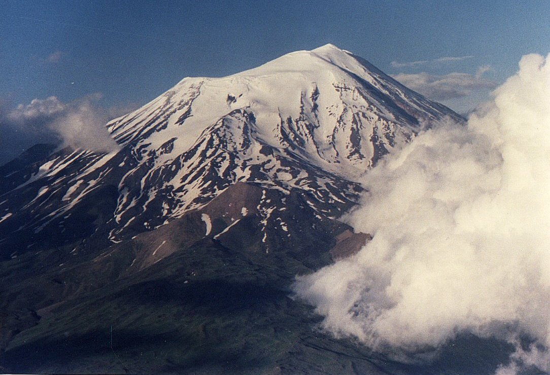
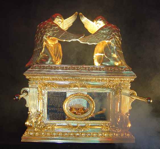
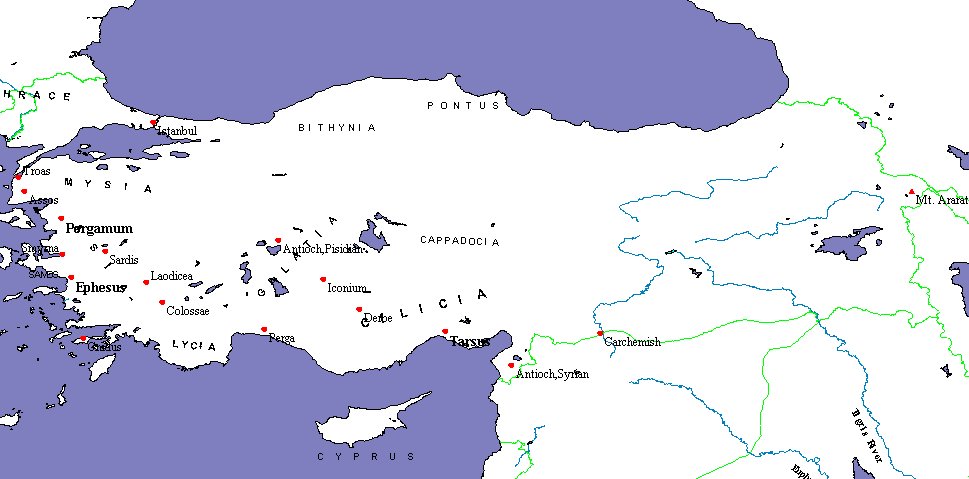
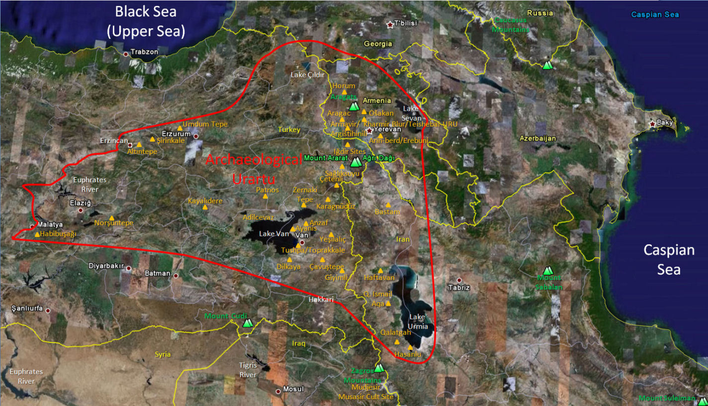
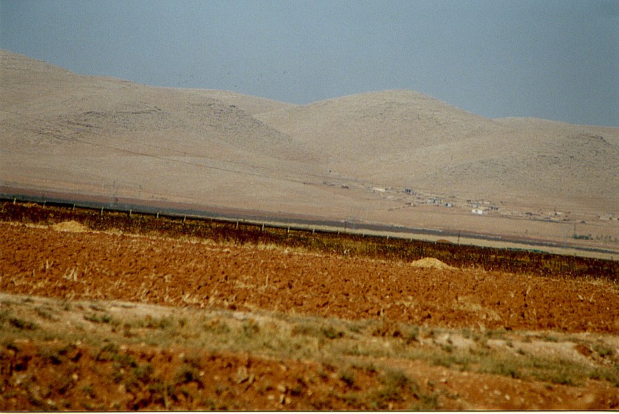
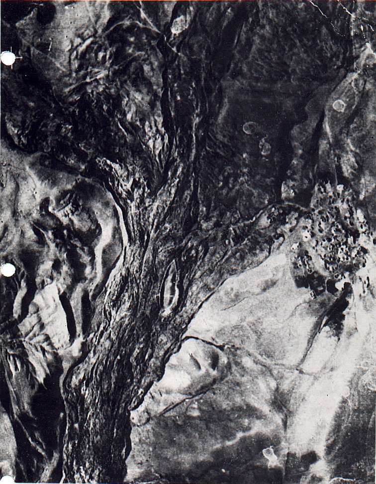
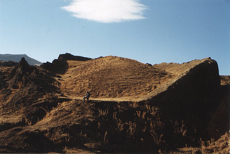
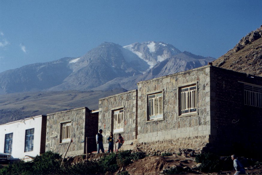
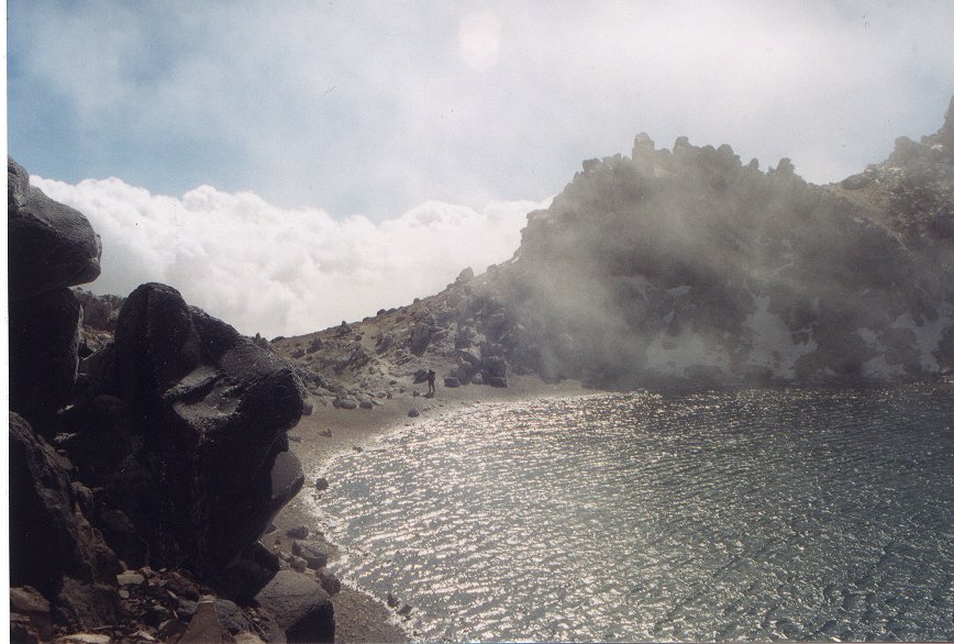
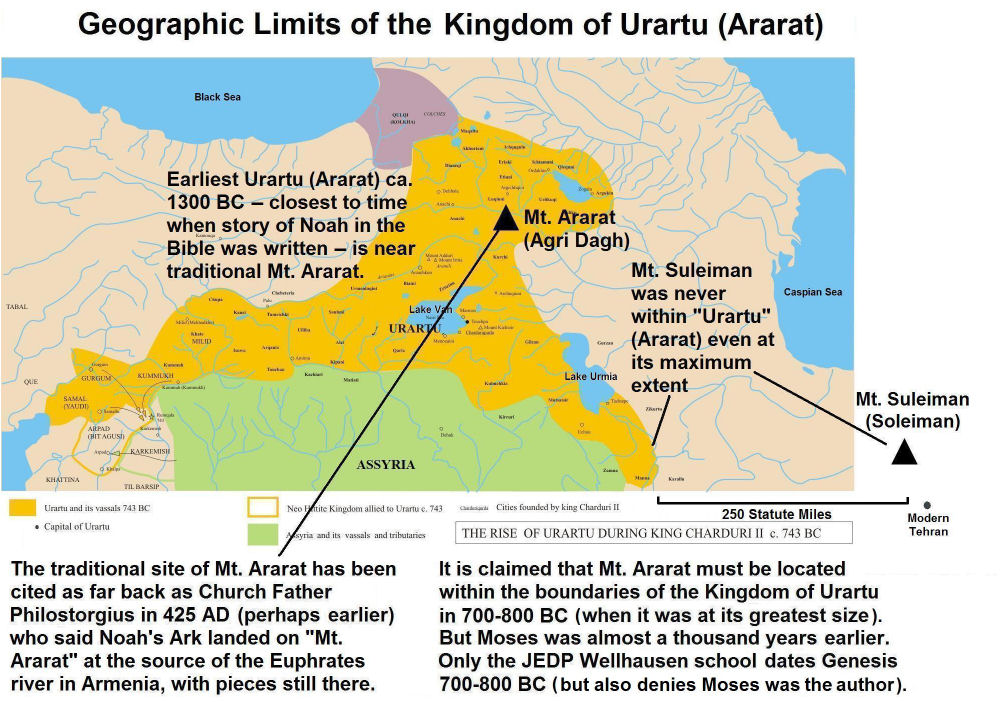
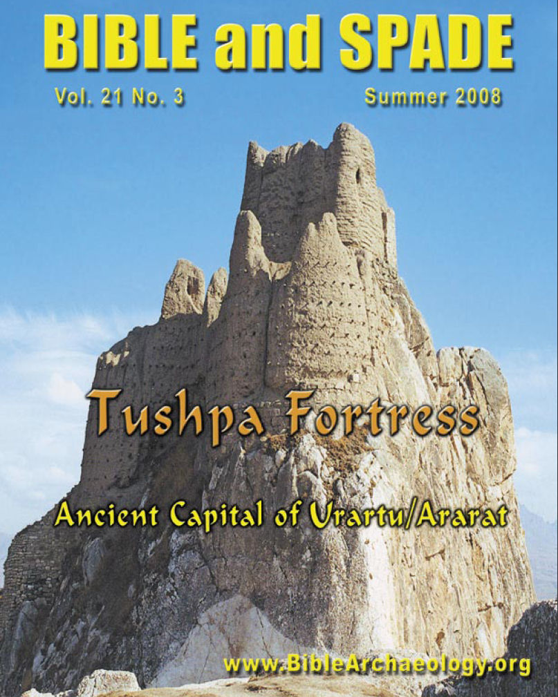
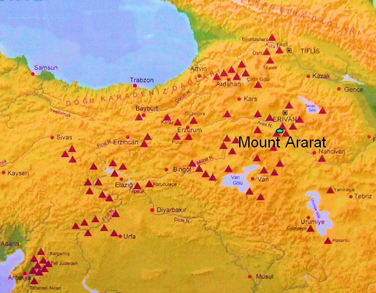
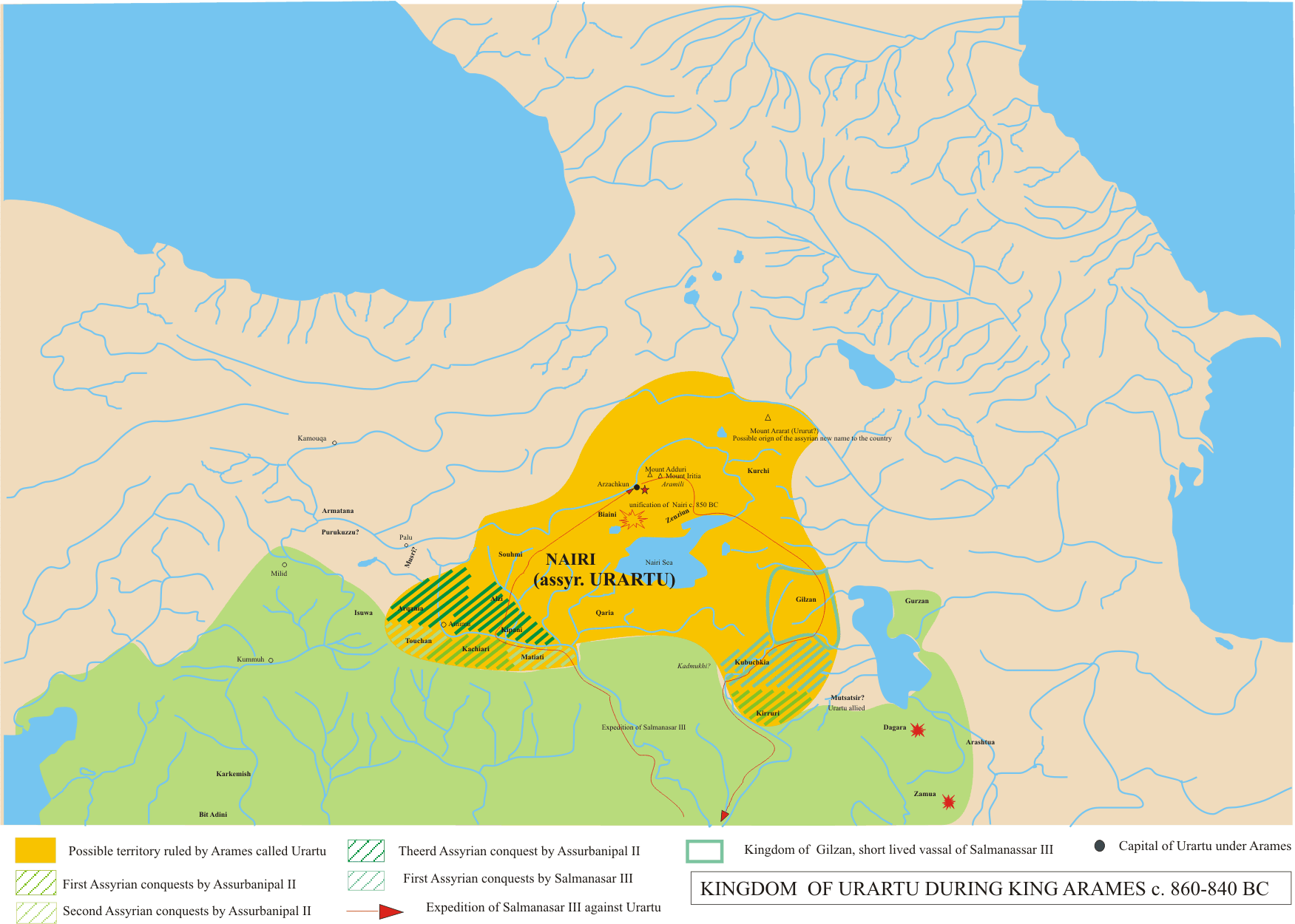
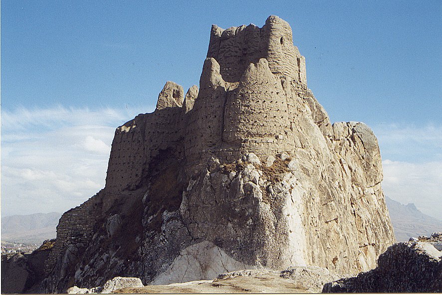
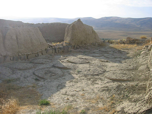
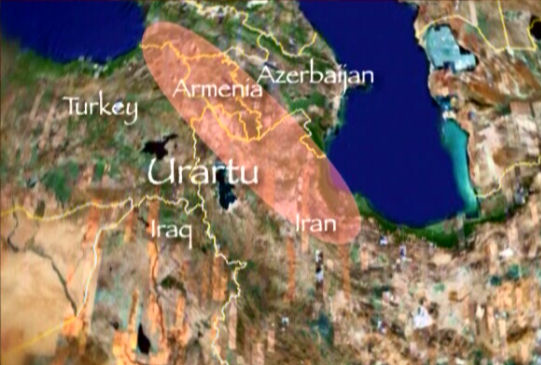
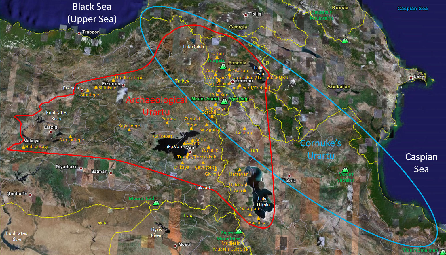
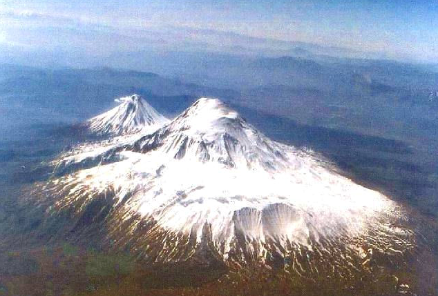
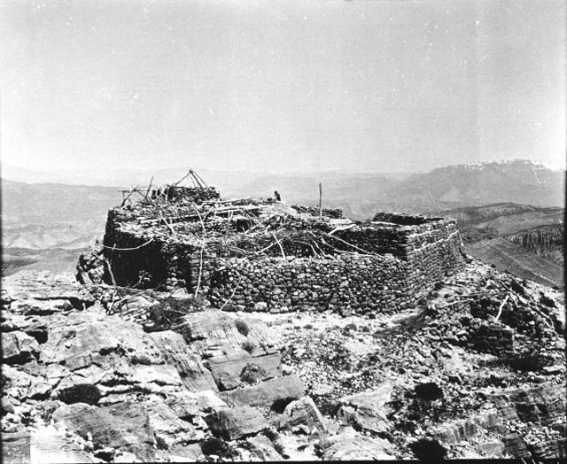
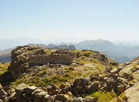
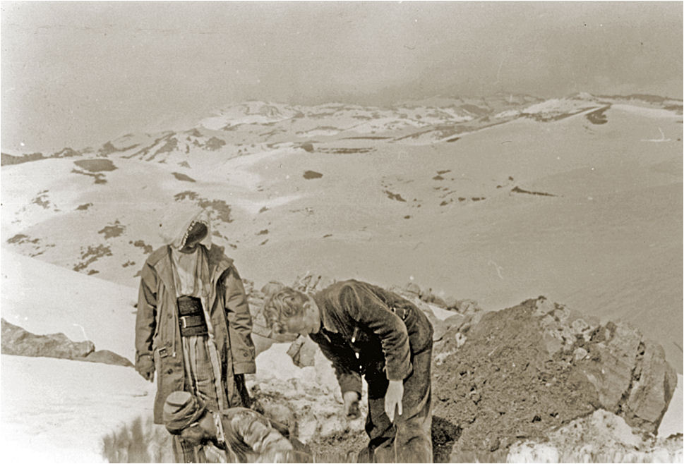
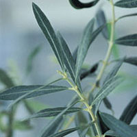
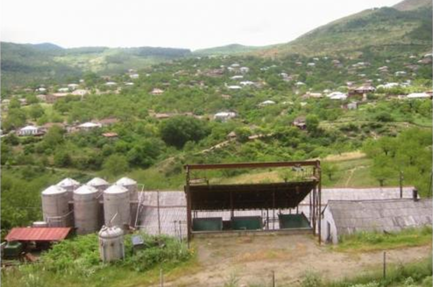
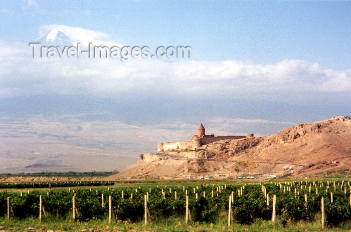
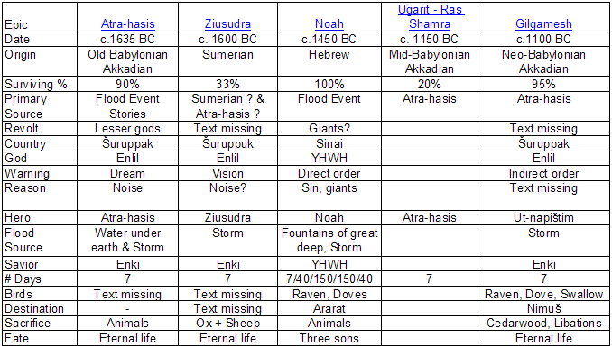
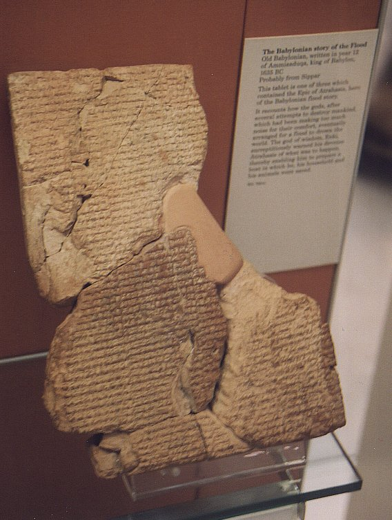
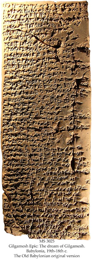
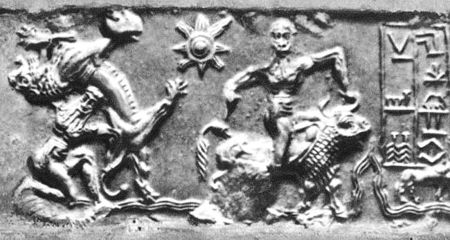
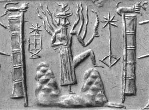
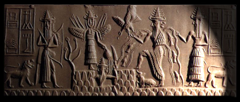
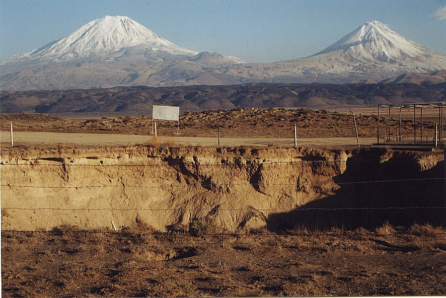
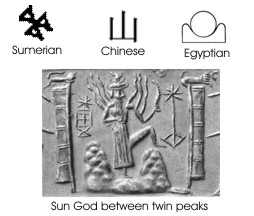
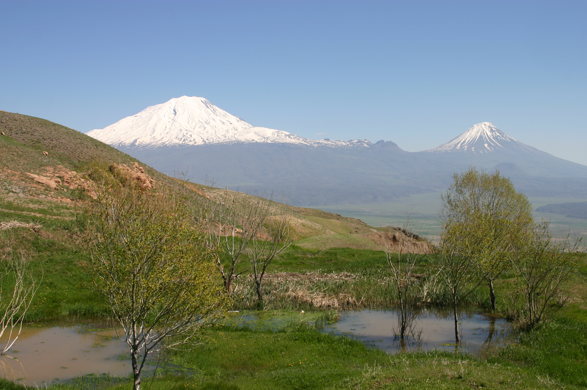
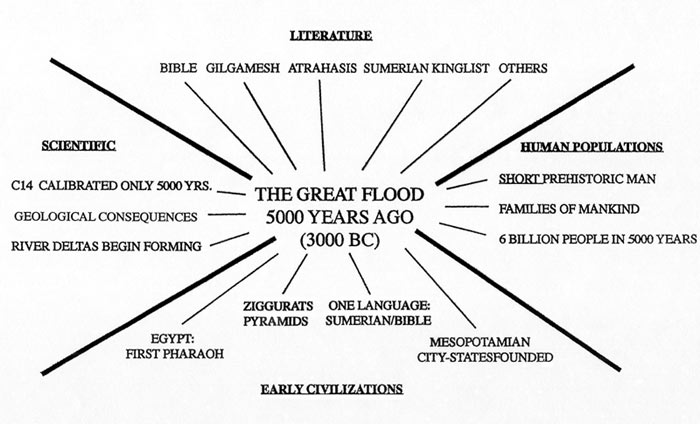
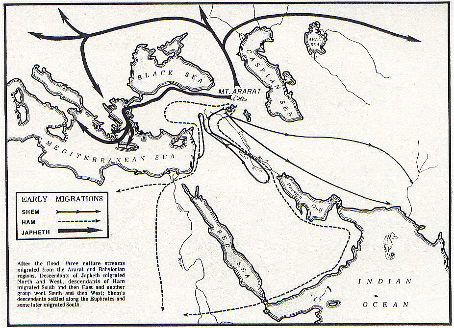
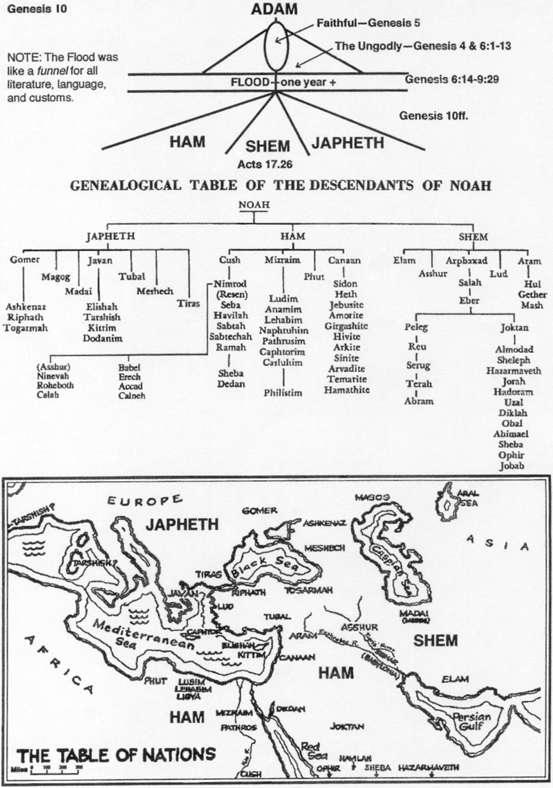
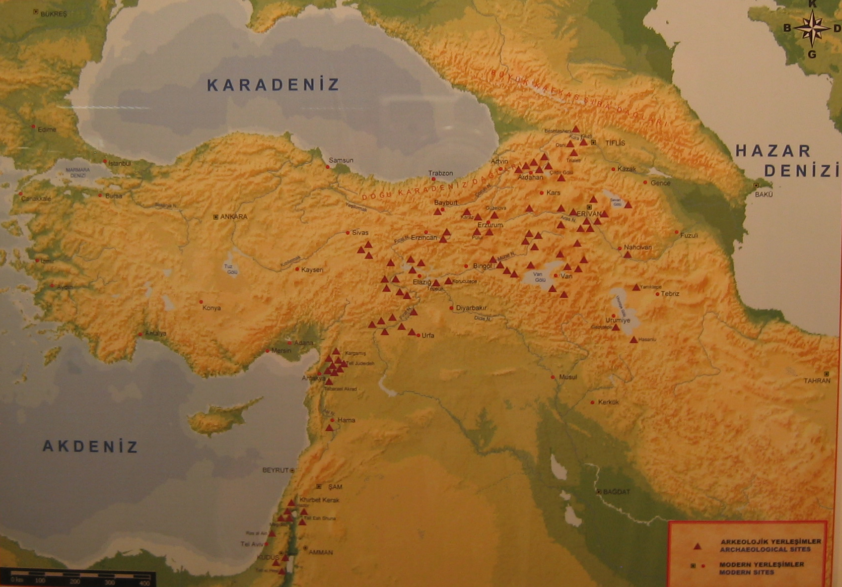
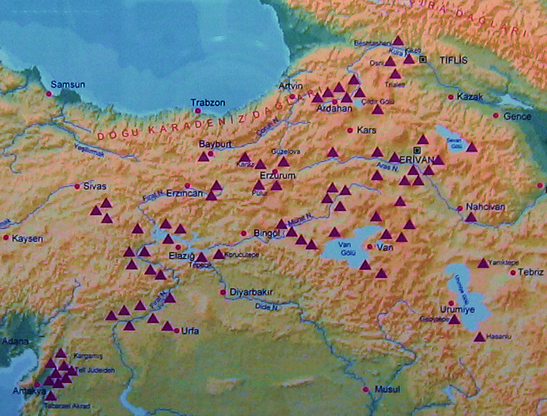
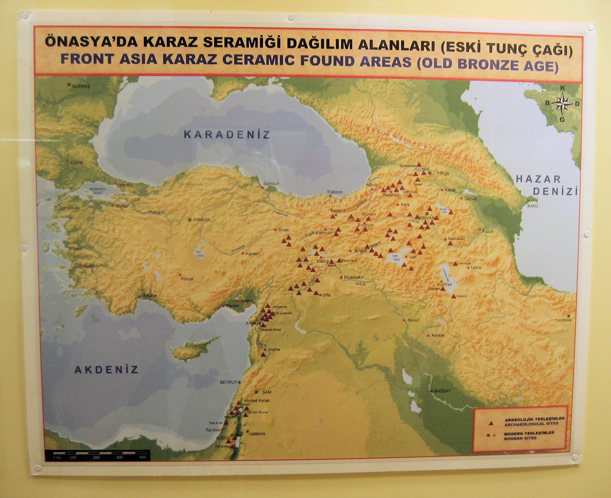
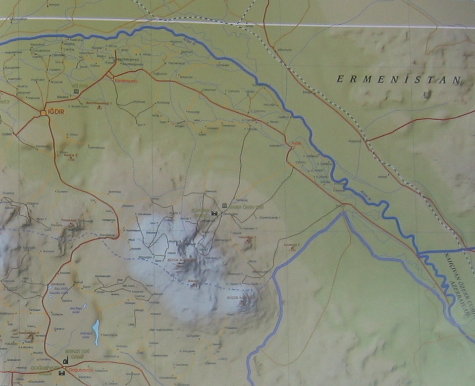
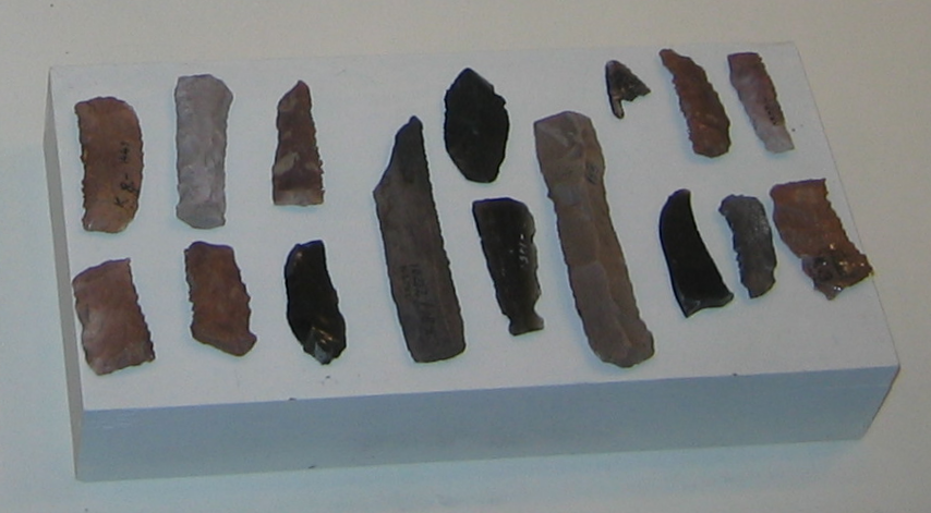
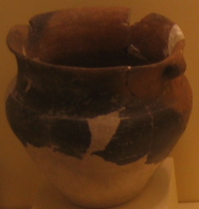
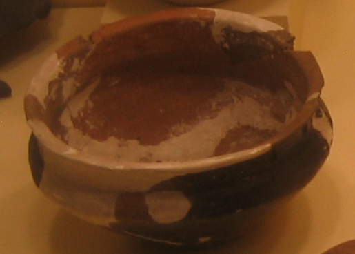
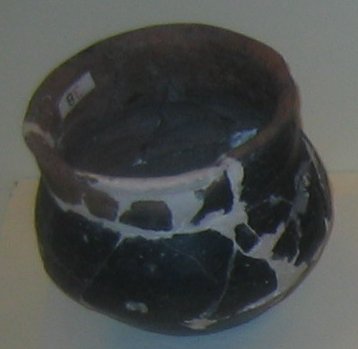
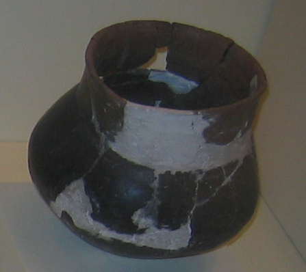
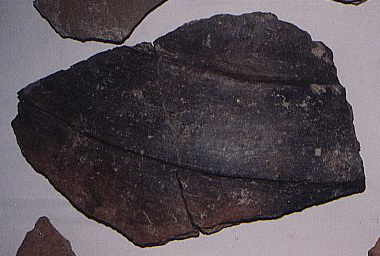
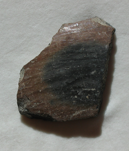
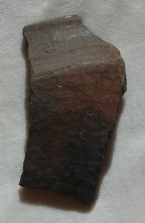
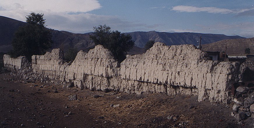
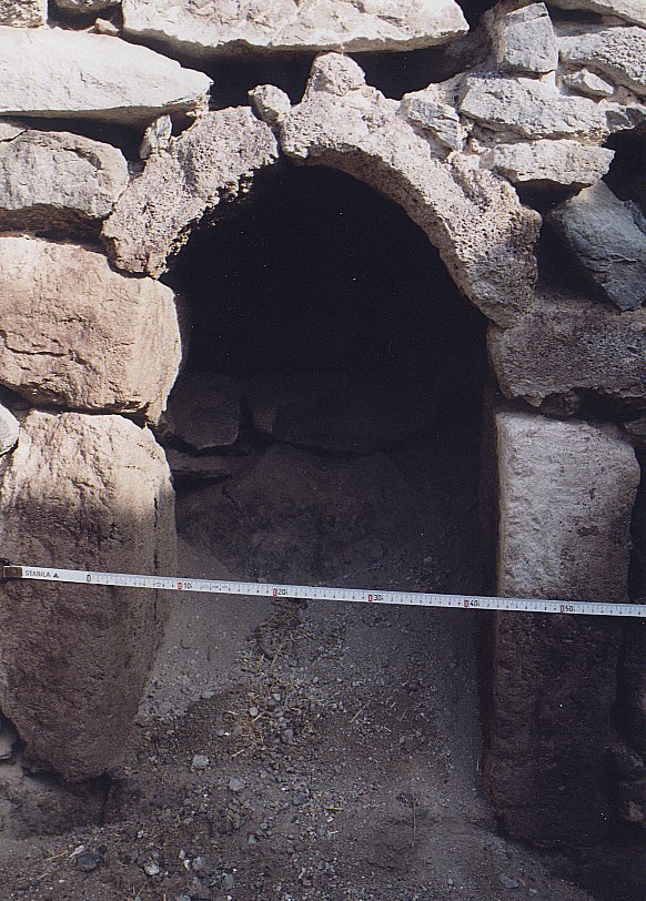
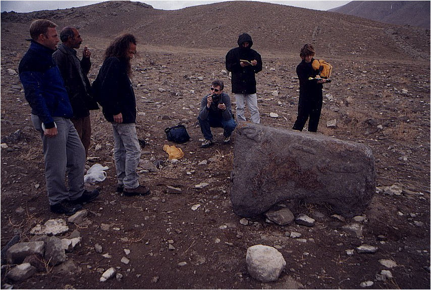
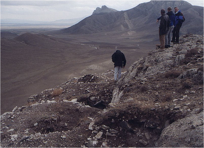
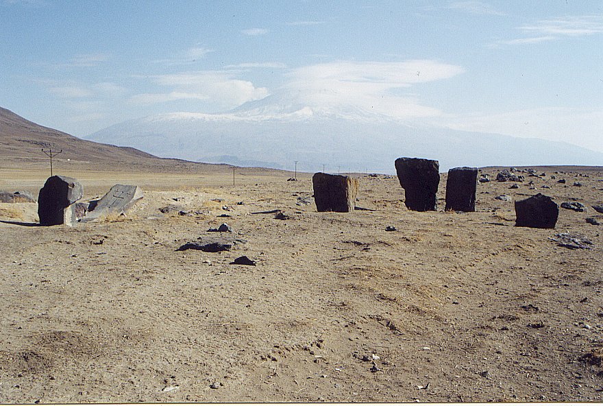
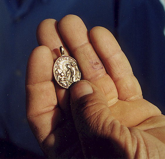
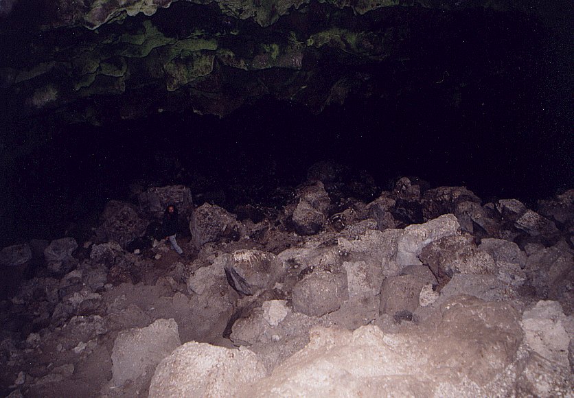
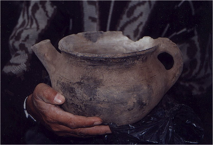
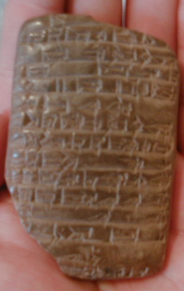
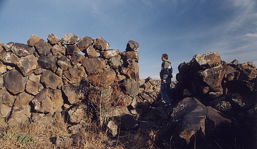
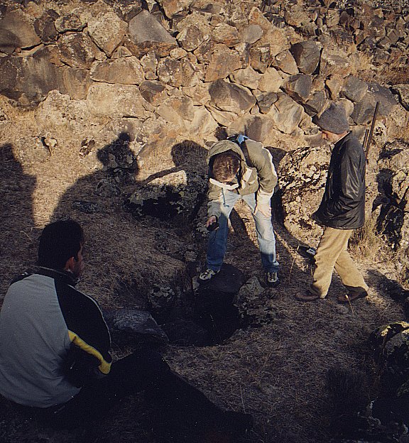
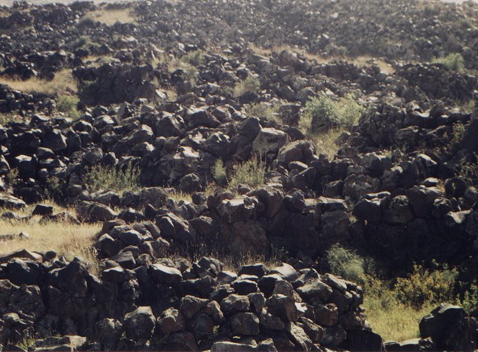
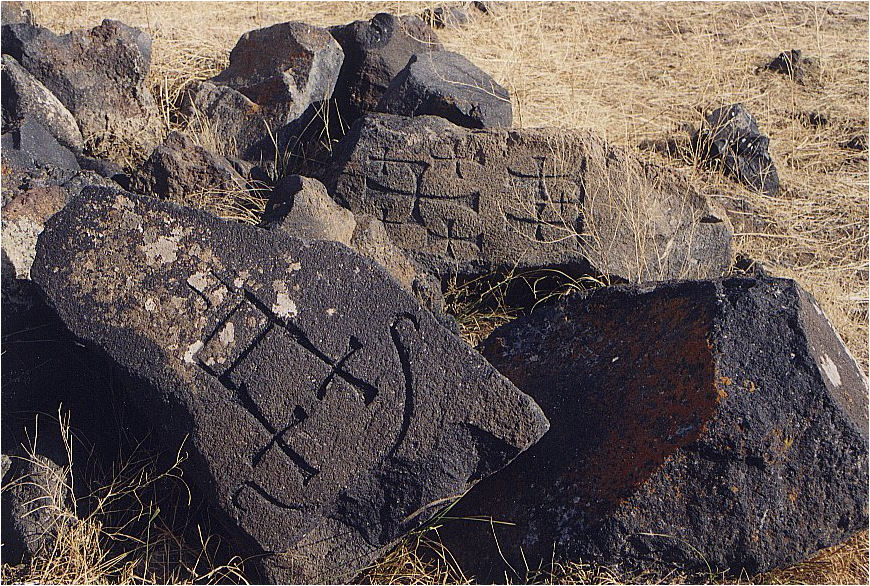
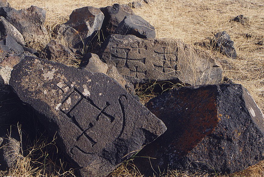
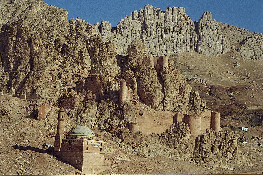
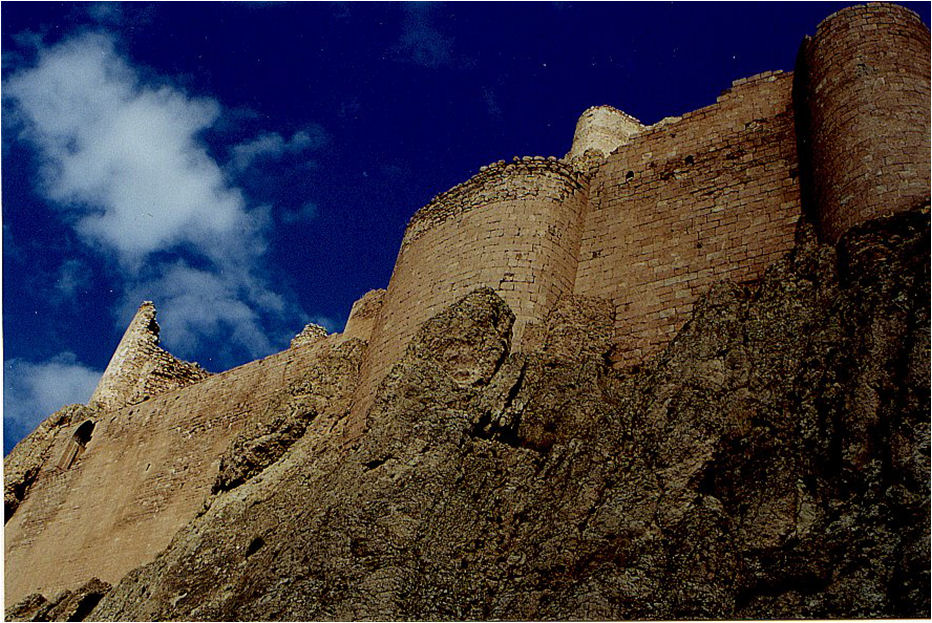
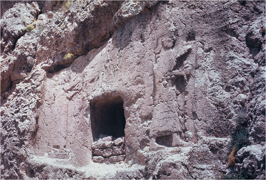
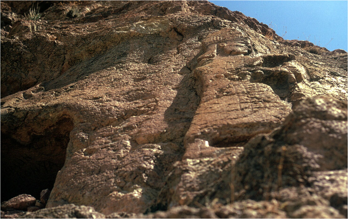
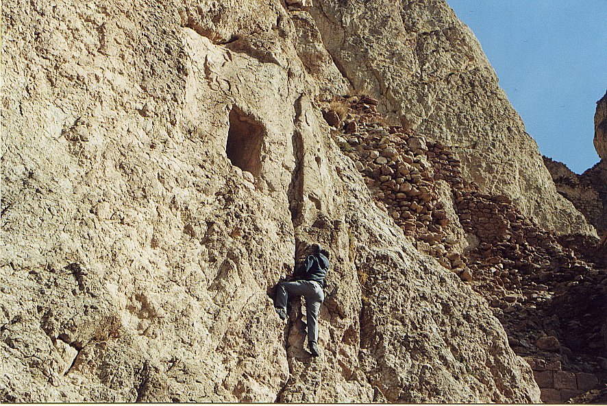
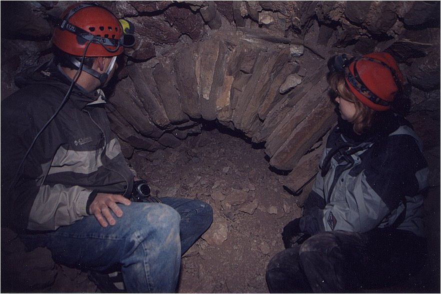
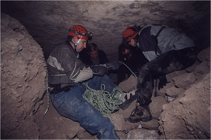
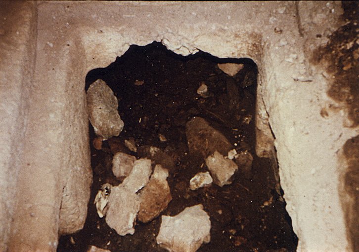
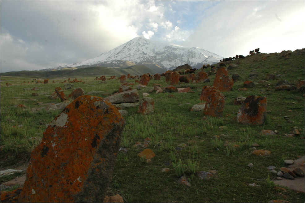
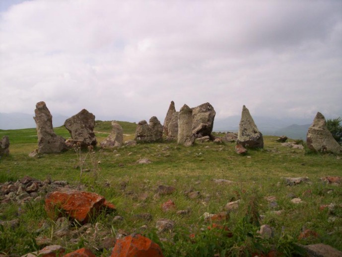
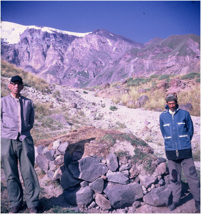
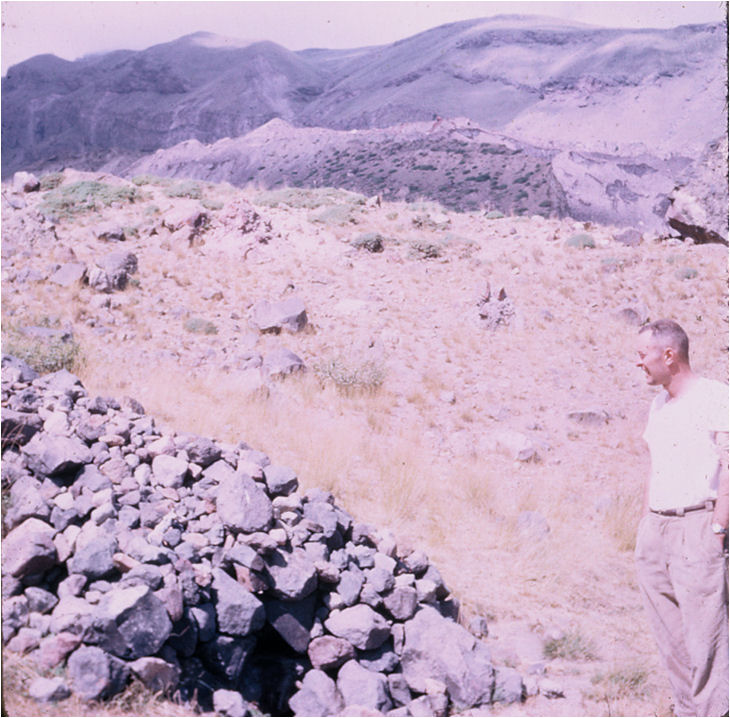
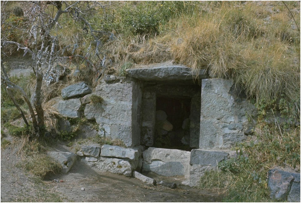
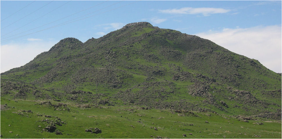
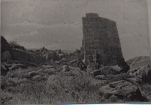
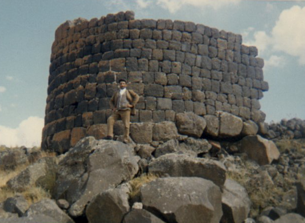
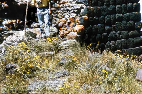
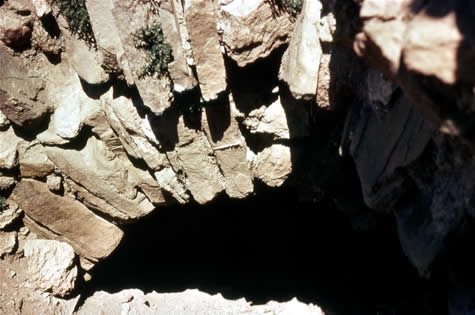
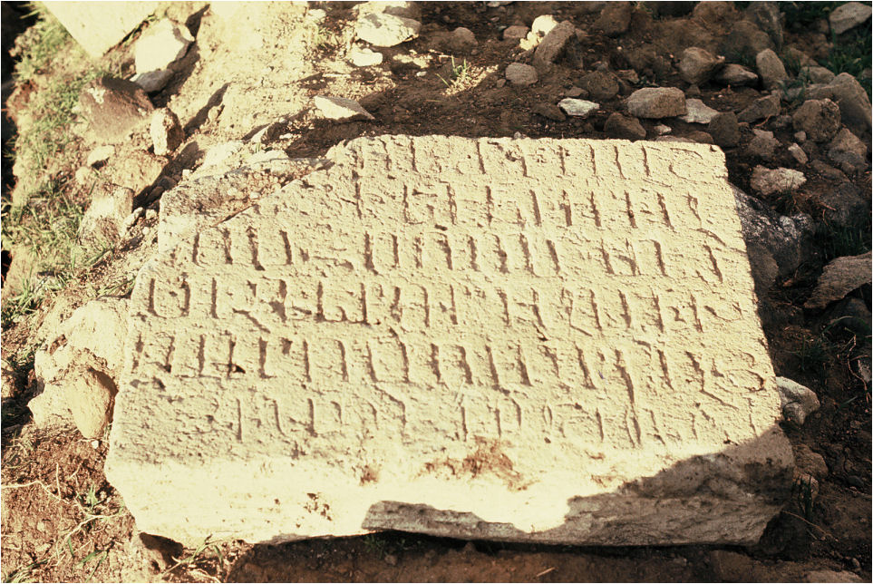
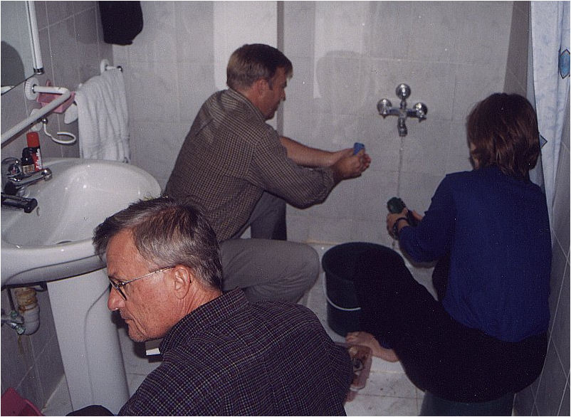
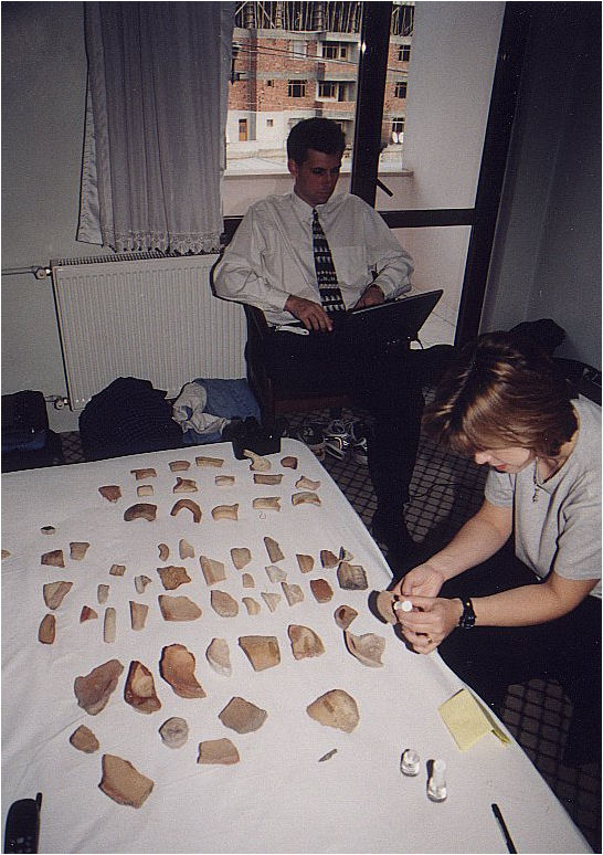
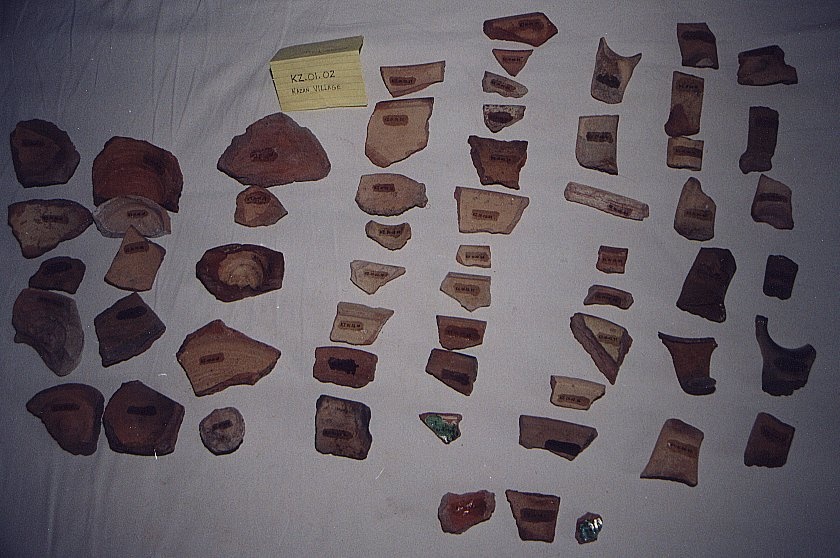
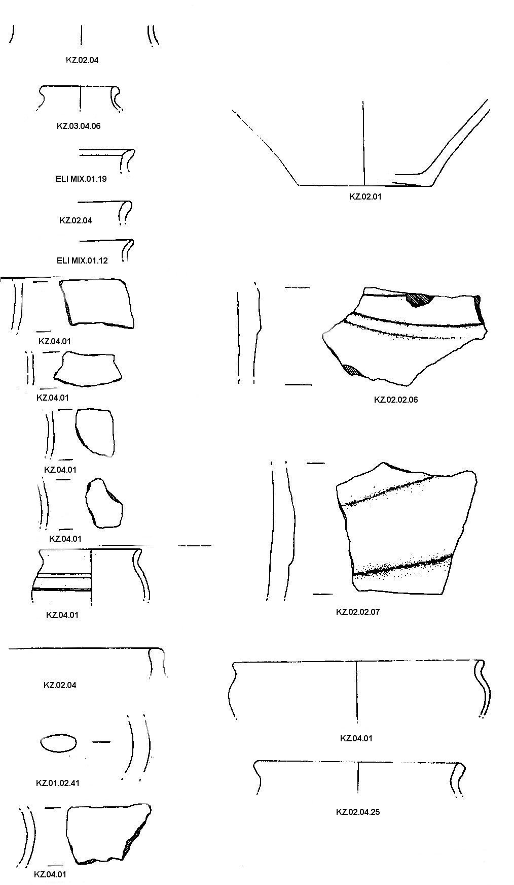
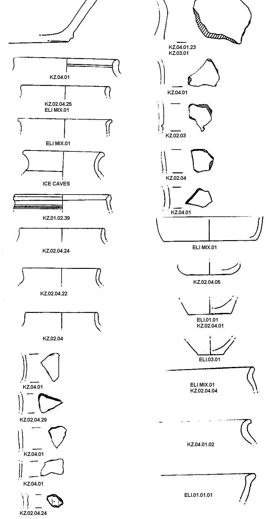
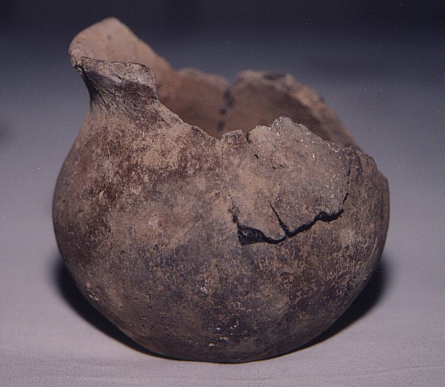
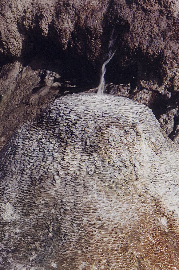
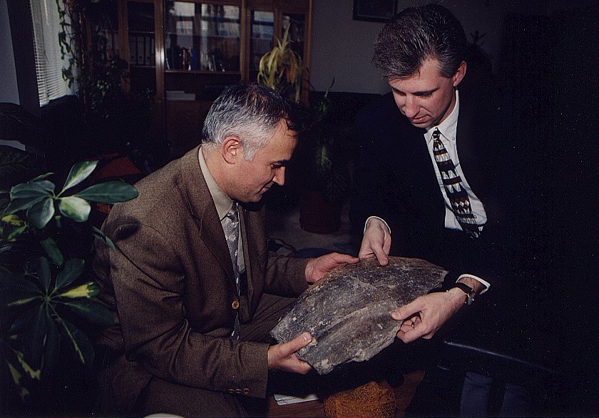
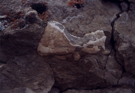
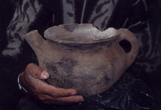
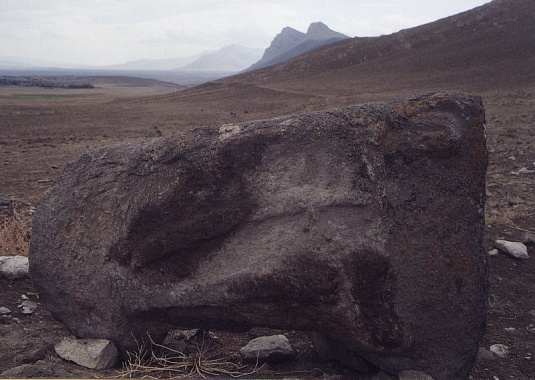
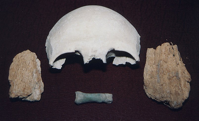
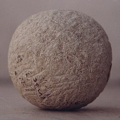
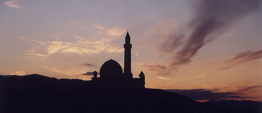
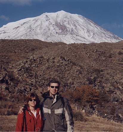
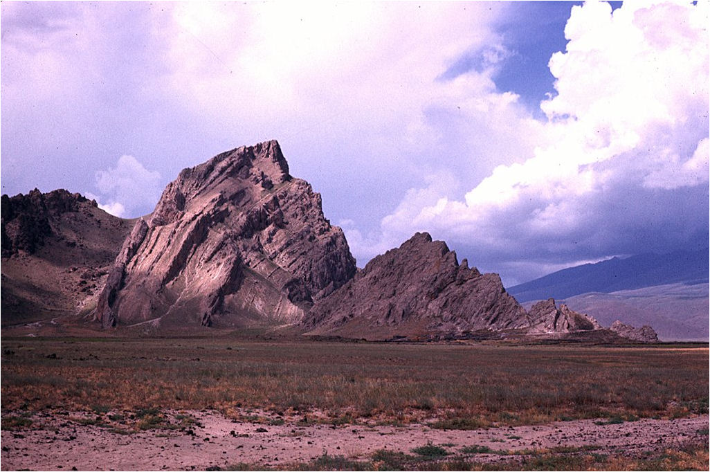
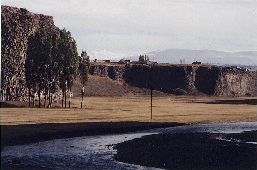
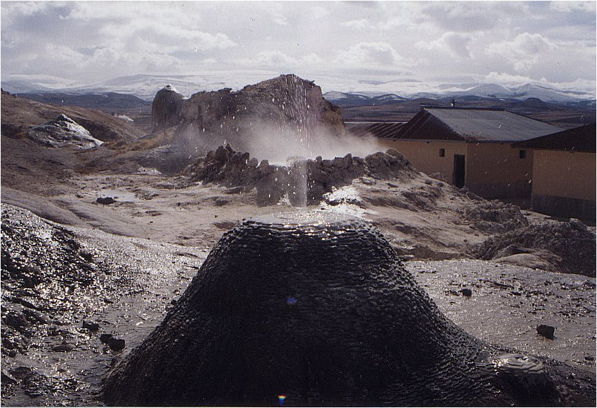
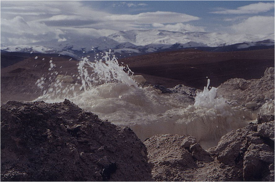
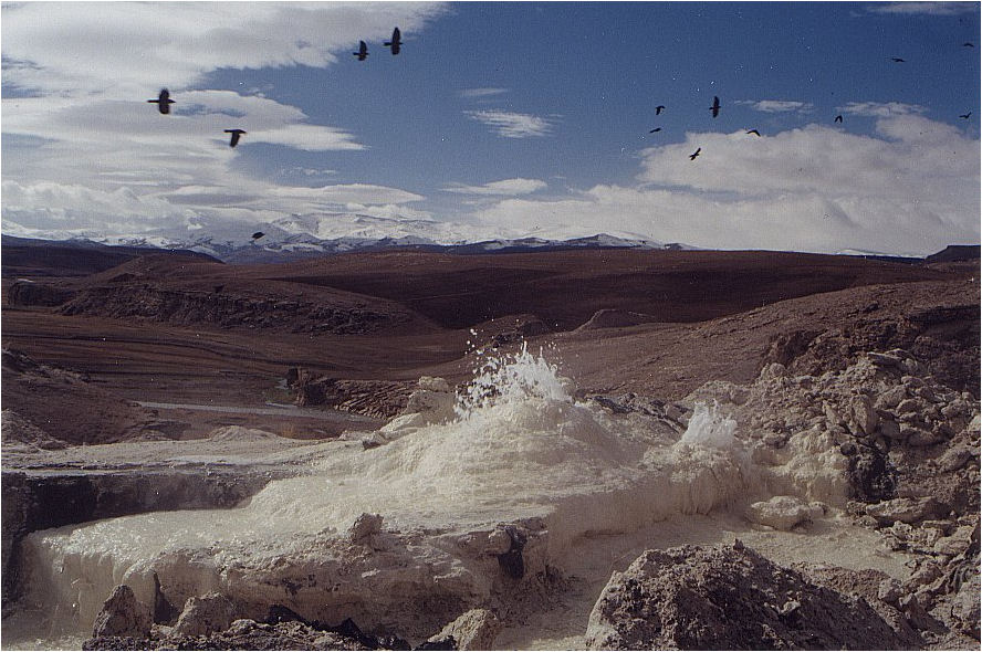
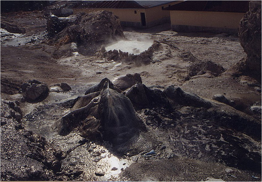
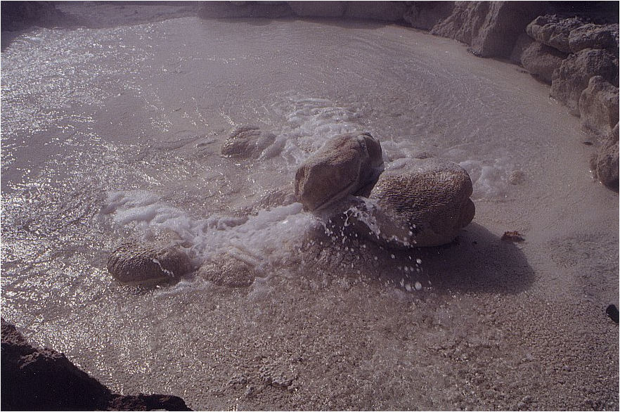
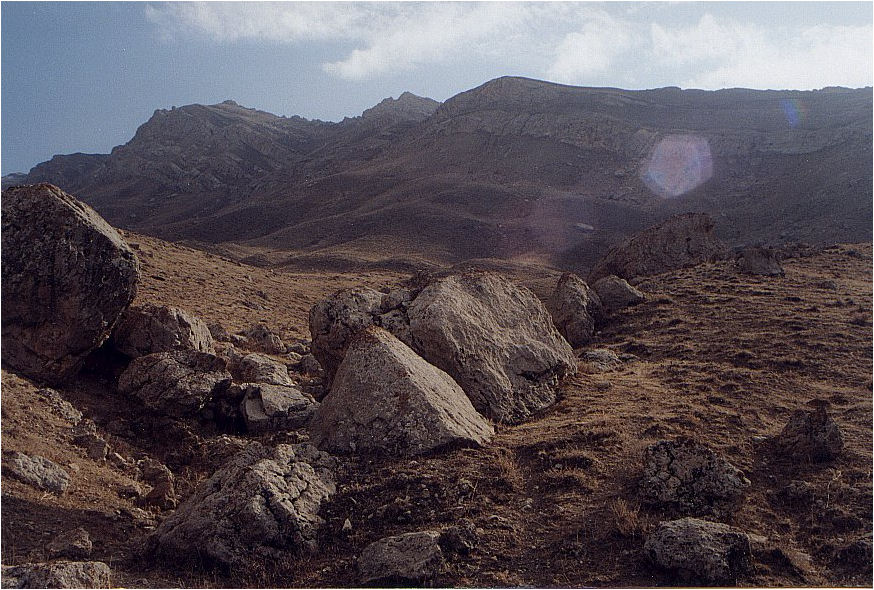
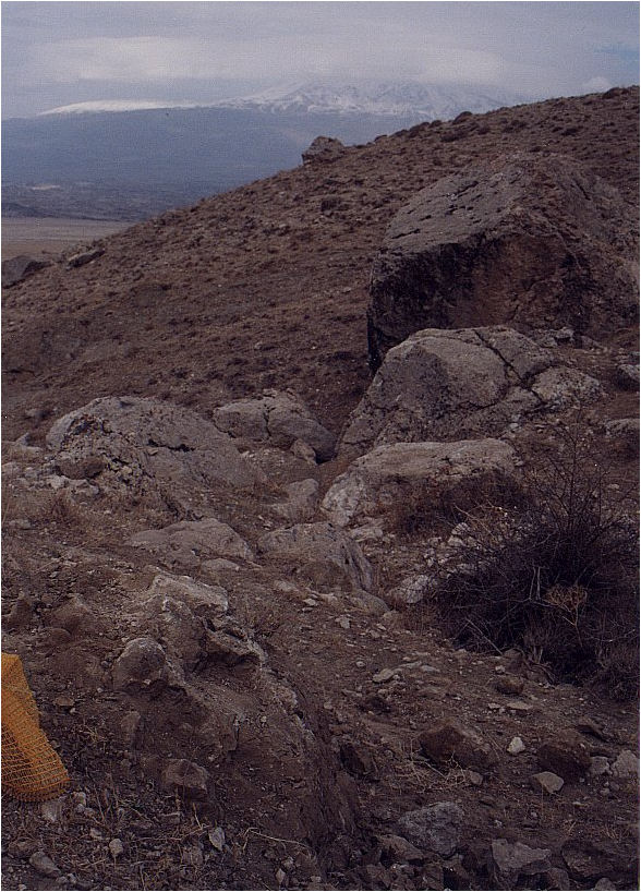
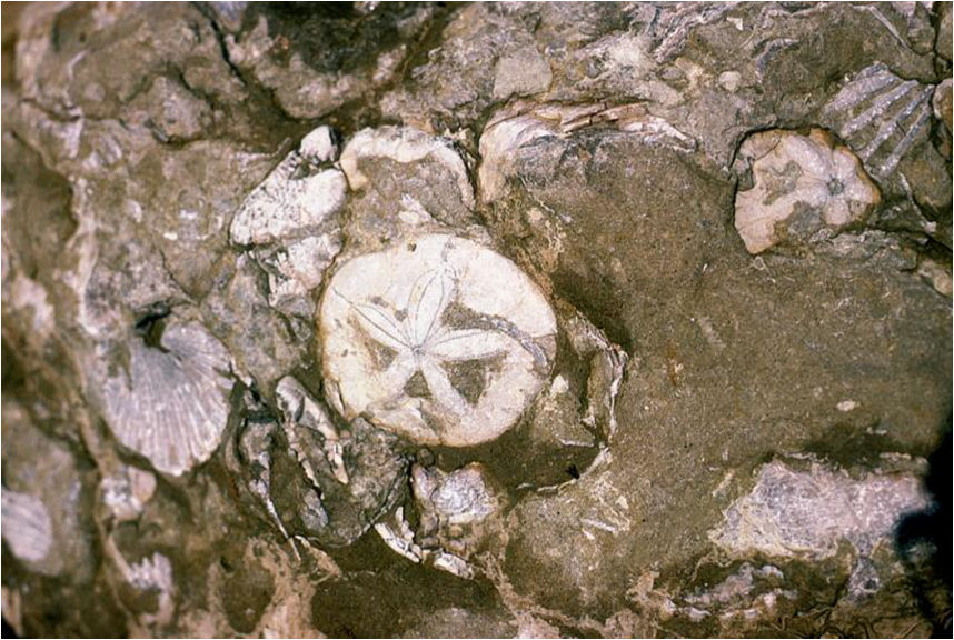
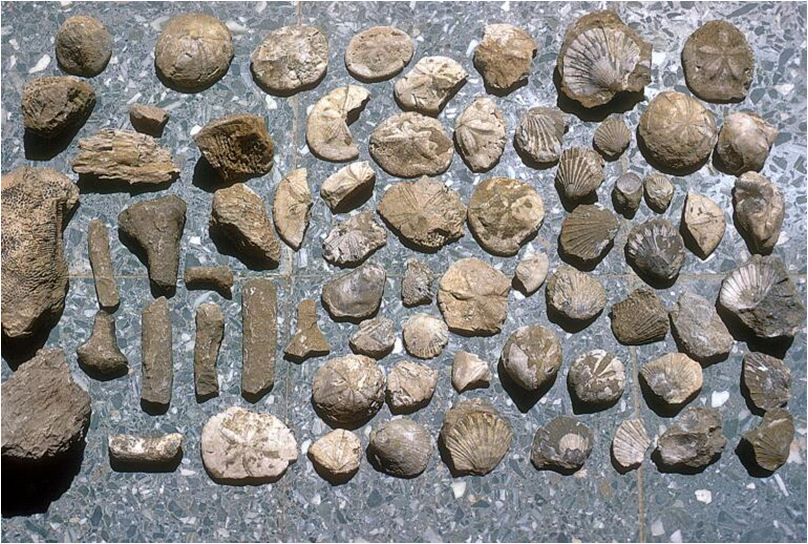
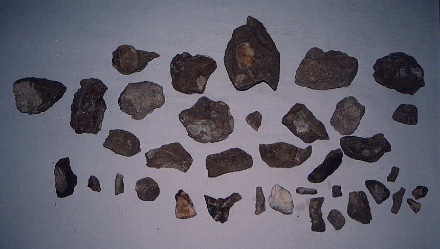
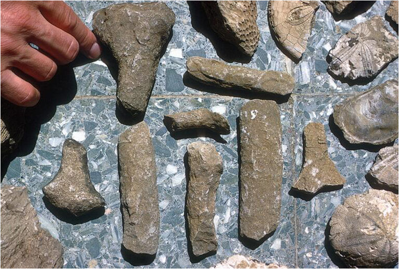
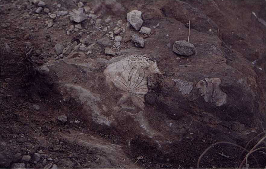
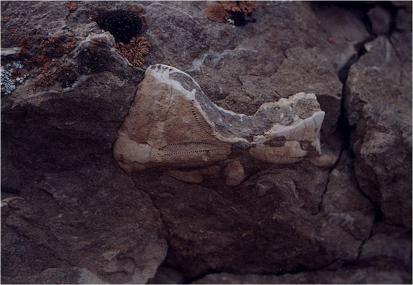
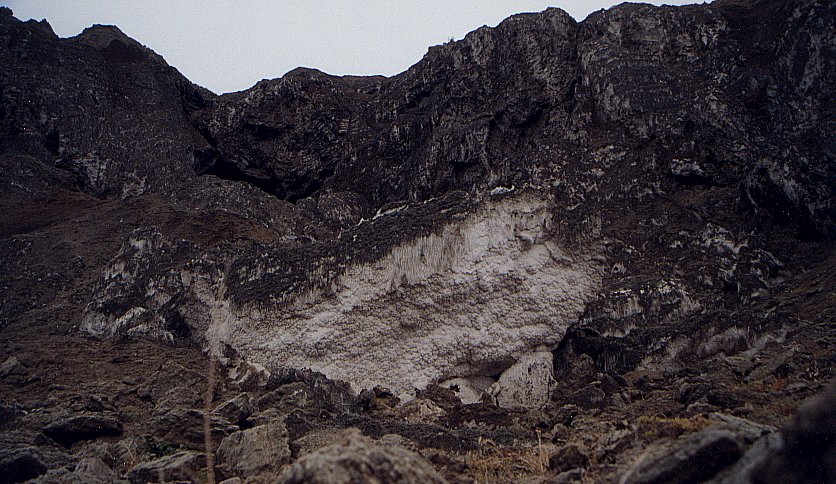
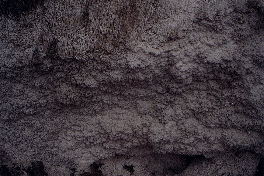
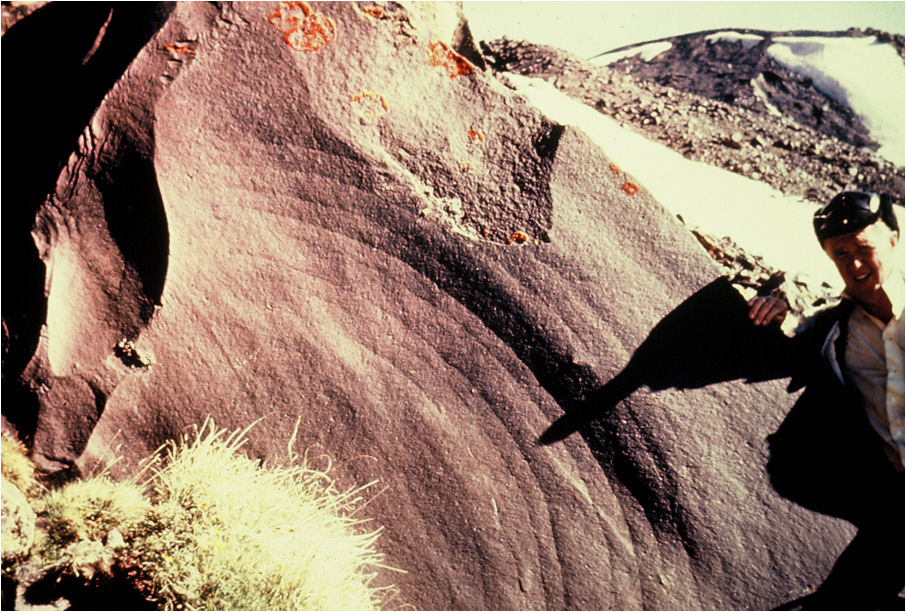
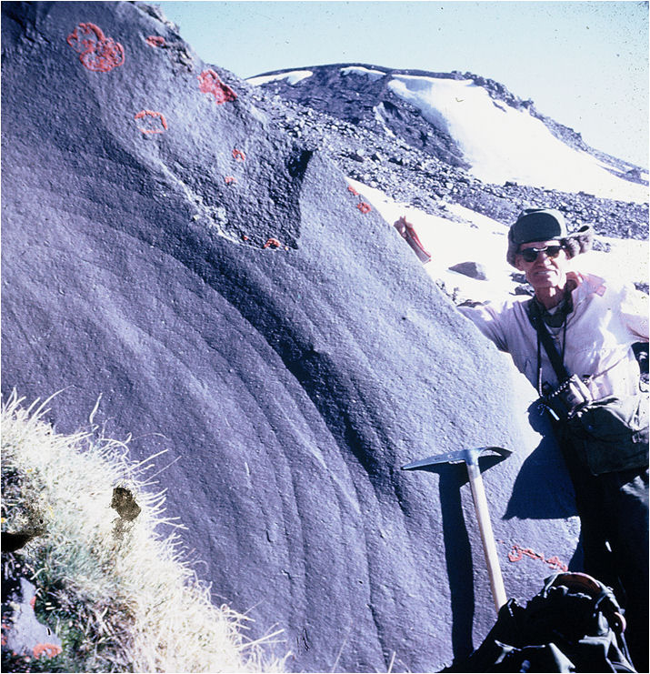
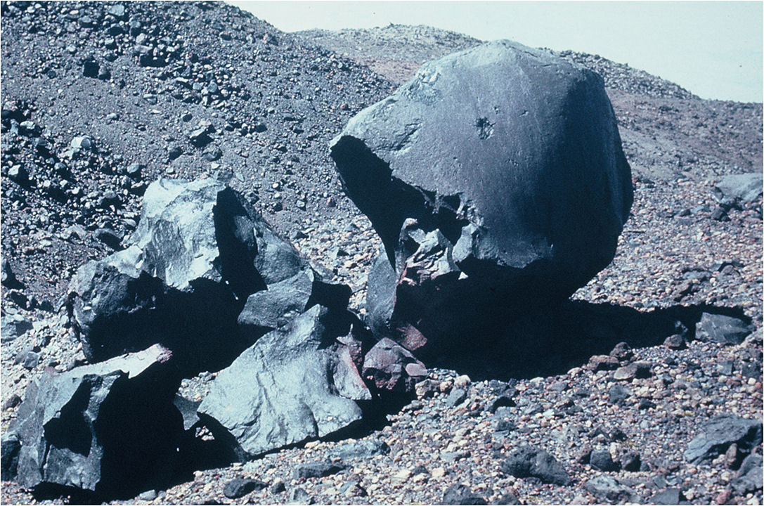
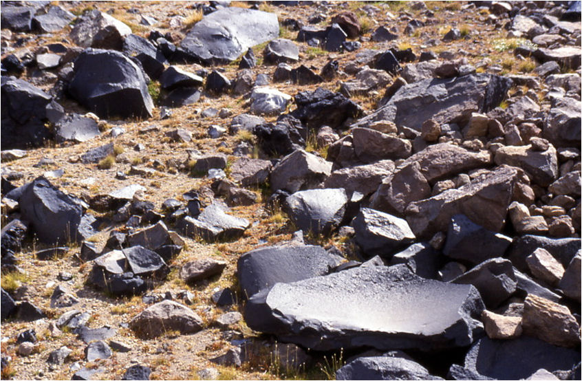
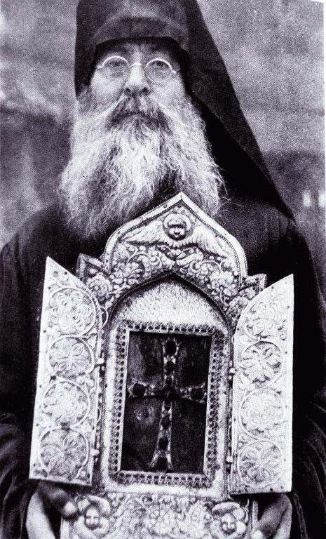
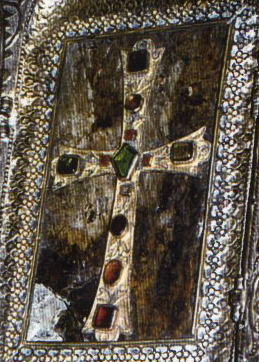
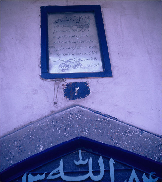
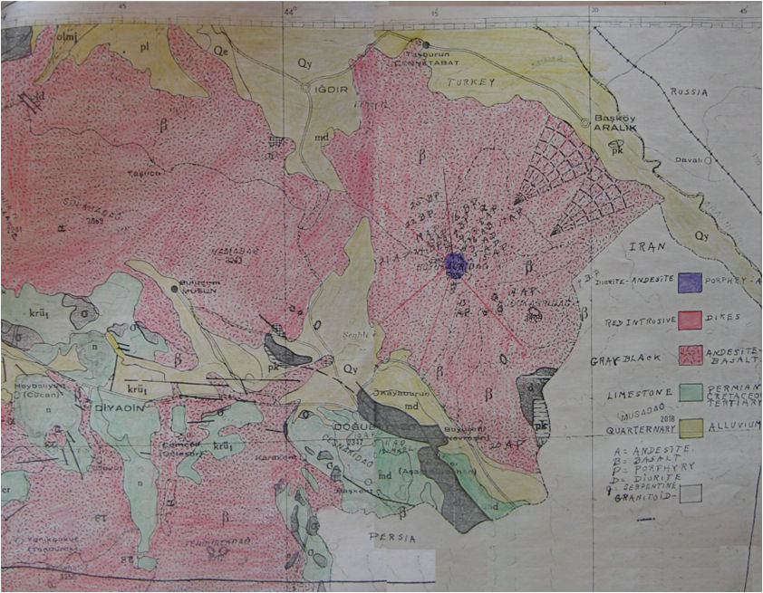
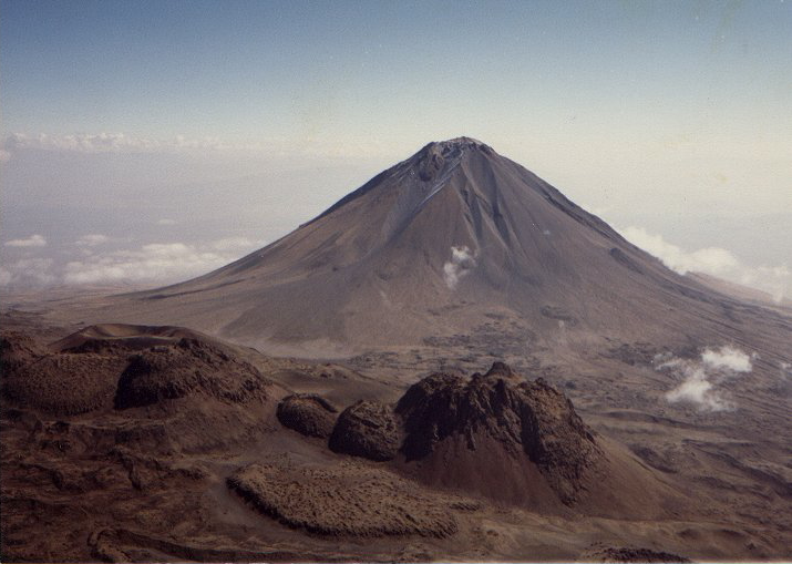
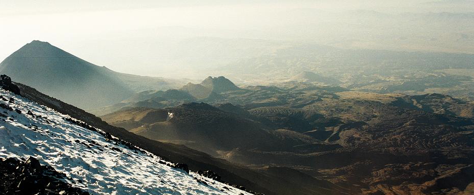
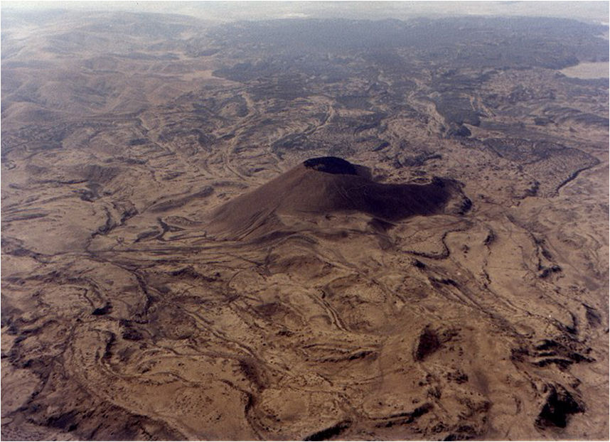
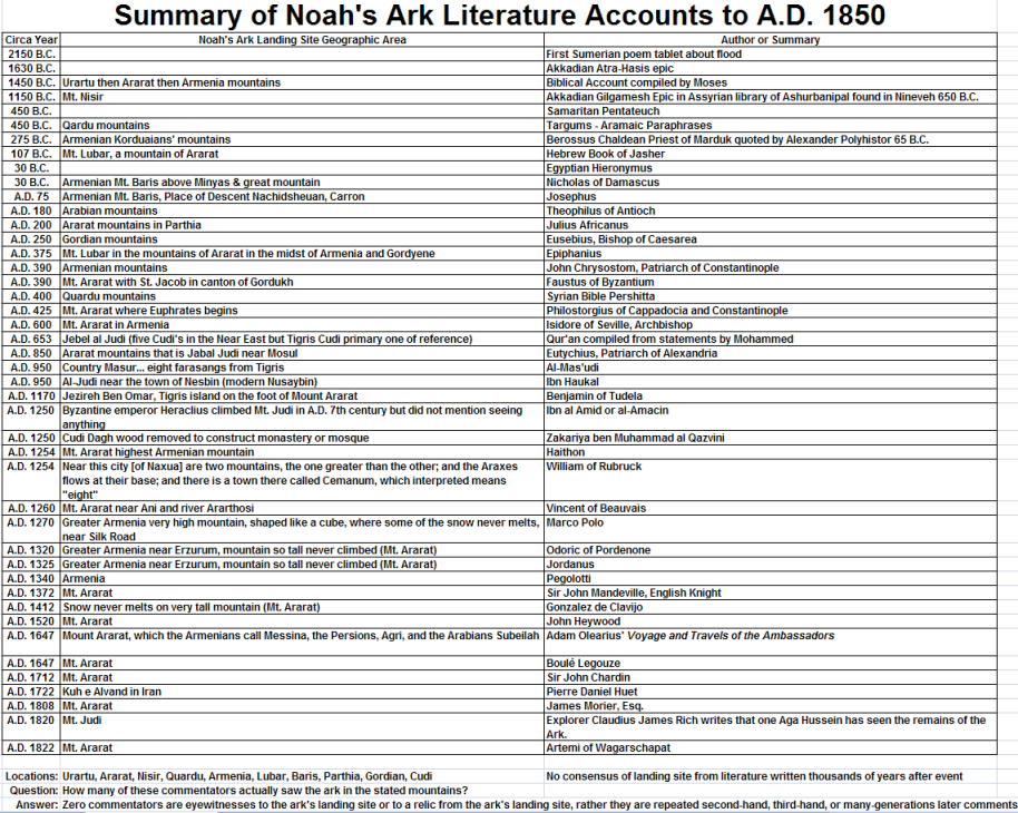
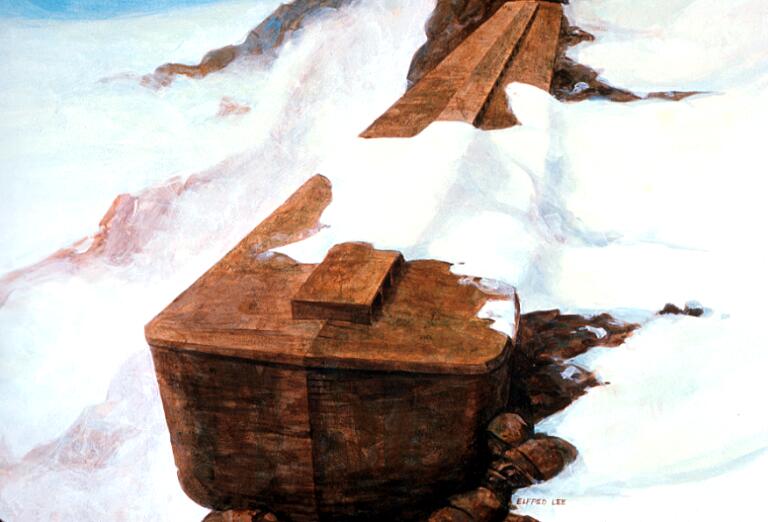
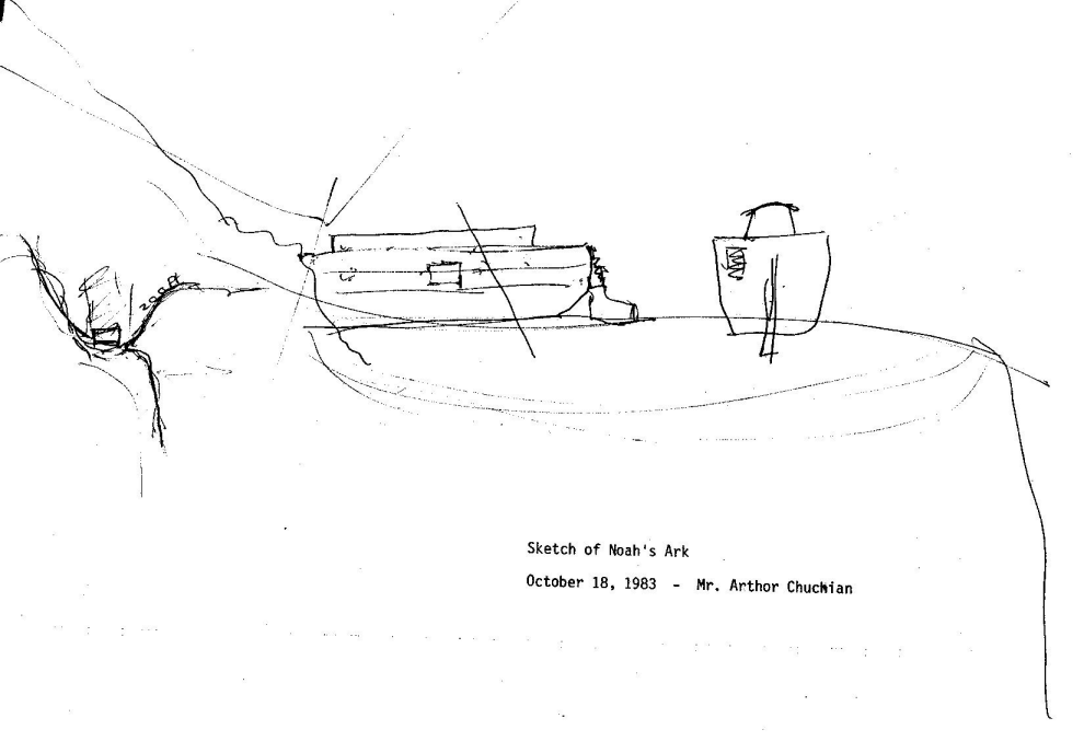
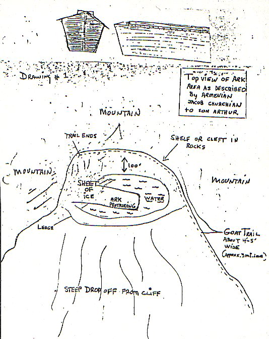
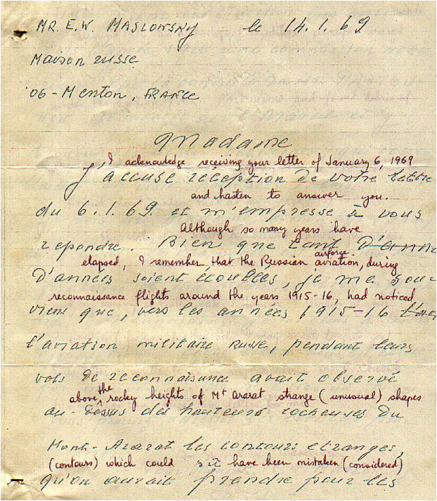
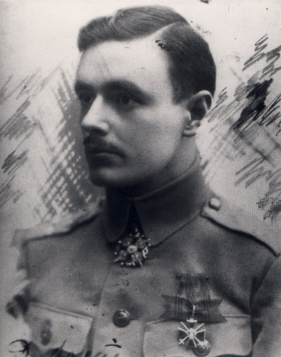
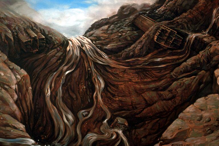
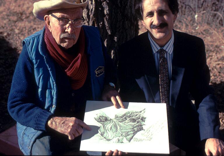
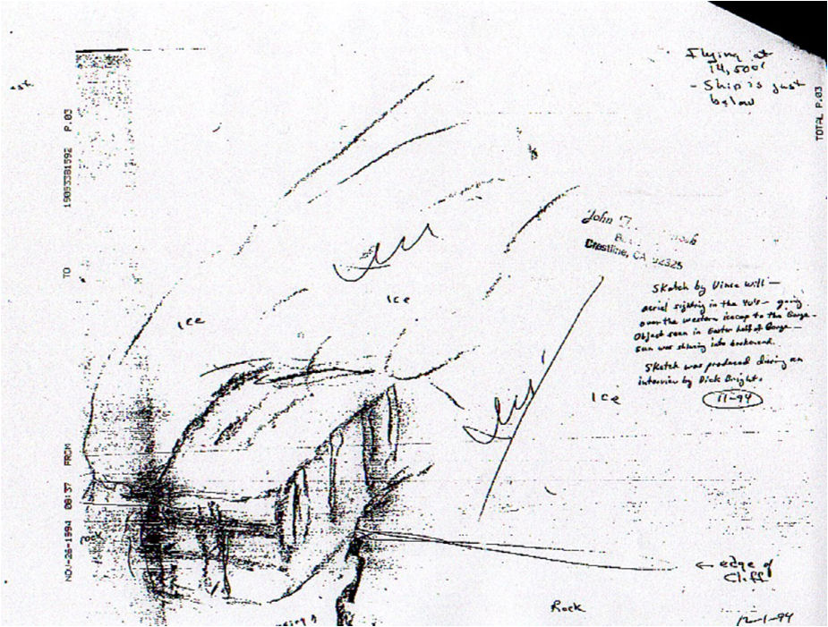
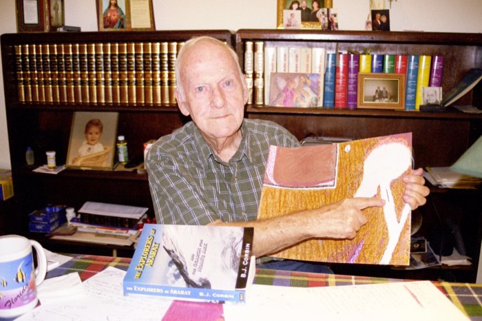
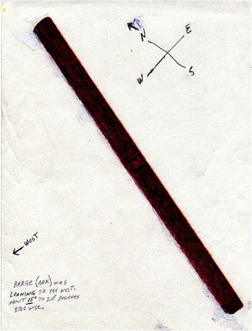
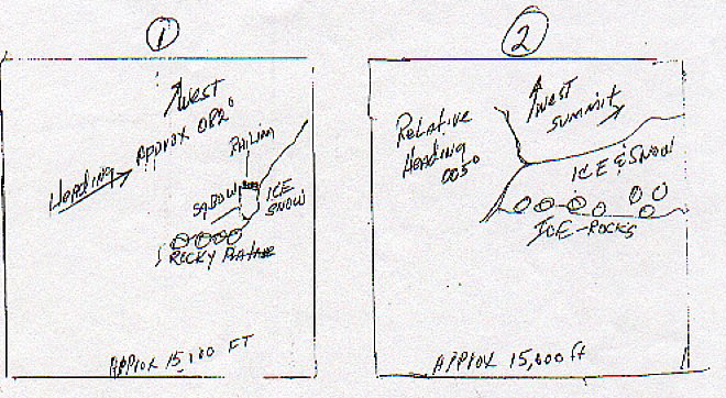
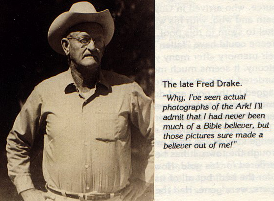
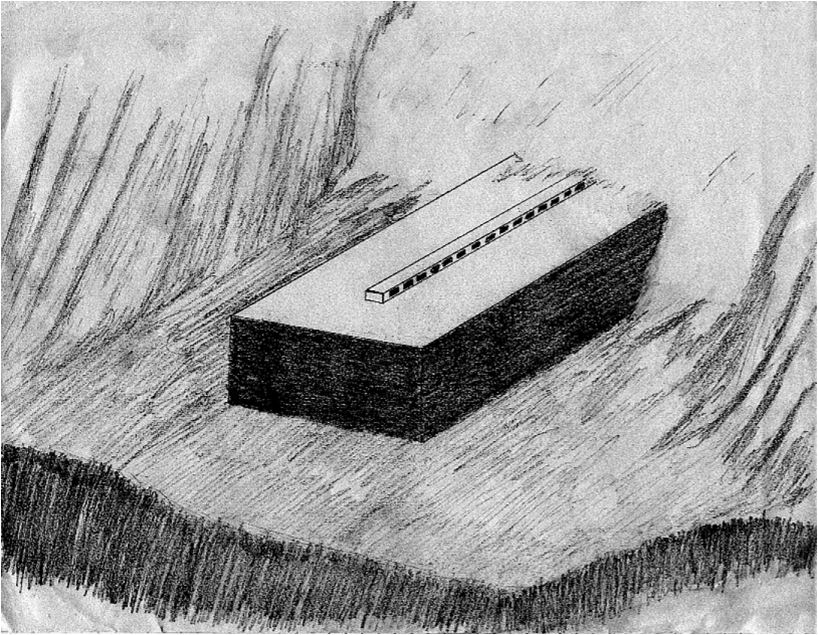
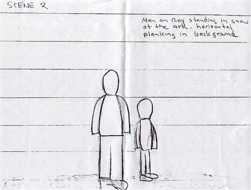
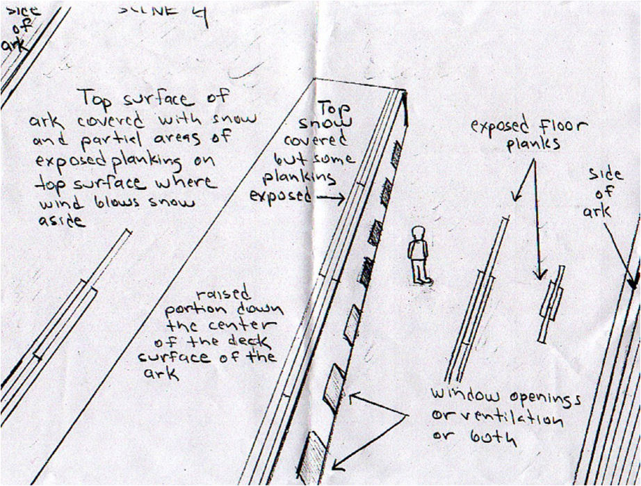
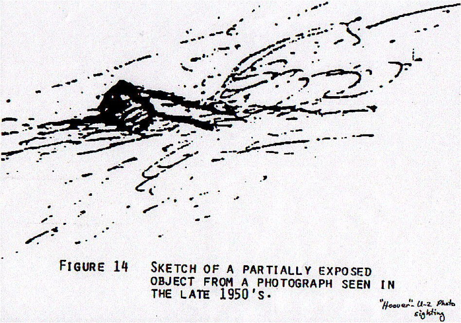
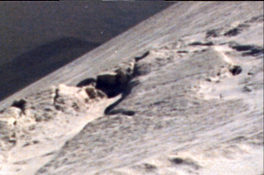
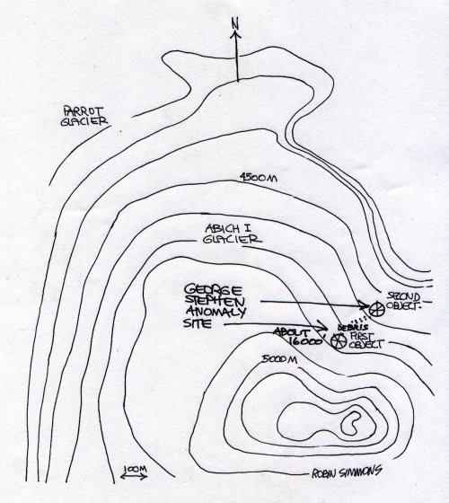
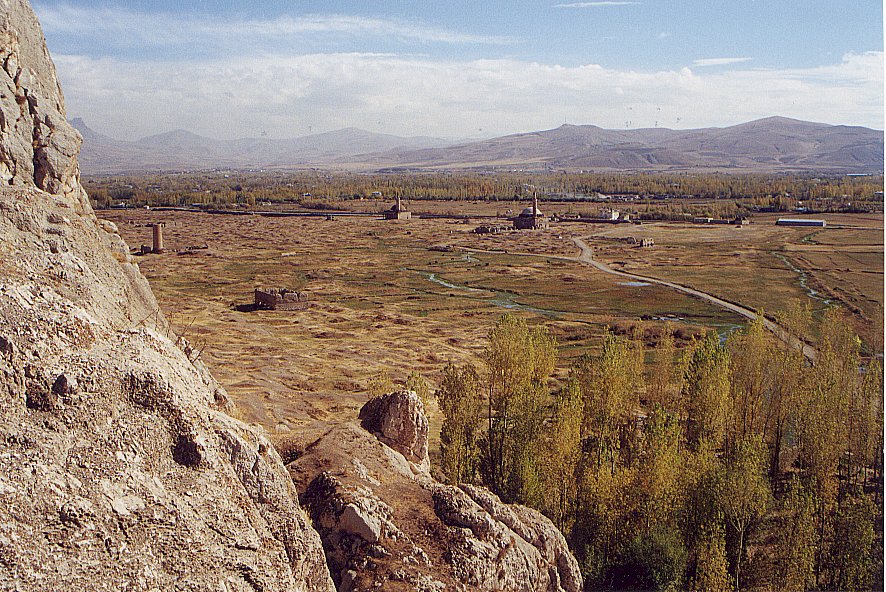
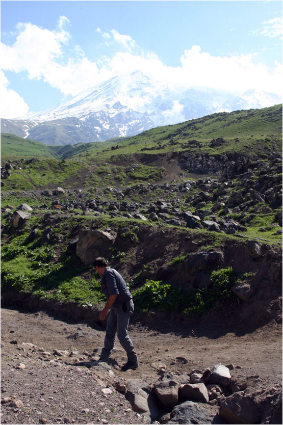
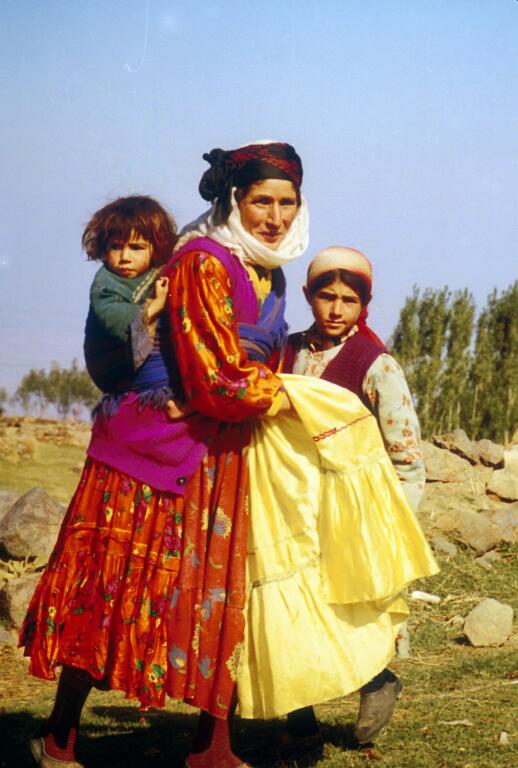
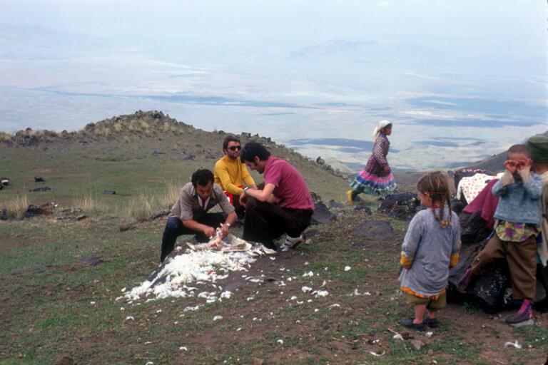
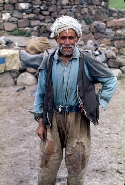
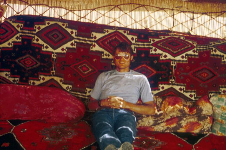
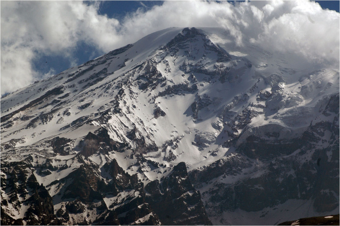
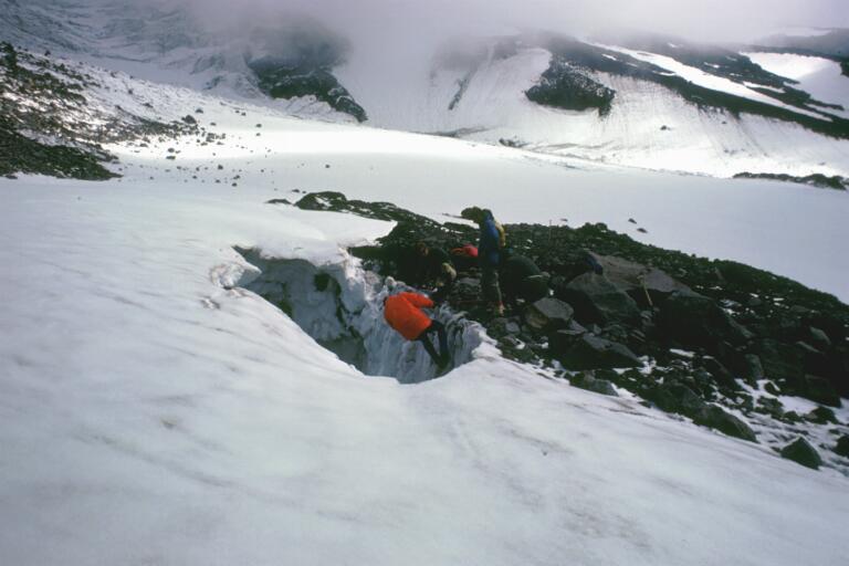
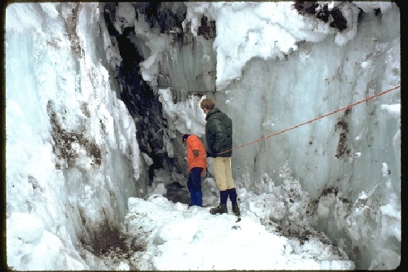
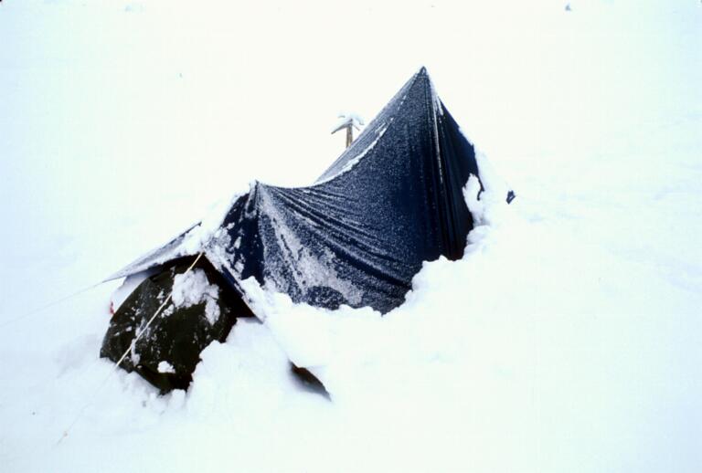
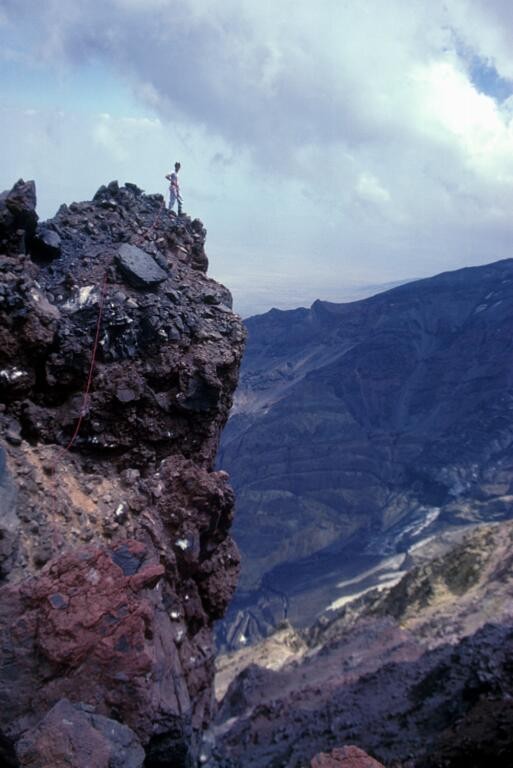
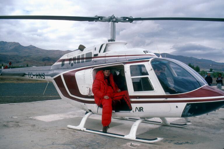
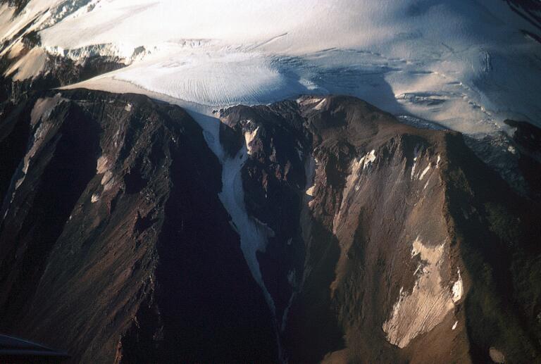
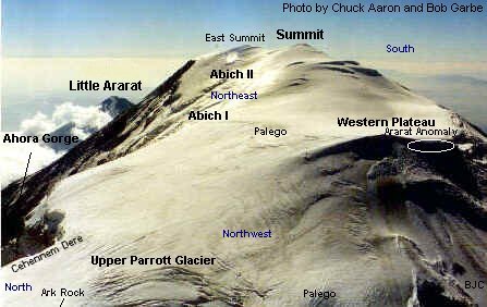
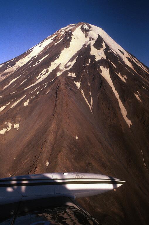
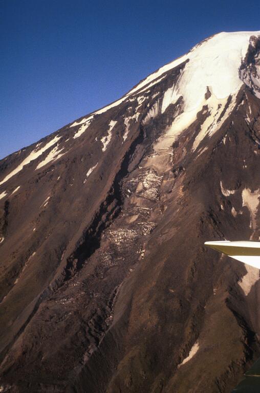
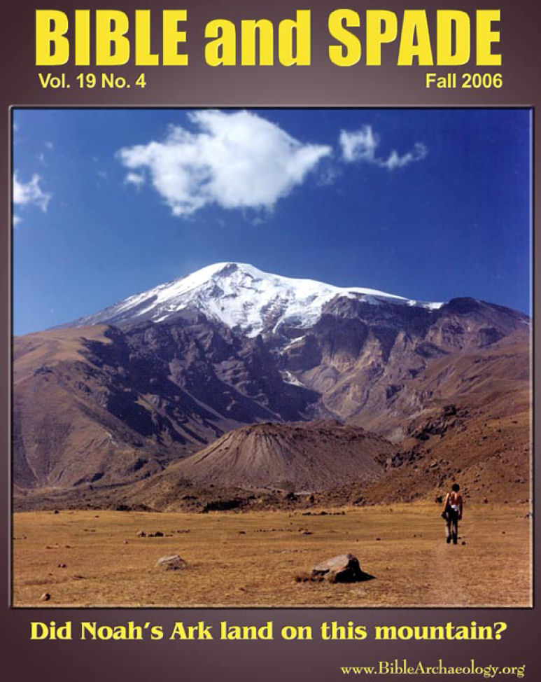
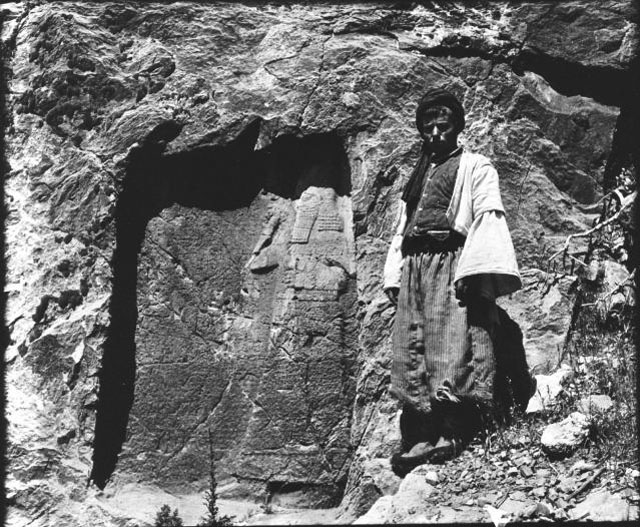
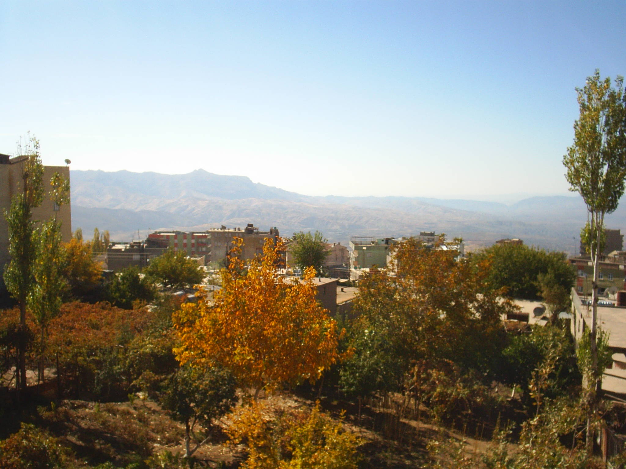
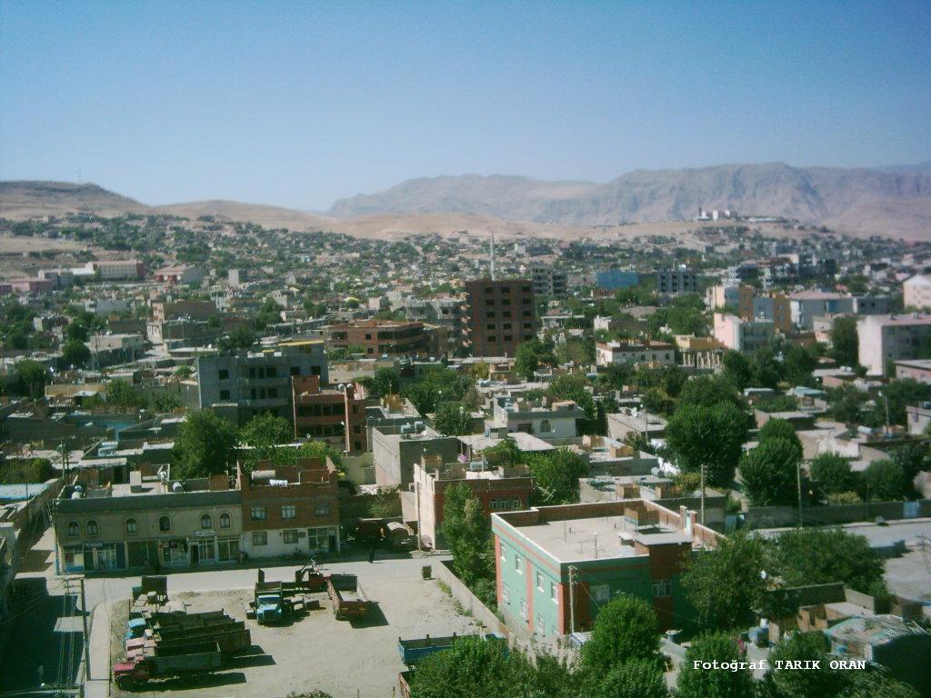
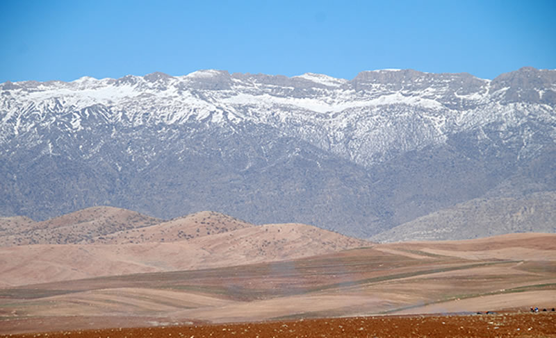
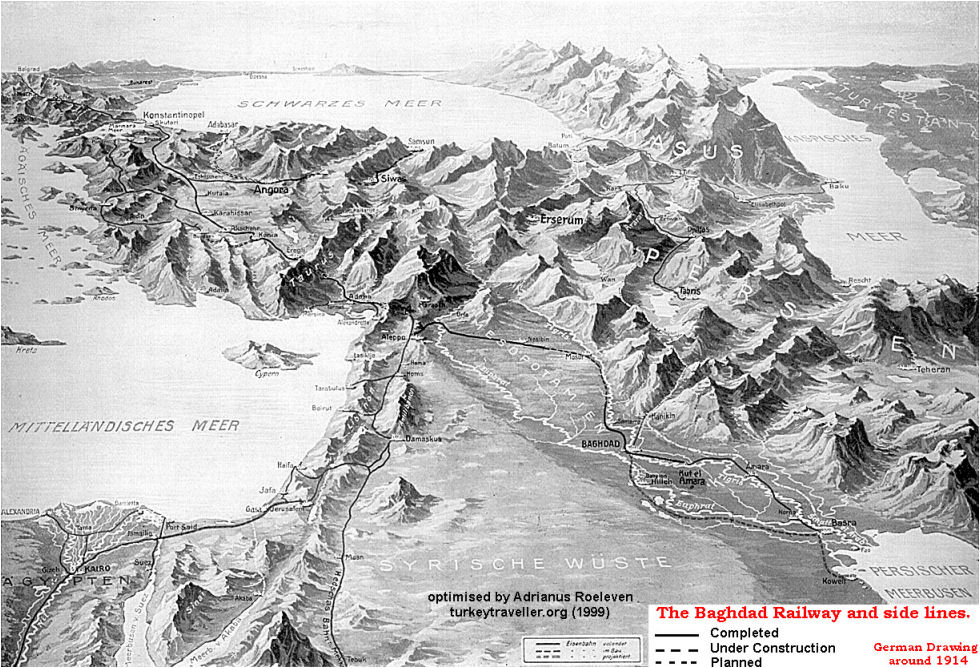
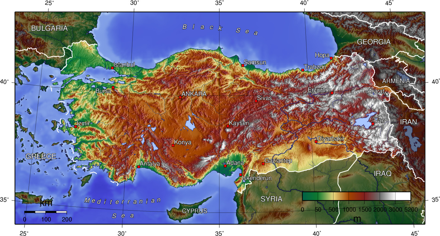
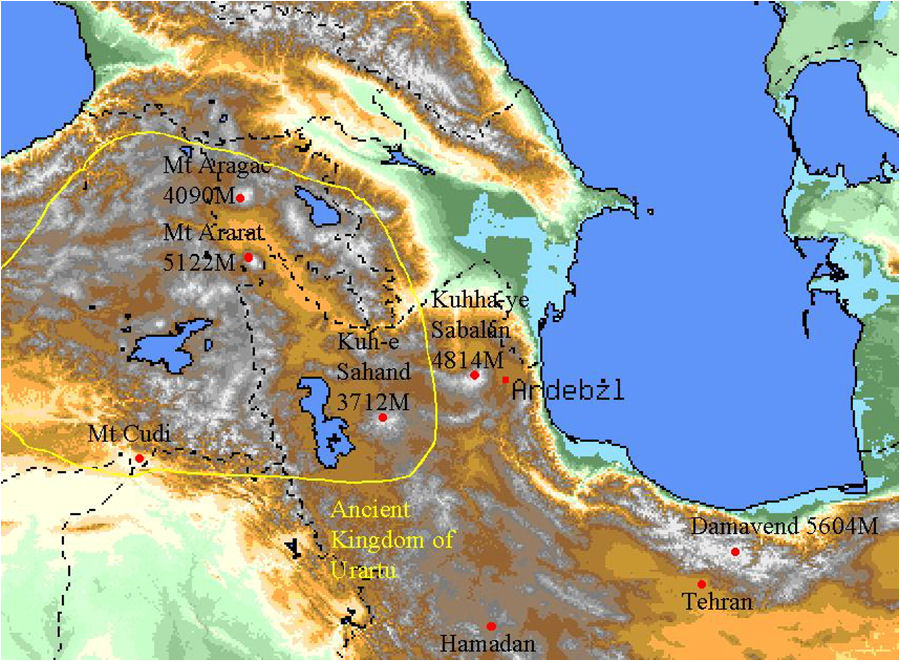
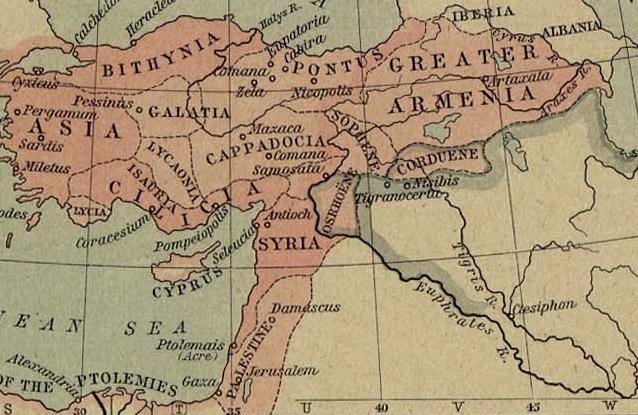
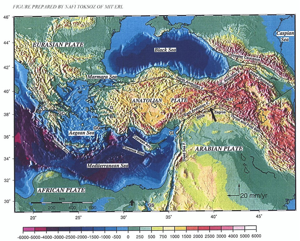
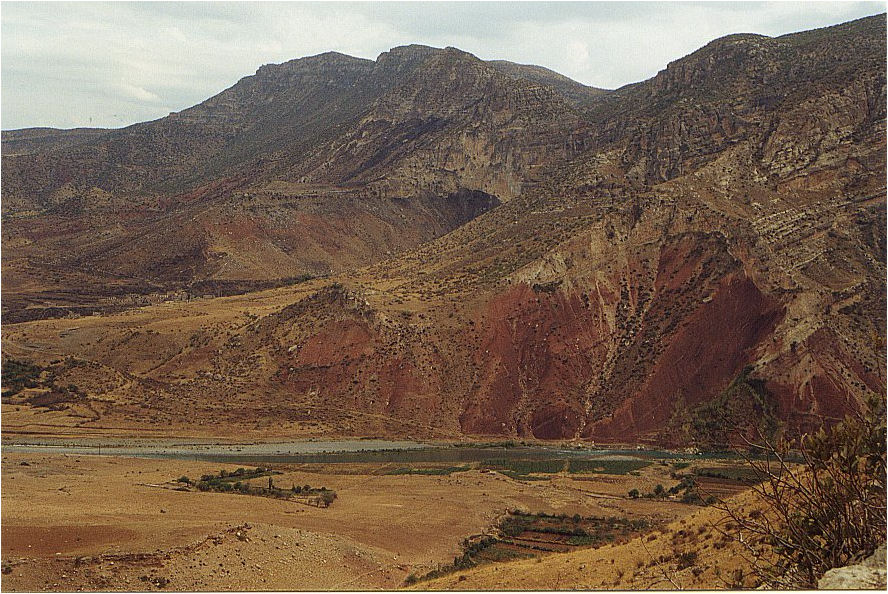
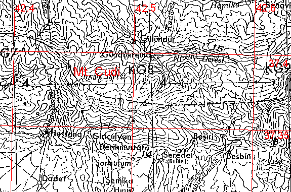
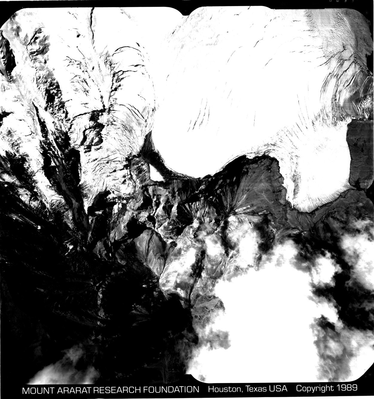
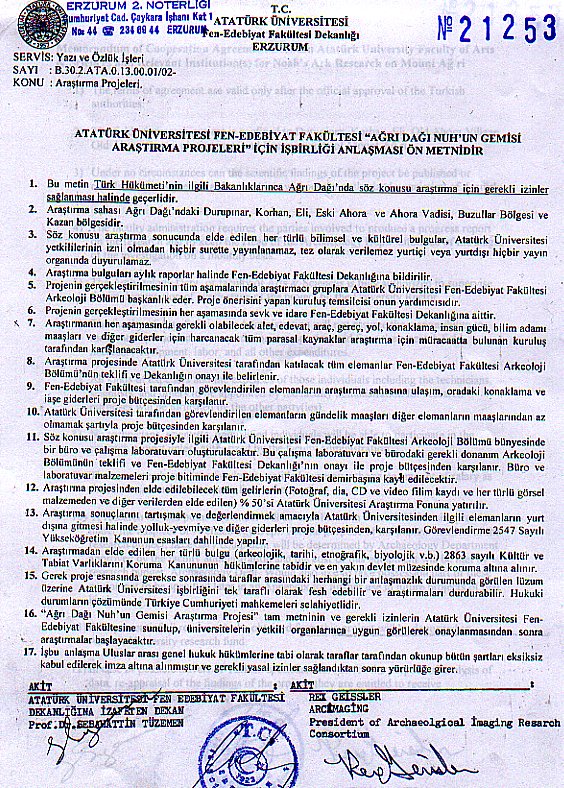
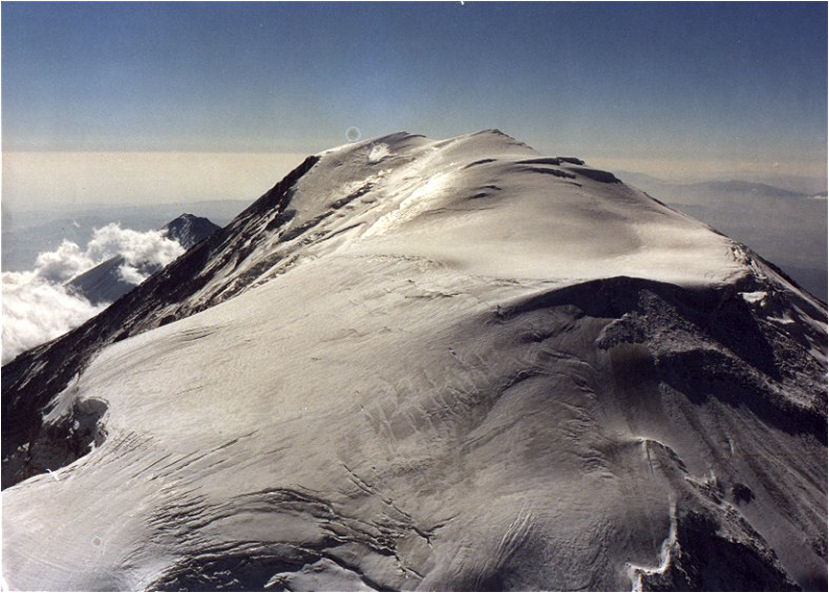
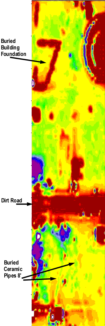
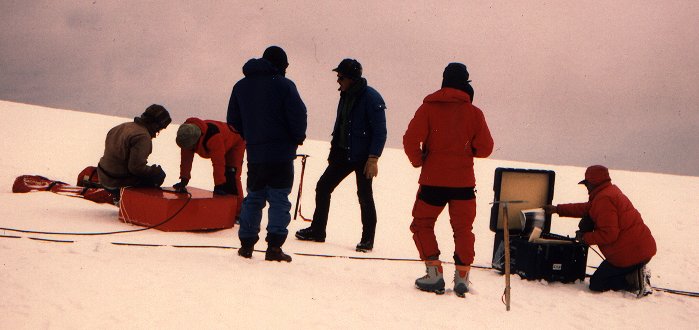
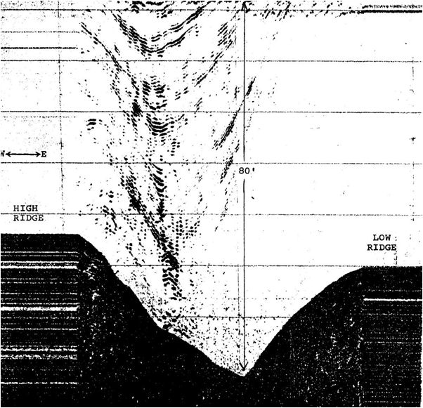
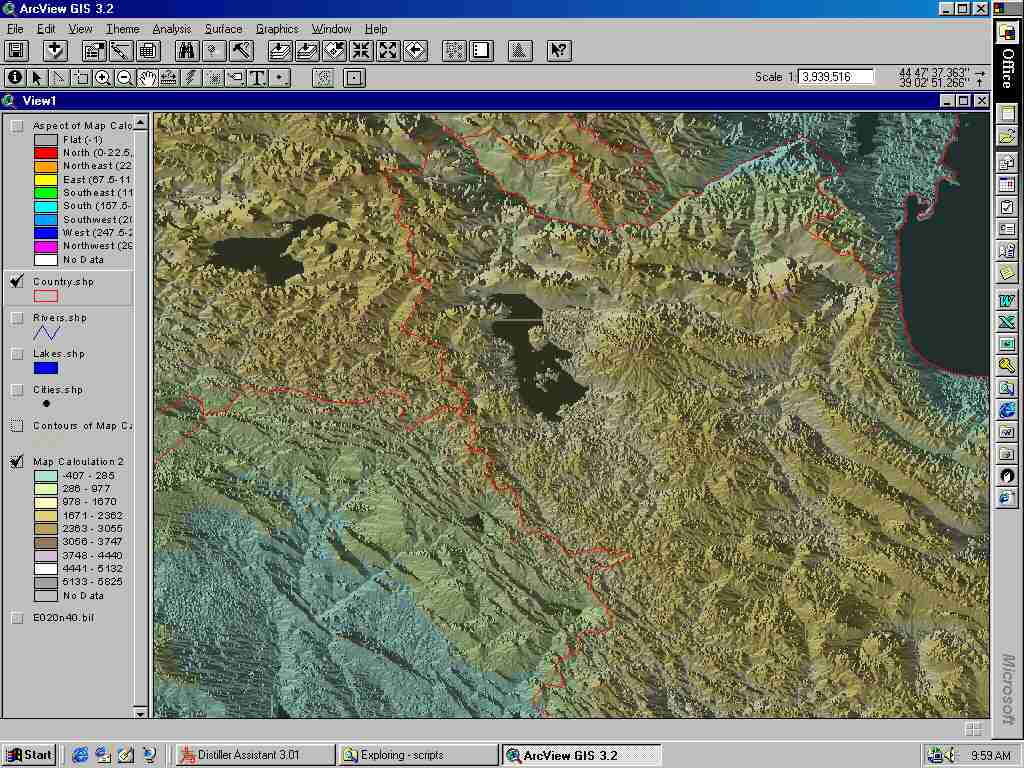